Property Record
3594 Old Atlanta Rd, Suwanee, GA 30024
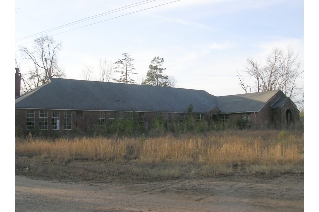

Property Detail
3594 Old Atlanta Rd
159-006
2-1 1017
Commercialnec
FORSYTH
CBD
Georgia
B and X Area of moderate flood hazard, usually the area between the limits of the 100-year and 500-year floods.
999
2025
2.92 AC
2025
N Fulton/Forsyth County
050243
Atlanta
5,300 SF
Atlanta-Sandy Springs-Roswell, GA
NEARBY LISTINGS FOR SALE OR LEASE
DEMOGRAPHICS near 3594 Old Atlanta Rd
1 mile
3 mile
5 mile
2025 Total Population
7,553
62,026
167,680
2030 Population
8,083
66,489
177,142
Pop Growth 2025-2030
+ 7.02%
+ 7.20%
+ 5.64%
Average Age
39
39
39
2025 Total Households
2,158
18,850
53,542
HH Growth 2025-2030
+ 6.90%
+ 7.18%
+ 5.66%
Median Household Inc
$195,009
$175,131
$161,022
Avg Household Size
3.50
3.30
3.10
2025 Avg HH Vehicles
3.00
2.00
2.00
Median Home Value
$756,906
$720,129
$667,388
Median Year Built
1999
2003
2001
Nearby Places
Map Layers
Map Styles
 Street
 Aerial
Layers
 Traffic
 Biking
Places
Listings with unknown addresses are not visible on the map
- Restaurants
- Banks
- Shops
- Fitness
- Groceries
Nearby Properties
Address
Land Use
TOTAL SIZE
Lot Size
Zoning
Address
Land Use
TOTAL SIZE
Lot Size
Zoning
424,176 SF
59.62 AC
R3
Address
Land Use
TOTAL SIZE
Lot Size
Zoning
370,414 SF
14.34 AC
PMUD
Address
Land Use
TOTAL SIZE
Lot Size
Zoning
354,333 SF
17.06 AC
CBD
Address
Land Use
TOTAL SIZE
Lot Size
Zoning
308,020 SF
12.99 AC
CBD
Address
Land Use
TOTAL SIZE
Lot Size
Zoning
289,501 SF
91.27 AC
CR1
Address
Land Use
TOTAL SIZE
Lot Size
Zoning
379,621 SF
71.66 AC
RES3
Address
Land Use
TOTAL SIZE
Lot Size
Zoning
408 SF
217.12 AC
R100
Address
Land Use
TOTAL SIZE
Lot Size
Zoning
186,015 SF
13.72 AC
MP
Address
Land Use
TOTAL SIZE
Lot Size
Zoning
115,555 SF
34.65 AC
R100MOD
Address
Land Use
TOTAL SIZE
Lot Size
Zoning
82,900 SF
16.51 AC
CBD
Address
Land Use
TOTAL SIZE
Lot Size
Zoning
101,510 SF
15.45 AC
CBD
Address
Land Use
TOTAL SIZE
Lot Size
Zoning
45,603 SF
8.36 AC
CBD
Address
Land Use
TOTAL SIZE
Lot Size
Zoning
117,036 SF
13.62 AC
CBD
Address
Land Use
TOTAL SIZE
Lot Size
Zoning
73,022 SF
6.57 AC
CBD
Address
Land Use
TOTAL SIZE
Lot Size
Zoning
3,366 SF
20.07 AC
PUD
Address
Land Use
TOTAL SIZE
Lot Size
Zoning
73,963 SF
10.57 AC
CBD
Address
Land Use
TOTAL SIZE
Lot Size
Zoning
126,920 SF
12.25 AC
M1
Address
Land Use
TOTAL SIZE
Lot Size
Zoning
177,890 SF
34.52 AC
R2R
Address
Land Use
TOTAL SIZE
Lot Size
Zoning
99,972 SF
5.61 AC
CBD
Address
Land Use
TOTAL SIZE
Lot Size
Zoning
772.94 AC
MINE
Address
Land Use
TOTAL SIZE
Lot Size
Zoning
18,344 SF
58.35 AC
R2R
Address
Land Use
TOTAL SIZE
Lot Size
Zoning
67,580 SF
10.60 AC
CBD
Address
Land Use
TOTAL SIZE
Lot Size
Zoning
132,795 SF
41.71 AC
Address
Land Use
TOTAL SIZE
Lot Size
Zoning
88,350 SF
7.15 AC
CBD
Address
Land Use
TOTAL SIZE
Lot Size
Zoning
103,628 SF
7.94 AC
MIAC
Address
Land Use
TOTAL SIZE
Lot Size
Zoning
84,675 SF
5.60 AC
HB
Address
Land Use
TOTAL SIZE
Lot Size
Zoning
188,074 SF
27.23 AC
CR1
Address
Land Use
TOTAL SIZE
Lot Size
Zoning
184,848 SF
52.73 AC
R1
Address
Land Use
TOTAL SIZE
Lot Size
Zoning
130,255 SF
25.09 AC
RES4
Address
Land Use
TOTAL SIZE
Lot Size
Zoning
1,858 SF
55.66 AC
CBD
The World's #1 Commercial Real Estate Marketplace
Connect with us
© 2026 CoStar Group
The information above has been obtained from sources believed reliable. While we do not doubt its accuracy we have not verified it and make no guarantee, warranty or representation about it. It is your responsibility to independently confirm its accuracy and completeness. Any projections, opinions, assumptions, or estimates used are for example only and do not represent the current or future performance of the property. The value of this transaction to you depends on tax and other factors which should be evaluated by your tax, financial, and legal advisors. You and your advisors should conduct a careful, independent investigation of the property to determine to your satisfaction the suitability of the property for your needs.