Property Record
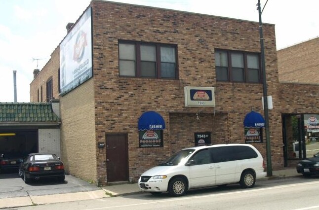
7543 W Irving Park Rd, Chicago, IL 60634


Property Detail
7543 W Irving Park Rd
12-24-200-006-0000
(VOLK) BROS (IRVING)(PARK) BLVD SUB A SUB IN LYING N OF IBL EX W10FT THEREOF & EX RW OF C TT RR NE SEC 24-40-12
Miscresidentialimprovement
Cook
C1-1
Illinois
B and X Area of moderate flood hazard, usually the area between the limits of the 100-year and 500-year floods.
3,4
2023
0.14 AC
2025
Belmont Heights
170400
Chicago
4,500 SF
Chicago-Naperville-Elgin, IL-IN
NEARBY LISTINGS FOR SALE OR LEASE
-
-
-
-
-
No Photo
-
-
-
View all Chicago listings for sale on LoopNet.com
DEMOGRAPHICS near 7543 W Irving Park Rd
1 mile
3 mile
5 mile
2025 Total Population
27,568
247,369
608,789
2030 Population
27,309
244,302
598,028
Pop Growth 2025-2030
(0.94%)
(1.24%)
(1.77%)
Average Age
43
42
41
2025 Total Households
9,868
91,844
223,862
HH Growth 2025-2030
(1.26%)
(1.38%)
(1.86%)
Median Household Inc
$89,543
$86,967
$86,369
Avg Household Size
2.70
2.60
2.60
2025 Avg HH Vehicles
2.00
2.00
2.00
Median Home Value
$346,005
$341,960
$357,033
Median Year Built
1956
1955
1951
Nearby Places
Map Layers
Map Styles
 Street
 Aerial
Layers
 Traffic
 Biking
Places
Listings with unknown addresses are not visible on the map
- Restaurants
- Banks
- Shops
- Fitness
- Groceries
PUBLIC TRANSPORTATION
COMMUTER RAIL
River Grove Station (Milwaukee District West Line - Northeast Illinois Regional Commuter Railroad (Metra), North Central Service - Northeast Illinois Regional Commuter Railroad (Metra))
Drive
Walk
Distance
River Grove Station (Milwaukee District West Line - Northeast Illinois Regional Commuter Railroad (Metra), North Central Service - Northeast Illinois Regional Commuter Railroad (Metra))
5 min
2.2 mi
Mont Clare Station (Milwaukee District West Line - Northeast Illinois Regional Commuter Railroad (Metra), North Central Service - Northeast Illinois Regional Commuter Railroad (Metra))
Drive
Walk
Distance
Mont Clare Station (Milwaukee District West Line - Northeast Illinois Regional Commuter Railroad (Metra), North Central Service - Northeast Illinois Regional Commuter Railroad (Metra))
8 min
2.8 mi
AIRPORT
Chicago O'Hare International
Drive
Walk
Distance
Chicago O'Hare International
30 min
8.6 mi
Chicago Midway International
Drive
Walk
Distance
Chicago Midway International
32 min
16.4 mi
Nearby Properties
Address
Land Use
TOTAL SIZE
Lot Size
Zoning
Address
Land Use
TOTAL SIZE
Lot Size
Zoning
240,942 SF
15.94 AC
PD 72
Address
Land Use
TOTAL SIZE
Lot Size
Zoning
833,077 SF
11.90 AC
Address
Land Use
TOTAL SIZE
Lot Size
Zoning
809,460 SF
6.60 AC
PD 258
Address
Land Use
TOTAL SIZE
Lot Size
Zoning
697,000 SF
11.60 AC
PD 71
Address
Land Use
TOTAL SIZE
Lot Size
Zoning
Address
Land Use
TOTAL SIZE
Lot Size
Zoning
2.62 AC
Address
Land Use
TOTAL SIZE
Lot Size
Zoning
595,800 SF
9.40 AC
Address
Land Use
TOTAL SIZE
Lot Size
Zoning
403,200 SF
6.82 AC
PD 193
Address
Land Use
TOTAL SIZE
Lot Size
Zoning
398,424 SF
3.08 AC
PD 71
Address
Land Use
TOTAL SIZE
Lot Size
Zoning
9.90 AC
Address
Land Use
TOTAL SIZE
Lot Size
Zoning
920,000 SF
7.45 AC
PD 193
Address
Land Use
TOTAL SIZE
Lot Size
Zoning
555,681 SF
7.36 AC
PD 340
Address
Land Use
TOTAL SIZE
Lot Size
Zoning
248,726 SF
11.79 AC
PD 44
Address
Land Use
TOTAL SIZE
Lot Size
Zoning
310,145 SF
5.08 AC
PD 71
Address
Land Use
TOTAL SIZE
Lot Size
Zoning
192,365 SF
21.34 AC
PD 127
Address
Land Use
TOTAL SIZE
Lot Size
Zoning
372,935 SF
7.34 AC
Address
Land Use
TOTAL SIZE
Lot Size
Zoning
396,650 SF
19.12 AC
Address
Land Use
TOTAL SIZE
Lot Size
Zoning
403,815 SF
0.77 AC
Address
Land Use
TOTAL SIZE
Lot Size
Zoning
548,206 SF
21.13 AC
Address
Land Use
TOTAL SIZE
Lot Size
Zoning
1.04 AC
PD 130
Address
Land Use
TOTAL SIZE
Lot Size
Zoning
121,117 SF
3.09 AC
Address
Land Use
TOTAL SIZE
Lot Size
Zoning
246,000 SF
2.29 AC
PD 340
Address
Land Use
TOTAL SIZE
Lot Size
Zoning
531,227 SF
18.32 AC
Address
Land Use
TOTAL SIZE
Lot Size
Zoning
322,805 SF
Address
Land Use
TOTAL SIZE
Lot Size
Zoning
1,201,215 SF
8.27 AC
B1-3,RT-4
Address
Land Use
TOTAL SIZE
Lot Size
Zoning
194,219 SF
17.26 AC
Address
Land Use
TOTAL SIZE
Lot Size
Zoning
Address
Land Use
TOTAL SIZE
Lot Size
Zoning
13.33 AC
PD 127
Address
Land Use
TOTAL SIZE
Lot Size
Zoning
325,045 SF
13.79 AC
Address
Land Use
TOTAL SIZE
Lot Size
Zoning
167,156 SF
6.23 AC
B3-1
The World's #1 Commercial Real Estate Marketplace
Connect with us
© 2026 CoStar Group
The information above has been obtained from sources believed reliable. While we do not doubt its accuracy we have not verified it and make no guarantee, warranty or representation about it. It is your responsibility to independently confirm its accuracy and completeness. Any projections, opinions, assumptions, or estimates used are for example only and do not represent the current or future performance of the property. The value of this transaction to you depends on tax and other factors which should be evaluated by your tax, financial, and legal advisors. You and your advisors should conduct a careful, independent investigation of the property to determine to your satisfaction the suitability of the property for your needs.