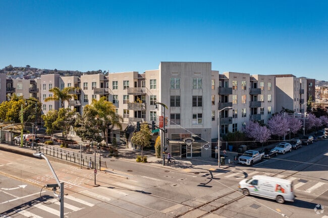
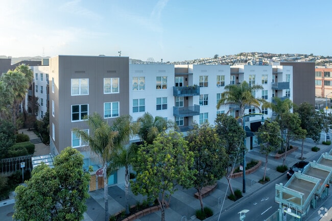
Property Record
5800 3Rd St, San Francisco, CA 94124

NEARBY LISTINGS FOR SALE OR LEASE
Property Detail
5800 3Rd St
San Francisco
5800 Third Street
San Francisco-Redwood City-South San Francisco, CA
San Francisco
5431B-005
California
Condominium
2.95 AC
816 SF
Bayview
DEMOGRAPHICS near 5800 3Rd St
1 Mile
3 Mile
5 Mile
2024 Total Population
43,541
230,154
660,424
2029 Population
39,217
211,061
611,655
Pop Growth 2024-2029
(9.93%)
(8.30%)
(7.38%)
Average Age
42
42
42
2024 Total Households
12,362
80,413
269,142
HH Growth 2024-2029
(10.55%)
(8.60%)
(7.72%)
Median Household Inc
$83,951
$129,474
$119,293
Avg Household Size
3.20
2.70
2.30
2024 Avg HH Vehicles
2.00
1.00
1.00
Median Home Value
$967,367
$1,076,624
$1,081,468
Median Year Built
1958
1949
1953
Nearby Places
- Restaurants
- Banks
- Shops
- Fitness
- Groceries
PUBLIC TRANSPORTATION
TRANSIT/SUBWAY
Carroll Station Outbound (T Third Street - San Francisco Municipal Railway (MUNI Metro), THIRD - San Francisco Municipal Railway (MUNI Metro))
DRIVE
WALK
Distance
Carroll Station Outbound (T Third Street - San Francisco Municipal Railway (MUNI Metro), THIRD - San Francisco Municipal Railway (MUNI Metro))
0 min
2 min
0.1 mi
Gilman/Paul Station Inbound (T Third Street - San Francisco Municipal Railway (MUNI Metro))
DRIVE
WALK
Distance
Gilman/Paul Station Inbound (T Third Street - San Francisco Municipal Railway (MUNI Metro))
1 min
4 min
0.2 mi
Williams Station Outbound (T Third Street - San Francisco Municipal Railway (MUNI Metro))
DRIVE
WALK
Distance
Williams Station Outbound (T Third Street - San Francisco Municipal Railway (MUNI Metro))
2 min
7 min
0.4 mi
Le Conte Station (T Third Street - San Francisco Municipal Railway (MUNI Metro))
DRIVE
WALK
Distance
Le Conte Station (T Third Street - San Francisco Municipal Railway (MUNI Metro))
3 min
10 min
0.5 mi
Third Street & Le Conte Ave (THIRD - San Francisco Municipal Transportation Agency)
DRIVE
WALK
Distance
Third Street & Le Conte Ave (THIRD - San Francisco Municipal Transportation Agency)
3 min
10 min
0.5 mi
COMMUTER RAIL
Bayshore Caltrain Station (Local - Caltrain (Caltrain), Local Weekday - Caltrain (Caltrain), Local Weekend - Caltrain (Caltrain))
DRIVE
WALK
Distance
Bayshore Caltrain Station (Local - Caltrain (Caltrain), Local Weekday - Caltrain (Caltrain), Local Weekend - Caltrain (Caltrain))
4 min
1.3 mi
22Nd Street (Caltrain - Caltrain (Caltrain))
DRIVE
WALK
Distance
22Nd Street (Caltrain - Caltrain (Caltrain))
8 min
5.0 mi
AIRPORT
San Francisco International
DRIVE
WALK
Distance
San Francisco International
15 min
9.2 mi
Metro Oakland International
DRIVE
WALK
Distance
Metro Oakland International
36 min
23.6 mi
Freight Ports
Port of San Francisco
DRIVE
WALK
Distance
Port of San Francisco
13 min
7.2 mi
SALE & LEASE HISTORY
LISTING DATE
SALE/LEASE

Oct 12, 2017
For Sale
Nov 07, 2023
For Sale
Jan 27, 2023
For Sale
Feb 15, 2019
For Lease
Nearby Properties
Address
Land Use
TOTAL SIZE
Lot Size
Zoning
Address
Land Use
TOTAL SIZE
Lot Size
Zoning
750,370 SF
3.25 AC
MBR3
Address
Land Use
TOTAL SIZE
Lot Size
Zoning
248,303 SF
4.35 AC
Address
Land Use
TOTAL SIZE
Lot Size
Zoning
10.92 AC
Address
Land Use
TOTAL SIZE
Lot Size
Zoning
10.92 AC
Address
Land Use
TOTAL SIZE
Lot Size
Zoning
241,659 SF
3.76 AC
Address
Land Use
TOTAL SIZE
Lot Size
Zoning
230,853 SF
3.76 AC
Address
Land Use
TOTAL SIZE
Lot Size
Zoning
10.92 AC
Address
Land Use
TOTAL SIZE
Lot Size
Zoning
250,884 SF
1.66 AC
MB-RA
Address
Land Use
TOTAL SIZE
Lot Size
Zoning
2.22 AC
M1
Address
Land Use
TOTAL SIZE
Lot Size
Zoning
333,244 SF
2.67 AC
UMU
Address
Land Use
TOTAL SIZE
Lot Size
Zoning
347,857 SF
2.76 AC
Address
Land Use
TOTAL SIZE
Lot Size
Zoning
346,710 SF
7.45 AC
RH2
Address
Land Use
TOTAL SIZE
Lot Size
Zoning
167,053 SF
0.99 AC
MB-RA
Address
Land Use
TOTAL SIZE
Lot Size
Zoning
3.49 AC
Address
Land Use
TOTAL SIZE
Lot Size
Zoning
100,732 SF
4.55 AC
M2
Address
Land Use
TOTAL SIZE
Lot Size
Zoning
210,036 SF
23.85 AC
UMU
Address
Land Use
TOTAL SIZE
Lot Size
Zoning
243,176 SF
1.48 AC
UMU
Address
Land Use
TOTAL SIZE
Lot Size
Zoning
231,687 SF
8.64 AC
Address
Land Use
TOTAL SIZE
Lot Size
Zoning
54,000 SF
1.67 AC
PDR2
Address
Land Use
TOTAL SIZE
Lot Size
Zoning
199,678 SF
1.06 AC
UMU
Address
Land Use
TOTAL SIZE
Lot Size
Zoning
157,256 SF
1.15 AC
M2
Address
Land Use
TOTAL SIZE
Lot Size
Zoning
439,294 SF
5.43 AC
PDR2
Address
Land Use
TOTAL SIZE
Lot Size
Zoning
147,000 SF
1.84 AC
UMU
Address
Land Use
TOTAL SIZE
Lot Size
Zoning
38,600 SF
0.89 AC
UMU
Address
Land Use
TOTAL SIZE
Lot Size
Zoning
1.37 AC
MB-RA
Address
Land Use
TOTAL SIZE
Lot Size
Zoning
143,920 SF
7.29 AC
PDR2
Address
Land Use
TOTAL SIZE
Lot Size
Zoning
176,000 SF
1.84 AC
M1
Address
Land Use
TOTAL SIZE
Lot Size
Zoning
139,739 SF
0.92 AC
UMU
Address
Land Use
TOTAL SIZE
Lot Size
Zoning
183,284 SF
6.85 AC
PD0000
Address
Land Use
TOTAL SIZE
Lot Size
Zoning
161,125 SF
1.21 AC
PDR1G
The World's #1 Commercial Real Estate Marketplace
Connect with us
© 2025 CoStar Group
The information above has been obtained from sources believed reliable. While we do not doubt its accuracy we have not verified it and make no guarantee, warranty or representation about it. It is your responsibility to independently confirm its accuracy and completeness. Any projections, opinions, assumptions, or estimates used are for example only and do not represent the current or future performance of the property. The value of this transaction to you depends on tax and other factors which should be evaluated by your tax, financial, and legal advisors. You and your advisors should conduct a careful, independent investigation of the property to determine to your satisfaction the suitability of the property for your needs.