Property Record
7475 N I10 Eb Frontage Rd, Tucson, AZ 85743


Property Detail
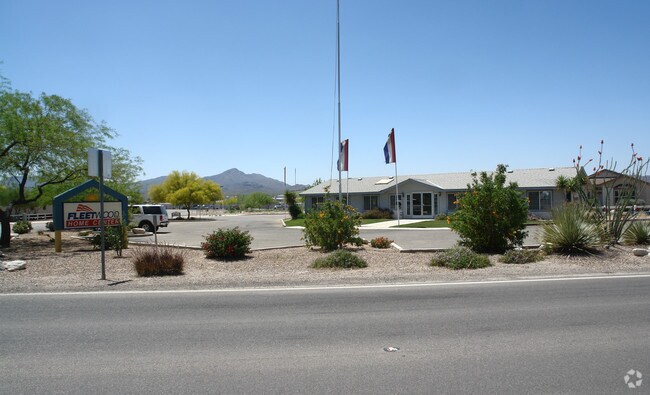
7475 N I10 Eb Frontage Rd
226-35-021C
INA ROAD MODEL HOME SWLY PTN BLOCK 6
Vehiclerentalsvehiclesales
PIMA
B and X Area of moderate flood hazard, usually the area between the limits of the 100-year and 500-year floods.
Arizona
2025
3.72 AC
2026
Northwest Tucson
004426
Tucson
2,432 SF
Tucson, AZ
NEARBY LISTINGS FOR SALE OR LEASE
DEMOGRAPHICS near 7475 N I10 Eb Frontage Rd
1 mile
3 mile
5 mile
2025 Total Population
3,546
51,778
109,846
2030 Population
3,643
53,003
112,758
Pop Growth 2025-2030
+ 2.74%
+ 2.37%
+ 2.65%
Average Age
39
40
42
2025 Total Households
1,325
20,331
43,647
HH Growth 2025-2030
+ 2.72%
+ 2.41%
+ 2.74%
Median Household Inc
$84,704
$91,219
$90,636
Avg Household Size
2.60
2.50
2.40
2025 Avg HH Vehicles
2.00
2.00
2.00
Median Home Value
$331,763
$343,644
$360,229
Median Year Built
1986
1991
1992
Nearby Places
Map Layers
Map Styles
 Street
 Aerial
Layers
 Traffic
 Biking
Places
Listings with unknown addresses are not visible on the map
- Restaurants
- Banks
- Shops
- Fitness
- Groceries
PUBLIC TRANSPORTATION
AIRPORT
Tucson International
Drive
Walk
Distance
Tucson International
27 min
18.6 mi
Nearby Properties
Address
Land Use
TOTAL SIZE
Lot Size
Zoning
Address
Land Use
TOTAL SIZE
Lot Size
Zoning
100,996 SF
14.58 AC
Address
Land Use
TOTAL SIZE
Lot Size
Zoning
406,289 SF
46.21 AC
Address
Land Use
TOTAL SIZE
Lot Size
Zoning
315,816 SF
35.57 AC
SR
Address
Land Use
TOTAL SIZE
Lot Size
Zoning
254,904 SF
11.65 AC
Address
Land Use
TOTAL SIZE
Lot Size
Zoning
50,340 SF
14.37 AC
HI
Address
Land Use
TOTAL SIZE
Lot Size
Zoning
296,817 SF
13.59 AC
Address
Land Use
TOTAL SIZE
Lot Size
Zoning
398,608 SF
22.49 AC
Address
Land Use
TOTAL SIZE
Lot Size
Zoning
389,239 SF
35.51 AC
Address
Land Use
TOTAL SIZE
Lot Size
Zoning
313,622 SF
17.83 AC
F
Address
Land Use
TOTAL SIZE
Lot Size
Zoning
274,022 SF
16.35 AC
LI
Address
Land Use
TOTAL SIZE
Lot Size
Zoning
131,575 SF
25.97 AC
SR
Address
Land Use
TOTAL SIZE
Lot Size
Zoning
234,277 SF
18.11 AC
F
Address
Land Use
TOTAL SIZE
Lot Size
Zoning
230,296 SF
177.79 AC
Address
Land Use
TOTAL SIZE
Lot Size
Zoning
280,281 SF
12.85 AC
TR
Address
Land Use
TOTAL SIZE
Lot Size
Zoning
318,278 SF
18.26 AC
TR
Address
Land Use
TOTAL SIZE
Lot Size
Zoning
203,101 SF
11.35 AC
F
Address
Land Use
TOTAL SIZE
Lot Size
Zoning
277,576 SF
13.49 AC
TR
Address
Land Use
TOTAL SIZE
Lot Size
Zoning
189,753 SF
18.18 AC
VC
Address
Land Use
TOTAL SIZE
Lot Size
Zoning
138,993 SF
9.40 AC
Address
Land Use
TOTAL SIZE
Lot Size
Zoning
103,121 SF
12.39 AC
Address
Land Use
TOTAL SIZE
Lot Size
Zoning
197,627 SF
10.13 AC
F
Address
Land Use
TOTAL SIZE
Lot Size
Zoning
115,005 SF
2.83 AC
F
Address
Land Use
TOTAL SIZE
Lot Size
Zoning
259,071 SF
7.57 AC
NC
Address
Land Use
TOTAL SIZE
Lot Size
Zoning
63,761 SF
19 AC
SR
Address
Land Use
TOTAL SIZE
Lot Size
Zoning
51,618 SF
18.17 AC
HI
Address
Land Use
TOTAL SIZE
Lot Size
Zoning
81,714 SF
5.07 AC
Address
Land Use
TOTAL SIZE
Lot Size
Zoning
112,522 SF
9.86 AC
Address
Land Use
TOTAL SIZE
Lot Size
Zoning
107,870 SF
11.58 AC
HI
Address
Land Use
TOTAL SIZE
Lot Size
Zoning
146,066 SF
20 AC
SR
The World's #1 Commercial Real Estate Marketplace
Connect with us
© 2026 CoStar Group
The information above has been obtained from sources believed reliable. While we do not doubt its accuracy we have not verified it and make no guarantee, warranty or representation about it. It is your responsibility to independently confirm its accuracy and completeness. Any projections, opinions, assumptions, or estimates used are for example only and do not represent the current or future performance of the property. The value of this transaction to you depends on tax and other factors which should be evaluated by your tax, financial, and legal advisors. You and your advisors should conduct a careful, independent investigation of the property to determine to your satisfaction the suitability of the property for your needs.