Property Record
25830 Ford Rd, Dearborn Heights, MI 48127


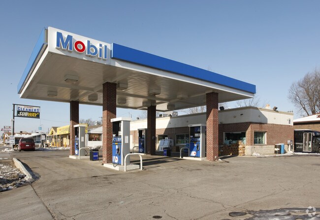
Property Detail
25830 Ford Rd
Detroit-Warren-Dearborn, MI
07D563B TO 569 E 15FT LOT 563 ALSO LOTS 564 TO 569 INCL ALSO S 1/2 ADJ VAC ALLEY ADJ TO LOTS 565 TO 569 CUMMINGS FORD ROAD
33-014-01-0563-002
Wayne
Conveniencestore
Michigan
B and X Area of moderate flood hazard, usually the area between the limits of the 100-year and 500-year floods.
563-569
2025
0.34 AC
2025
Dearborn
572200
Detroit
2,146 SF
NEARBY LISTINGS FOR SALE OR LEASE
DEMOGRAPHICS near 25830 Ford Rd
1 mile
3 mile
5 mile
2025 Total Population
18,741
126,119
312,209
2030 Population
18,348
123,801
307,699
Pop Growth 2025-2030
(2.10%)
(1.84%)
(1.44%)
Average Age
38
39
39
2025 Total Households
6,211
48,235
121,473
HH Growth 2025-2030
(2.13%)
(1.85%)
(1.52%)
Median Household Inc
$81,956
$67,478
$61,385
Avg Household Size
2.90
2.60
2.50
2025 Avg HH Vehicles
2.00
2.00
2.00
Median Home Value
$263,721
$191,833
$169,271
Median Year Built
1960
1956
1956
Nearby Places
Map Layers
Map Styles
 Street
 Aerial
Transit
 Traffic
 Biking
Places
Listings with unknown addresses are not visible on the map
- Restaurants
- Banks
- Shops
- Fitness
- Groceries
PUBLIC TRANSPORTATION
COMMUTER RAIL
Drive
Walk
Distance
11 min
4.2 mi
AIRPORT
Detroit Metro Wayne County
Drive
Walk
Distance
Detroit Metro Wayne County
25 min
12.2 mi
Windsor International
Drive
Walk
Distance
Windsor International
45 min
23.9 mi
Freight Ports
Drive
Walk
Distance
77 min
56.6 mi
Nearby Properties
Address
Land Use
TOTAL SIZE
Lot Size
Zoning
Address
Land Use
TOTAL SIZE
Lot Size
Zoning
335,133 SF
22.08 AC
Address
Land Use
TOTAL SIZE
Lot Size
Zoning
126,712 SF
4.52 AC
BC
Address
Land Use
TOTAL SIZE
Lot Size
Zoning
188,958 SF
7.71 AC
Address
Land Use
TOTAL SIZE
Lot Size
Zoning
463,642 SF
22.82 AC
Address
Land Use
TOTAL SIZE
Lot Size
Zoning
197,774 SF
11.72 AC
Address
Land Use
TOTAL SIZE
Lot Size
Zoning
247,588 SF
4.12 AC
RE
Address
Land Use
TOTAL SIZE
Lot Size
Zoning
328,480 SF
11.54 AC
IA
Address
Land Use
TOTAL SIZE
Lot Size
Zoning
84,333 SF
1.15 AC
BC
Address
Land Use
TOTAL SIZE
Lot Size
Zoning
196,930 SF
9.93 AC
Address
Land Use
TOTAL SIZE
Lot Size
Zoning
107,680 SF
7.46 AC
BC
Address
Land Use
TOTAL SIZE
Lot Size
Zoning
63,706 SF
0.96 AC
BC
Address
Land Use
TOTAL SIZE
Lot Size
Zoning
179,412 SF
2.17 AC
Address
Land Use
TOTAL SIZE
Lot Size
Zoning
149,735 SF
6.64 AC
Address
Land Use
TOTAL SIZE
Lot Size
Zoning
Address
Land Use
TOTAL SIZE
Lot Size
Zoning
152,424 SF
5.02 AC
Address
Land Use
TOTAL SIZE
Lot Size
Zoning
58,958 SF
2.15 AC
BC
Address
Land Use
TOTAL SIZE
Lot Size
Zoning
127,017 SF
6.91 AC
Address
Land Use
TOTAL SIZE
Lot Size
Zoning
94,353 SF
8.70 AC
BC
Address
Land Use
TOTAL SIZE
Lot Size
Zoning
57,345 SF
0.73 AC
BC
Address
Land Use
TOTAL SIZE
Lot Size
Zoning
176,883 SF
10.83 AC
Address
Land Use
TOTAL SIZE
Lot Size
Zoning
88,769 SF
0.91 AC
IB
Address
Land Use
TOTAL SIZE
Lot Size
Zoning
171,414 SF
23.57 AC
Address
Land Use
TOTAL SIZE
Lot Size
Zoning
240,100 SF
4.09 AC
OS
Address
Land Use
TOTAL SIZE
Lot Size
Zoning
61,031 SF
5.14 AC
BC
Address
Land Use
TOTAL SIZE
Lot Size
Zoning
47,900 SF
2.34 AC
BC
Address
Land Use
TOTAL SIZE
Lot Size
Zoning
110,371 SF
8.68 AC
Address
Land Use
TOTAL SIZE
Lot Size
Zoning
42,928 SF
4.88 AC
Address
Land Use
TOTAL SIZE
Lot Size
Zoning
111,699 SF
10.08 AC
Address
Land Use
TOTAL SIZE
Lot Size
Zoning
97,740 SF
4.47 AC
Address
Land Use
TOTAL SIZE
Lot Size
Zoning
99,831 SF
8.54 AC
The World's #1 Commercial Real Estate Marketplace
Connect with us
© 2026 CoStar Group
The information above has been obtained from sources believed reliable. While we do not doubt its accuracy we have not verified it and make no guarantee, warranty or representation about it. It is your responsibility to independently confirm its accuracy and completeness. Any projections, opinions, assumptions, or estimates used are for example only and do not represent the current or future performance of the property. The value of this transaction to you depends on tax and other factors which should be evaluated by your tax, financial, and legal advisors. You and your advisors should conduct a careful, independent investigation of the property to determine to your satisfaction the suitability of the property for your needs.