Property Record
203 Naamans Rd, Claymont, DE 19703
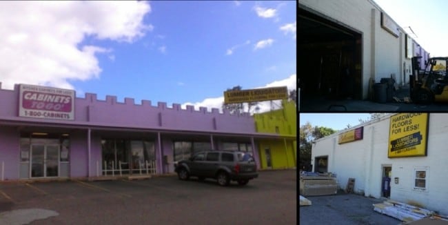


Property Detail
203 Naamans Rd
06-049.00-014
PCL 1= 1.776 AC M/L PCL 3= 0.115 AC M/L
Storebuilding
New Castle
CR
Delaware
B and X Area of moderate flood hazard, usually the area between the limits of the 100-year and 500-year floods.
1
2025
1.89 AC
2025
Wilmington
010105
Philadelphia
15,260 SF
Philadelphia-Camden-Wilmington, PA-NJ-DE-MD
NEARBY LISTINGS FOR SALE OR LEASE
DEMOGRAPHICS near 203 Naamans Rd
1 mile
3 mile
5 mile
2025 Total Population
6,018
60,978
150,327
2030 Population
6,164
62,115
153,652
Pop Growth 2025-2030
+ 2.43%
+ 1.86%
+ 2.21%
Average Age
39
42
42
2025 Total Households
2,653
25,092
59,336
HH Growth 2025-2030
+ 2.56%
+ 1.99%
+ 2.31%
Median Household Inc
$82,075
$81,606
$85,245
Avg Household Size
2.20
2.40
2.50
2025 Avg HH Vehicles
1.00
2.00
2.00
Median Home Value
$284,055
$310,323
$345,520
Median Year Built
1975
1964
1964
Nearby Places
Map Layers
Map Styles
 Street
 Aerial
Layers
 Traffic
 Biking
Places
Listings with unknown addresses are not visible on the map
- Restaurants
- Banks
- Shops
- Fitness
- Groceries
PUBLIC TRANSPORTATION
COMMUTER RAIL
Claymont Transportation Center (Wilmington/Newark Line - SEPTA)
Drive
Walk
Distance
Claymont Transportation Center (Wilmington/Newark Line - SEPTA)
4 min
1.6 mi
Marcus Hook (R2 - Southeastern Pennsylvania Transportation Authority Regional Rail (SEPTA Regional Rail))
Drive
Walk
Distance
Marcus Hook (R2 - Southeastern Pennsylvania Transportation Authority Regional Rail (SEPTA Regional Rail))
4 min
1.6 mi
AIRPORT
Philadelphia International
Drive
Walk
Distance
Philadelphia International
20 min
13.2 mi
Freight Ports
Port of Wilmington, RI
Drive
Walk
Distance
Port of Wilmington, RI
15 min
10.1 mi
Nearby Properties
Address
Land Use
TOTAL SIZE
Lot Size
Zoning
Address
Land Use
TOTAL SIZE
Lot Size
Zoning
Address
Land Use
TOTAL SIZE
Lot Size
Zoning
26,424 SF
341 AC
Address
Land Use
TOTAL SIZE
Lot Size
Zoning
141,978 SF
2.11 AC
Address
Land Use
TOTAL SIZE
Lot Size
Zoning
167.83 AC
LI
Address
Land Use
TOTAL SIZE
Lot Size
Zoning
36.50 AC
Address
Land Use
TOTAL SIZE
Lot Size
Zoning
240,690 SF
18.44 AC
NCAP
Address
Land Use
TOTAL SIZE
Lot Size
Zoning
359,520 SF
28.18 AC
HI
Address
Land Use
TOTAL SIZE
Lot Size
Zoning
258.38 AC
HI
Address
Land Use
TOTAL SIZE
Lot Size
Zoning
324,733 SF
17.70 AC
NCAP
Address
Land Use
TOTAL SIZE
Lot Size
Zoning
141,066 SF
36.52 AC
S
Address
Land Use
TOTAL SIZE
Lot Size
Zoning
164,862 SF
10.70 AC
Address
Land Use
TOTAL SIZE
Lot Size
Zoning
297,333 SF
11.95 AC
NCAP
Address
Land Use
TOTAL SIZE
Lot Size
Zoning
297,108 SF
5.74 AC
NCAP
Address
Land Use
TOTAL SIZE
Lot Size
Zoning
282,932 SF
20.12 AC
NCAP
Address
Land Use
TOTAL SIZE
Lot Size
Zoning
15,880 SF
27.07 AC
Address
Land Use
TOTAL SIZE
Lot Size
Zoning
23,179 SF
2 AC
Address
Land Use
TOTAL SIZE
Lot Size
Zoning
95,760 SF
20 AC
Address
Land Use
TOTAL SIZE
Lot Size
Zoning
22,140 SF
16 AC
Address
Land Use
TOTAL SIZE
Lot Size
Zoning
187,209 SF
13.88 AC
NCAP
Address
Land Use
TOTAL SIZE
Lot Size
Zoning
114,192 SF
7.84 AC
CR
Address
Land Use
TOTAL SIZE
Lot Size
Zoning
401,000 SF
10 AC
Address
Land Use
TOTAL SIZE
Lot Size
Zoning
232,890 SF
4.30 AC
NCAP
Address
Land Use
TOTAL SIZE
Lot Size
Zoning
191,222 SF
8.44 AC
NCAP
Address
Land Use
TOTAL SIZE
Lot Size
Zoning
10,716 SF
14.34 AC
Address
Land Use
TOTAL SIZE
Lot Size
Zoning
116,534 SF
3.23 AC
CN
Address
Land Use
TOTAL SIZE
Lot Size
Zoning
208,352 SF
21 AC
Address
Land Use
TOTAL SIZE
Lot Size
Zoning
86,916 SF
24.70 AC
S
Address
Land Use
TOTAL SIZE
Lot Size
Zoning
90,354 SF
8.92 AC
NCAP
Address
Land Use
TOTAL SIZE
Lot Size
Zoning
212,990 SF
13.69 AC
S
Address
Land Use
TOTAL SIZE
Lot Size
Zoning
5,626 SF
54.24 AC
The World's #1 Commercial Real Estate Marketplace
Connect with us
© 2026 CoStar Group
The information above has been obtained from sources believed reliable. While we do not doubt its accuracy we have not verified it and make no guarantee, warranty or representation about it. It is your responsibility to independently confirm its accuracy and completeness. Any projections, opinions, assumptions, or estimates used are for example only and do not represent the current or future performance of the property. The value of this transaction to you depends on tax and other factors which should be evaluated by your tax, financial, and legal advisors. You and your advisors should conduct a careful, independent investigation of the property to determine to your satisfaction the suitability of the property for your needs.