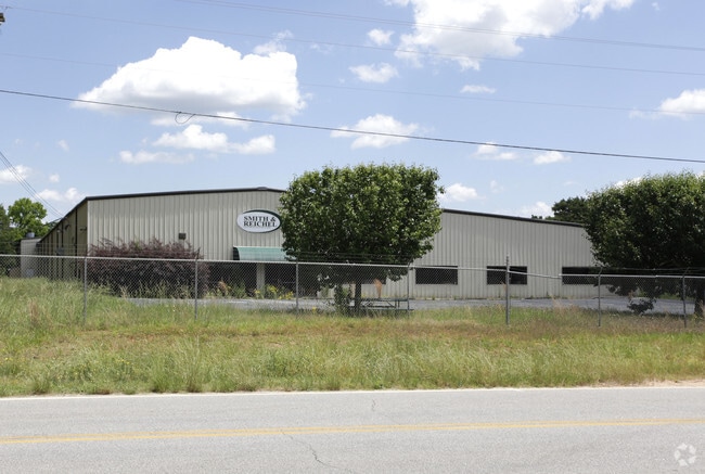
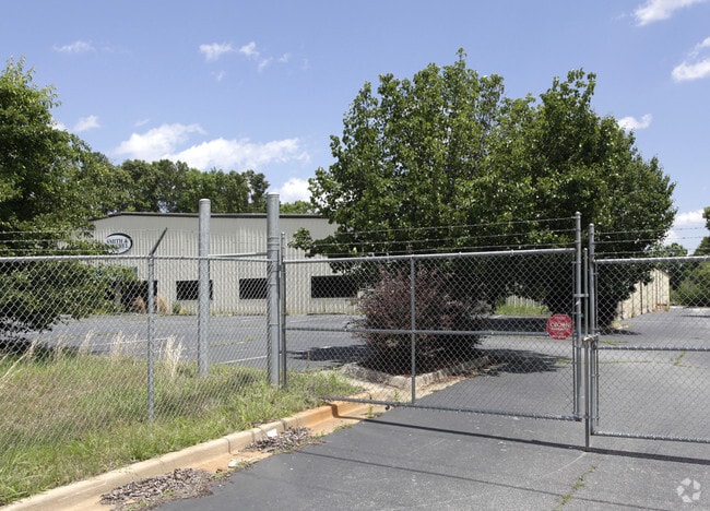
Property Record
536 Corinth Rd, Newnan, GA 30263


Property Detail
536 Corinth Rd
076-2041-007
BLDG 3.269 AC LL 41 2LD
Warehouse
Coweta
M
Georgia
B and X Area of moderate flood hazard, usually the area between the limits of the 100-year and 500-year floods.
41
2025
3.27 AC
2025
Fayette/Coweta County
170605
Atlanta
54,780 SF
Atlanta-Sandy Springs-Roswell, GA
NEARBY LISTINGS FOR SALE OR LEASE
DEMOGRAPHICS near 536 Corinth Rd
1 mile
3 mile
5 mile
2025 Total Population
500
23,218
58,065
2030 Population
538
24,885
61,866
Pop Growth 2025-2030
+ 7.60%
+ 7.18%
+ 6.55%
Average Age
37
38
39
2025 Total Households
183
8,822
22,499
HH Growth 2025-2030
+ 7.65%
+ 7.20%
+ 6.56%
Median Household Inc
$14,614
$66,582
$77,226
Avg Household Size
2.70
2.60
2.50
2025 Avg HH Vehicles
1.00
2.00
2.00
Median Home Value
$306,250
$328,007
$349,723
Median Year Built
1987
1989
1999
Nearby Places
Map Layers
Map Styles
 Street
 Aerial
Layers
 Traffic
 Biking
Places
Listings with unknown addresses are not visible on the map
- Restaurants
- Banks
- Shops
- Fitness
- Groceries
PUBLIC TRANSPORTATION
AIRPORT
Hartsfield - Jackson Atlanta International
Drive
Walk
Distance
Hartsfield - Jackson Atlanta International
48 min
36.3 mi
Freight Ports
Port of Panama City
Drive
Walk
Distance
Port of Panama City
311 min
252.8 mi
Nearby Properties
Address
Land Use
TOTAL SIZE
Lot Size
Zoning
Address
Land Use
TOTAL SIZE
Lot Size
Zoning
409,449 SF
93.83 AC
R1
Address
Land Use
TOTAL SIZE
Lot Size
Zoning
1,514,040 SF
147.92 AC
C1
Address
Land Use
TOTAL SIZE
Lot Size
Zoning
208,092 SF
9.85 AC
R2
Address
Land Use
TOTAL SIZE
Lot Size
Zoning
1,396,640 SF
78.52 AC
C1
Address
Land Use
TOTAL SIZE
Lot Size
Zoning
1,002,450 SF
62.54 AC
R1
Address
Land Use
TOTAL SIZE
Lot Size
Zoning
340,087 SF
24.91 AC
R1
Address
Land Use
TOTAL SIZE
Lot Size
Zoning
562,800 SF
34.39 AC
R1
Address
Land Use
TOTAL SIZE
Lot Size
Zoning
205,636 SF
32 AC
R1
Address
Land Use
TOTAL SIZE
Lot Size
Zoning
208,524 SF
19.59 AC
R2
Address
Land Use
TOTAL SIZE
Lot Size
Zoning
274,787 SF
31.66 AC
001
Address
Land Use
TOTAL SIZE
Lot Size
Zoning
237,164 SF
16.85 AC
R1
Address
Land Use
TOTAL SIZE
Lot Size
Zoning
188,907 SF
25.22 AC
001
Address
Land Use
TOTAL SIZE
Lot Size
Zoning
113,618 SF
0.88 AC
R1
Address
Land Use
TOTAL SIZE
Lot Size
Zoning
99,789 SF
0.88 AC
R1
Address
Land Use
TOTAL SIZE
Lot Size
Zoning
121,224 SF
15.94 AC
R2
Address
Land Use
TOTAL SIZE
Lot Size
Zoning
271,408 SF
30.33 AC
R1
Address
Land Use
TOTAL SIZE
Lot Size
Zoning
137,519 SF
30.65 AC
R2
Address
Land Use
TOTAL SIZE
Lot Size
Zoning
237,975 SF
20 AC
C1
Address
Land Use
TOTAL SIZE
Lot Size
Zoning
118,282 SF
4.85 AC
C2
Address
Land Use
TOTAL SIZE
Lot Size
Zoning
124,120 SF
30.64 AC
001
Address
Land Use
TOTAL SIZE
Lot Size
Zoning
145,274 SF
10 AC
R1
Address
Land Use
TOTAL SIZE
Lot Size
Zoning
194,322 SF
14.25 AC
M
Address
Land Use
TOTAL SIZE
Lot Size
Zoning
131,836 SF
16.01 AC
R2
Address
Land Use
TOTAL SIZE
Lot Size
Zoning
135,456 SF
7.28 AC
R1
Address
Land Use
TOTAL SIZE
Lot Size
Zoning
42,672 SF
5.32 AC
R1
Address
Land Use
TOTAL SIZE
Lot Size
Zoning
42,672 SF
3.95 AC
R1
Address
Land Use
TOTAL SIZE
Lot Size
Zoning
50,956 SF
0.60 AC
C1
Address
Land Use
TOTAL SIZE
Lot Size
Zoning
42,670 SF
129 AC
R1
The World's #1 Commercial Real Estate Marketplace
Connect with us
© 2026 CoStar Group
The information above has been obtained from sources believed reliable. While we do not doubt its accuracy we have not verified it and make no guarantee, warranty or representation about it. It is your responsibility to independently confirm its accuracy and completeness. Any projections, opinions, assumptions, or estimates used are for example only and do not represent the current or future performance of the property. The value of this transaction to you depends on tax and other factors which should be evaluated by your tax, financial, and legal advisors. You and your advisors should conduct a careful, independent investigation of the property to determine to your satisfaction the suitability of the property for your needs.