Property Record
14525 Shady Hills Rd, Spring Hill, FL 34610

Property Detail
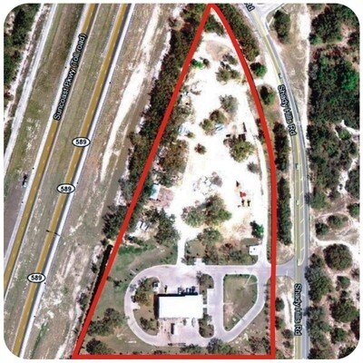
14525 Shady Hills Rd
30-24-18-0000-00100-0017
COM AT NE COR OF NE1/4 OF SEC TH N89DEG 4705W ALG N LINE OF NE1/4 2611.09 FT TO NW COR OF NE1/4 TH S00DEG 1057E ALG W LINE OF NE1/4 2646.32 FT TO SE COR OF NW1/4 OF SEC FOR POB TH N89DEG 4658W ALG S LINE OF NW1/4 298.84 FT TO ELY BDY OF SR 589 SEC 97
Commercialnec
PASCO
C3
Florida
AE The base floodplain where base flood elevations are provided. AE Zones are now used on new format FIRMs instead of A1-A30 Zones.
17
2024
9.07 AC
2026
Pasco County
031808
Tampa/St Petersburg
10,700 SF
Tampa-St. Petersburg-Clearwater, FL
NEARBY LISTINGS FOR SALE OR LEASE
-
-
View all Spring Hill listings for sale on LoopNet.com
DEMOGRAPHICS near 14525 Shady Hills Rd
1 mile
3 mile
5 mile
2025 Total Population
134
10,777
39,991
2030 Population
153
12,381
45,894
Pop Growth 2025-2030
+ 14.18%
+ 14.88%
+ 14.76%
Average Age
43
42
43
2025 Total Households
52
3,998
15,308
HH Growth 2025-2030
+ 13.46%
+ 14.38%
+ 14.20%
Median Household Inc
$68,437
$79,812
$77,925
Avg Household Size
2.60
2.60
2.50
2025 Avg HH Vehicles
2.00
2.00
2.00
Median Home Value
$369,999
$340,442
$342,290
Median Year Built
1995
2001
2001
Nearby Places
Map Layers
Map Styles
 Street
 Aerial
Layers
 Traffic
 Biking
Places
Listings with unknown addresses are not visible on the map
- Restaurants
- Banks
- Shops
- Fitness
- Groceries
PUBLIC TRANSPORTATION
AIRPORT
Tampa International
Drive
Walk
Distance
Tampa International
56 min
44.5 mi
Freight Ports
Port of Tampa Bay
Drive
Walk
Distance
Port of Tampa Bay
69 min
46.0 mi
Nearby Properties
Address
Land Use
TOTAL SIZE
Lot Size
Zoning
Address
Land Use
TOTAL SIZE
Lot Size
Zoning
207,043 SF
18.17 AC
AC
Address
Land Use
TOTAL SIZE
Lot Size
Zoning
501,673 SF
37.63 AC
I1
Address
Land Use
TOTAL SIZE
Lot Size
Zoning
451,725 SF
34.99 AC
I1
Address
Land Use
TOTAL SIZE
Lot Size
Zoning
181,328 SF
88.76 AC
AC
Address
Land Use
TOTAL SIZE
Lot Size
Zoning
103,893 SF
4.80 AC
I1
Address
Land Use
TOTAL SIZE
Lot Size
Zoning
172,977 SF
433.08 AC
AC
Address
Land Use
TOTAL SIZE
Lot Size
Zoning
20,914 SF
8.10 AC
MPUD
Address
Land Use
TOTAL SIZE
Lot Size
Zoning
78,182 SF
18.60 AC
MPUD
Address
Land Use
TOTAL SIZE
Lot Size
Zoning
139,565 SF
303.79 AC
AC
Address
Land Use
TOTAL SIZE
Lot Size
Zoning
74,254 SF
19.66 AC
AC
Address
Land Use
TOTAL SIZE
Lot Size
Zoning
218.89 AC
AC
Address
Land Use
TOTAL SIZE
Lot Size
Zoning
85,400 SF
14.46 AC
I2
Address
Land Use
TOTAL SIZE
Lot Size
Zoning
73,003 SF
78.69 AC
AC
Address
Land Use
TOTAL SIZE
Lot Size
Zoning
10,449 SF
14.22 AC
C2
Address
Land Use
TOTAL SIZE
Lot Size
Zoning
3,080 SF
11.32 AC
I1
Address
Land Use
TOTAL SIZE
Lot Size
Zoning
16,030 SF
4.99 AC
AR
Address
Land Use
TOTAL SIZE
Lot Size
Zoning
30,912 SF
176.98 AC
AC
Address
Land Use
TOTAL SIZE
Lot Size
Zoning
4,362 SF
1.59 AC
C1
Address
Land Use
TOTAL SIZE
Lot Size
Zoning
24,184 SF
28.31 AC
C3
Address
Land Use
TOTAL SIZE
Lot Size
Zoning
19.24 AC
MF1
Address
Land Use
TOTAL SIZE
Lot Size
Zoning
4,859 SF
2.15 AC
MPUD
Address
Land Use
TOTAL SIZE
Lot Size
Zoning
31,636 SF
4 AC
C2
Address
Land Use
TOTAL SIZE
Lot Size
Zoning
18.65 AC
C2
Address
Land Use
TOTAL SIZE
Lot Size
Zoning
31,815 SF
5 AC
I2
Address
Land Use
TOTAL SIZE
Lot Size
Zoning
3.73 AC
MPUD
Address
Land Use
TOTAL SIZE
Lot Size
Zoning
1,288 SF
240.26 AC
AC
Address
Land Use
TOTAL SIZE
Lot Size
Zoning
1.30 AC
C2
Address
Land Use
TOTAL SIZE
Lot Size
Zoning
0.96 AC
C2
Address
Land Use
TOTAL SIZE
Lot Size
Zoning
17,680 SF
19.21 AC
I1
The World's #1 Commercial Real Estate Marketplace
Connect with us
© 2026 CoStar Group
The information above has been obtained from sources believed reliable. While we do not doubt its accuracy we have not verified it and make no guarantee, warranty or representation about it. It is your responsibility to independently confirm its accuracy and completeness. Any projections, opinions, assumptions, or estimates used are for example only and do not represent the current or future performance of the property. The value of this transaction to you depends on tax and other factors which should be evaluated by your tax, financial, and legal advisors. You and your advisors should conduct a careful, independent investigation of the property to determine to your satisfaction the suitability of the property for your needs.