Property Record
6179 Us Route 4, Killington, VT 05751
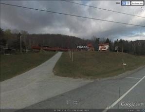

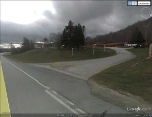
Property Detail
6179 Us Route 4
Rutland, VT
23.5A; COMM
384-119-12440
RUTLAND
Commercialnec
Vermont
B and X Area of moderate flood hazard, usually the area between the limits of the 100-year and 500-year floods.
23.50 AC
0
Vermont South Area
2025
Other Market Areas
962800
NEARBY LISTINGS FOR SALE OR LEASE
DEMOGRAPHICS near 6179 Us Route 4
1 mile
3 mile
5 mile
2025 Total Population
245
1,009
4,098
2030 Population
245
1,012
4,065
Pop Growth 2025-2030
0.00%
+ 0.30%
(0.81%)
Average Age
47
46
47
2025 Total Households
111
463
1,878
HH Growth 2025-2030
0.00%
+ 0.43%
(0.69%)
Median Household Inc
$84,166
$84,274
$84,317
Avg Household Size
2.20
2.20
2.20
2025 Avg HH Vehicles
2.00
2.00
2.00
Median Home Value
$383,333
$411,428
$386,021
Median Year Built
1977
1979
1980
Nearby Places
Map Layers
Map Styles
 Street
 Aerial
Layers
 Traffic
 Biking
Places
Listings with unknown addresses are not visible on the map
- Restaurants
- Banks
- Shops
- Fitness
- Groceries
PUBLIC TRANSPORTATION
COMMUTER RAIL
Rutland (Ethan Allen Express - Amtrak)
Drive
Walk
Distance
Rutland (Ethan Allen Express - Amtrak)
15 min
8.1 mi
Freight Ports
Albany, NY Port
Drive
Walk
Distance
Albany, NY Port
155 min
99.9 mi
Nearby Properties
Address
Land Use
TOTAL SIZE
Lot Size
Zoning
Address
Land Use
TOTAL SIZE
Lot Size
Zoning
Address
Land Use
TOTAL SIZE
Lot Size
Zoning
Address
Land Use
TOTAL SIZE
Lot Size
Zoning
Address
Land Use
TOTAL SIZE
Lot Size
Zoning
Address
Land Use
TOTAL SIZE
Lot Size
Zoning
31.10 AC
Address
Land Use
TOTAL SIZE
Lot Size
Zoning
9.45 AC
Address
Land Use
TOTAL SIZE
Lot Size
Zoning
Address
Land Use
TOTAL SIZE
Lot Size
Zoning
Address
Land Use
TOTAL SIZE
Lot Size
Zoning
3.06 AC
Address
Land Use
TOTAL SIZE
Lot Size
Zoning
27.05 AC
Address
Land Use
TOTAL SIZE
Lot Size
Zoning
12.80 AC
Address
Land Use
TOTAL SIZE
Lot Size
Zoning
2,921.18 AC
Address
Land Use
TOTAL SIZE
Lot Size
Zoning
1,360 AC
Address
Land Use
TOTAL SIZE
Lot Size
Zoning
1,221.40 AC
Address
Land Use
TOTAL SIZE
Lot Size
Zoning
1,079 AC
Address
Land Use
TOTAL SIZE
Lot Size
Zoning
120.70 AC
Address
Land Use
TOTAL SIZE
Lot Size
Zoning
2.22 AC
Address
Land Use
TOTAL SIZE
Lot Size
Zoning
7.40 AC
Address
Land Use
TOTAL SIZE
Lot Size
Zoning
7.40 AC
Address
Land Use
TOTAL SIZE
Lot Size
Zoning
12.30 AC
Address
Land Use
TOTAL SIZE
Lot Size
Zoning
0.59 AC
R4
Address
Land Use
TOTAL SIZE
Lot Size
Zoning
25.63 AC
Address
Land Use
TOTAL SIZE
Lot Size
Zoning
Address
Land Use
TOTAL SIZE
Lot Size
Zoning
Address
Land Use
TOTAL SIZE
Lot Size
Zoning
Address
Land Use
TOTAL SIZE
Lot Size
Zoning
458.10 AC
Address
Land Use
TOTAL SIZE
Lot Size
Zoning
1.15 AC
Address
Land Use
TOTAL SIZE
Lot Size
Zoning
2.35 AC
Address
Land Use
TOTAL SIZE
Lot Size
Zoning
2.65 AC
Address
Land Use
TOTAL SIZE
Lot Size
Zoning
0.70 AC
The World's #1 Commercial Real Estate Marketplace
Connect with us
© 2026 CoStar Group
The information above has been obtained from sources believed reliable. While we do not doubt its accuracy we have not verified it and make no guarantee, warranty or representation about it. It is your responsibility to independently confirm its accuracy and completeness. Any projections, opinions, assumptions, or estimates used are for example only and do not represent the current or future performance of the property. The value of this transaction to you depends on tax and other factors which should be evaluated by your tax, financial, and legal advisors. You and your advisors should conduct a careful, independent investigation of the property to determine to your satisfaction the suitability of the property for your needs.