Property Record
847 Rancheros Dr, San Marcos, CA 92069
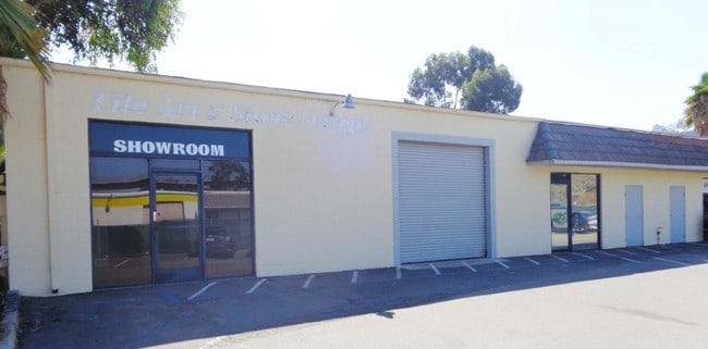

Property Detail
847 Rancheros Dr
San Diego-Chula Vista-Carlsbad, CA
LOT 37 TR 008881
226-691-19
SAN DIEGO
Lightindustrial
California
L-I
37
B and X Area of moderate flood hazard, usually the area between the limits of the 100-year and 500-year floods.
0.45 AC
2024
San Marcos
2025
San Diego
020041
NEARBY LISTINGS FOR SALE OR LEASE
DEMOGRAPHICS near 847 Rancheros Dr
1 mile
3 mile
5 mile
2025 Total Population
12,273
94,050
235,159
2030 Population
12,311
94,481
235,328
Pop Growth 2025-2030
+ 0.31%
+ 0.46%
+ 0.07%
Average Age
41
38
39
2025 Total Households
4,298
31,848
75,740
HH Growth 2025-2030
+ 0.49%
+ 0.33%
0.00%
Median Household Inc
$101,384
$99,512
$96,796
Avg Household Size
2.70
2.80
3.00
2025 Avg HH Vehicles
2.00
2.00
2.00
Median Home Value
$717,258
$754,829
$790,540
Median Year Built
1983
1986
1983
Nearby Places
Map Layers
Map Styles
 Street
 Aerial
Layers
 Traffic
 Biking
Places
Listings with unknown addresses are not visible on the map
- Restaurants
- Banks
- Shops
- Fitness
- Groceries
PUBLIC TRANSPORTATION
TRANSIT/SUBWAY
Nordahl Road (Sprinter - San Diego North County Transit District (Coaster/Sprinter/Breeze))
Drive
Walk
Distance
Nordahl Road (Sprinter - San Diego North County Transit District (Coaster/Sprinter/Breeze))
2 min
20 min
1.1 mi
AIRPORT
San Diego International
Drive
Walk
Distance
San Diego International
43 min
33.0 mi
Freight Ports
Port of San Diego
Drive
Walk
Distance
Port of San Diego
46 min
35.2 mi
SALE & LEASE HISTORY
LISTING DATE
SALE/LEASE

Oct 01, 2018
For Lease
Feb 20, 2020
For Lease
Feb 14, 2018
For Lease
Nearby Properties
Address
Land Use
TOTAL SIZE
Lot Size
Zoning
Address
Land Use
TOTAL SIZE
Lot Size
Zoning
27.98 AC
SPA
Address
Land Use
TOTAL SIZE
Lot Size
Zoning
14.98 AC
R-1-10
Address
Land Use
TOTAL SIZE
Lot Size
Zoning
9.77 AC
PD-R-18
Address
Land Use
TOTAL SIZE
Lot Size
Zoning
9,999 SF
15.37 AC
SPA
Address
Land Use
TOTAL SIZE
Lot Size
Zoning
5.25 AC
SPA
Address
Land Use
TOTAL SIZE
Lot Size
Zoning
5.37 AC
SPA
Address
Land Use
TOTAL SIZE
Lot Size
Zoning
10.82 AC
SPA
Address
Land Use
TOTAL SIZE
Lot Size
Zoning
Address
Land Use
TOTAL SIZE
Lot Size
Zoning
71,656 SF
S-P
Address
Land Use
TOTAL SIZE
Lot Size
Zoning
9.88 AC
R-3-10
Address
Land Use
TOTAL SIZE
Lot Size
Zoning
SPECIFIC P
Address
Land Use
TOTAL SIZE
Lot Size
Zoning
75,138 SF
C
Address
Land Use
TOTAL SIZE
Lot Size
Zoning
80,064 SF
1.53 AC
S-P
Address
Land Use
TOTAL SIZE
Lot Size
Zoning
5.94 AC
PD-R-24
Address
Land Use
TOTAL SIZE
Lot Size
Zoning
99,461 SF
4.89 AC
SPA
Address
Land Use
TOTAL SIZE
Lot Size
Zoning
10.80 AC
SPA
Address
Land Use
TOTAL SIZE
Lot Size
Zoning
1.94 AC
C
Address
Land Use
TOTAL SIZE
Lot Size
Zoning
8.30 AC
R-2-12
Address
Land Use
TOTAL SIZE
Lot Size
Zoning
Address
Land Use
TOTAL SIZE
Lot Size
Zoning
97,874 SF
8.47 AC
R-2-12
Address
Land Use
TOTAL SIZE
Lot Size
Zoning
1.49 AC
SPA
Address
Land Use
TOTAL SIZE
Lot Size
Zoning
13.99 AC
PD-C
Address
Land Use
TOTAL SIZE
Lot Size
Zoning
5.85 AC
SPA
Address
Land Use
TOTAL SIZE
Lot Size
Zoning
7.06 AC
SR
Address
Land Use
TOTAL SIZE
Lot Size
Zoning
6.24 AC
R-3-18
Address
Land Use
TOTAL SIZE
Lot Size
Zoning
95,713 SF
0.51 AC
C
Address
Land Use
TOTAL SIZE
Lot Size
Zoning
10.69 AC
R-3-10
Address
Land Use
TOTAL SIZE
Lot Size
Zoning
16.12 AC
SPA
Address
Land Use
TOTAL SIZE
Lot Size
Zoning
10.83 AC
SPA
Address
Land Use
TOTAL SIZE
Lot Size
Zoning
96,747 SF
3.34 AC
SPA
The World's #1 Commercial Real Estate Marketplace
Connect with us
© 2026 CoStar Group
The information above has been obtained from sources believed reliable. While we do not doubt its accuracy we have not verified it and make no guarantee, warranty or representation about it. It is your responsibility to independently confirm its accuracy and completeness. Any projections, opinions, assumptions, or estimates used are for example only and do not represent the current or future performance of the property. The value of this transaction to you depends on tax and other factors which should be evaluated by your tax, financial, and legal advisors. You and your advisors should conduct a careful, independent investigation of the property to determine to your satisfaction the suitability of the property for your needs.