Property Record
500 River Ridge Dr, Norwood, MA 02062


Property Detail
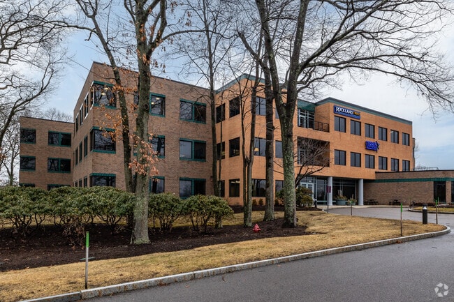
500 River Ridge Dr
NORW-000015-000022-000055
Norfolk
Officebuilding
Massachusetts
B and X Area of moderate flood hazard, usually the area between the limits of the 100-year and 500-year floods.
55
2025
6.41 AC
2025
Route 1 South
413500
Boston
100,577 SF
Boston-Cambridge-Newton, MA-NH
NEARBY LISTINGS FOR SALE OR LEASE
DEMOGRAPHICS near 500 River Ridge Dr
1 mile
3 mile
5 mile
2025 Total Population
8,900
57,601
130,206
2030 Population
9,034
59,144
133,947
Pop Growth 2025-2030
+ 1.51%
+ 2.68%
+ 2.87%
Average Age
42
42
42
2025 Total Households
3,454
22,644
49,935
HH Growth 2025-2030
+ 1.53%
+ 2.76%
+ 3.01%
Median Household Inc
$85,793
$123,853
$136,278
Avg Household Size
2.50
2.50
2.50
2025 Avg HH Vehicles
2.00
2.00
2.00
Median Home Value
$734,280
$738,149
$753,260
Median Year Built
1958
1965
1966
Nearby Places
Map Layers
Map Styles
 Street
 Aerial
Layers
 Traffic
 Biking
Places
Listings with unknown addresses are not visible on the map
- Restaurants
- Banks
- Shops
- Fitness
- Groceries
PUBLIC TRANSPORTATION
COMMUTER RAIL
Norwood Central (Franklin Line - Massachusetts Bay Transportation Authority Commuter Rail (Purple Line))
Drive
Walk
Distance
Norwood Central (Franklin Line - Massachusetts Bay Transportation Authority Commuter Rail (Purple Line))
6 min
1.8 mi
Windsor Gardens (Franklin Line - Massachusetts Bay Transportation Authority Commuter Rail (Purple Line))
Drive
Walk
Distance
Windsor Gardens (Franklin Line - Massachusetts Bay Transportation Authority Commuter Rail (Purple Line))
7 min
2.2 mi
AIRPORT
General Edward Lawrence Logan International
Drive
Walk
Distance
General Edward Lawrence Logan International
39 min
24.5 mi
Rhode Island Tf Green International
Drive
Walk
Distance
Rhode Island Tf Green International
56 min
37.8 mi
Freight Ports
Port of Boston
Drive
Walk
Distance
Port of Boston
36 min
19.1 mi
SALE & LEASE HISTORY
LISTING DATE
SALE/LEASE

Sep 25, 2016
For Lease
Sep 14, 2018
For Lease
Feb 16, 2021
For Lease
Nearby Properties
Address
Land Use
TOTAL SIZE
Lot Size
Zoning
Address
Land Use
TOTAL SIZE
Lot Size
Zoning
380,030 SF
24.87 AC
Address
Land Use
TOTAL SIZE
Lot Size
Zoning
544,990 SF
63.29 AC
Address
Land Use
TOTAL SIZE
Lot Size
Zoning
380,030 SF
24.87 AC
Address
Land Use
TOTAL SIZE
Lot Size
Zoning
45,836 SF
23.25 AC
Address
Land Use
TOTAL SIZE
Lot Size
Zoning
351,699 SF
27.36 AC
Address
Land Use
TOTAL SIZE
Lot Size
Zoning
5,349 SF
8.74 AC
Address
Land Use
TOTAL SIZE
Lot Size
Zoning
132,917 SF
24 AC
RE
Address
Land Use
TOTAL SIZE
Lot Size
Zoning
97.60 AC
Address
Land Use
TOTAL SIZE
Lot Size
Zoning
30.94 AC
Address
Land Use
TOTAL SIZE
Lot Size
Zoning
242,198 SF
53.28 AC
Address
Land Use
TOTAL SIZE
Lot Size
Zoning
198,120 SF
51 AC
3
Address
Land Use
TOTAL SIZE
Lot Size
Zoning
28,561 SF
26.30 AC
Address
Land Use
TOTAL SIZE
Lot Size
Zoning
81,796 SF
11.87 AC
Address
Land Use
TOTAL SIZE
Lot Size
Zoning
195,690 SF
14.98 AC
NV
Address
Land Use
TOTAL SIZE
Lot Size
Zoning
185,592 SF
37.21 AC
Address
Land Use
TOTAL SIZE
Lot Size
Zoning
294,771 SF
17.85 AC
Address
Land Use
TOTAL SIZE
Lot Size
Zoning
62,043 SF
10.68 AC
6
Address
Land Use
TOTAL SIZE
Lot Size
Zoning
81,009 SF
22.16 AC
Address
Land Use
TOTAL SIZE
Lot Size
Zoning
14.33 AC
Address
Land Use
TOTAL SIZE
Lot Size
Zoning
170,482 SF
18.60 AC
Address
Land Use
TOTAL SIZE
Lot Size
Zoning
218,676 SF
22.54 AC
Address
Land Use
TOTAL SIZE
Lot Size
Zoning
263,007 SF
8.11 AC
Address
Land Use
TOTAL SIZE
Lot Size
Zoning
329,800 SF
18.49 AC
Address
Land Use
TOTAL SIZE
Lot Size
Zoning
361,239 SF
37.28 AC
Address
Land Use
TOTAL SIZE
Lot Size
Zoning
127,278 SF
7.89 AC
Address
Land Use
TOTAL SIZE
Lot Size
Zoning
33,778 SF
18.86 AC
Address
Land Use
TOTAL SIZE
Lot Size
Zoning
354,197 SF
24.13 AC
Address
Land Use
TOTAL SIZE
Lot Size
Zoning
160,508 SF
9.46 AC
Address
Land Use
TOTAL SIZE
Lot Size
Zoning
138,380 SF
17.26 AC
Address
Land Use
TOTAL SIZE
Lot Size
Zoning
133,810 SF
8.60 AC
The World's #1 Commercial Real Estate Marketplace
Connect with us
© 2026 CoStar Group
The information above has been obtained from sources believed reliable. While we do not doubt its accuracy we have not verified it and make no guarantee, warranty or representation about it. It is your responsibility to independently confirm its accuracy and completeness. Any projections, opinions, assumptions, or estimates used are for example only and do not represent the current or future performance of the property. The value of this transaction to you depends on tax and other factors which should be evaluated by your tax, financial, and legal advisors. You and your advisors should conduct a careful, independent investigation of the property to determine to your satisfaction the suitability of the property for your needs.