Property Record
2044 Austin Ave, Rochester Hills, MI 48309
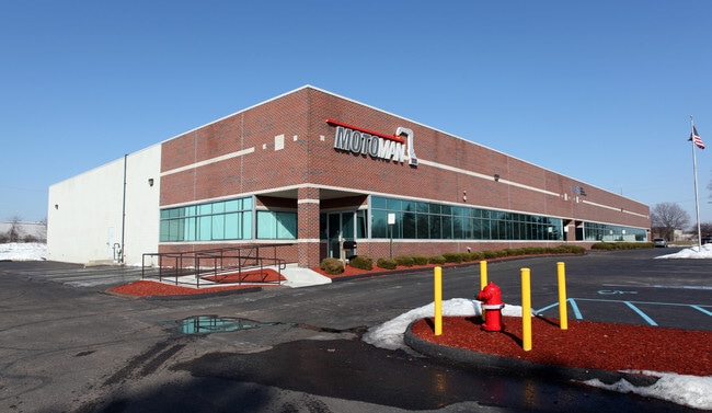


Property Detail
2044 Austin Ave
15-29-427-031
T3N, R11E, SEC 29 COMMERCE PARK OF ROCHESTER HILLS LOTS 1 & 2, ALSO E 57.50 FT OF LOT 3 8-22-03 FR 028 12-28-15 CORR
Industrialgeneral
Oakland
II
Michigan
B and X Area of moderate flood hazard, usually the area between the limits of the 100-year and 500-year floods.
1-3,8
2025
2.88 AC
2022
Auburn Hills, Pontiac & Rochester
194500
Detroit
38,487 SF
Detroit-Warren-Dearborn, MI
NEARBY LISTINGS FOR SALE OR LEASE
DEMOGRAPHICS near 2044 Austin Ave
1 mile
3 mile
5 mile
2025 Total Population
5,806
62,888
187,573
2030 Population
5,984
64,288
191,944
Pop Growth 2025-2030
+ 3.07%
+ 2.23%
+ 2.33%
Average Age
46
42
42
2025 Total Households
2,494
25,176
73,870
HH Growth 2025-2030
+ 3.01%
+ 2.34%
+ 2.54%
Median Household Inc
$101,185
$110,787
$107,832
Avg Household Size
2.30
2.40
2.40
2025 Avg HH Vehicles
2.00
2.00
2.00
Median Home Value
$321,168
$391,484
$404,103
Median Year Built
1988
1982
1980
Nearby Places
Map Layers
Map Styles
 Street
 Aerial
Layers
 Traffic
 Biking
Places
Listings with unknown addresses are not visible on the map
- Restaurants
- Banks
- Shops
- Fitness
- Groceries
PUBLIC TRANSPORTATION
COMMUTER RAIL
Pontiac Amtrak Station (Wolverine - Amtrak)
Drive
Walk
Distance
Pontiac Amtrak Station (Wolverine - Amtrak)
13 min
8.0 mi
Troy Amtrak Station (Wolverine - Amtrak)
Drive
Walk
Distance
Troy Amtrak Station (Wolverine - Amtrak)
16 min
8.1 mi
AIRPORT
Windsor International
Drive
Walk
Distance
Windsor International
54 min
34.3 mi
Freight Ports
Port of Toledo
Drive
Walk
Distance
Port of Toledo
104 min
84.9 mi
Nearby Properties
Address
Land Use
TOTAL SIZE
Lot Size
Zoning
Address
Land Use
TOTAL SIZE
Lot Size
Zoning
3,529 SF
29.19 AC
BI
Address
Land Use
TOTAL SIZE
Lot Size
Zoning
453,700 SF
Address
Land Use
TOTAL SIZE
Lot Size
Zoning
404,427 SF
28.15 AC
TR
Address
Land Use
TOTAL SIZE
Lot Size
Zoning
Address
Land Use
TOTAL SIZE
Lot Size
Zoning
337,992 SF
18.96 AC
TR
Address
Land Use
TOTAL SIZE
Lot Size
Zoning
104,434 SF
8.64 AC
Address
Land Use
TOTAL SIZE
Lot Size
Zoning
288,288 SF
15 AC
Address
Land Use
TOTAL SIZE
Lot Size
Zoning
144,450 SF
11.22 AC
OSC
Address
Land Use
TOTAL SIZE
Lot Size
Zoning
144,450 SF
11.22 AC
Address
Land Use
TOTAL SIZE
Lot Size
Zoning
337,992 SF
Address
Land Use
TOTAL SIZE
Lot Size
Zoning
136,962 SF
43.80 AC
OSC
Address
Land Use
TOTAL SIZE
Lot Size
Zoning
210,000 SF
14.46 AC
TR
Address
Land Use
TOTAL SIZE
Lot Size
Zoning
14.48 AC
Address
Land Use
TOTAL SIZE
Lot Size
Zoning
321,936 SF
29.11 AC
RM1
Address
Land Use
TOTAL SIZE
Lot Size
Zoning
64,217 SF
39.13 AC
Address
Land Use
TOTAL SIZE
Lot Size
Zoning
209,596 SF
9.16 AC
TR
Address
Land Use
TOTAL SIZE
Lot Size
Zoning
336,720 SF
63.11 AC
CR1
Address
Land Use
TOTAL SIZE
Lot Size
Zoning
75,717 SF
9.13 AC
TR
Address
Land Use
TOTAL SIZE
Lot Size
Zoning
22.09 AC
AI
Address
Land Use
TOTAL SIZE
Lot Size
Zoning
Address
Land Use
TOTAL SIZE
Lot Size
Zoning
21.52 AC
AI
Address
Land Use
TOTAL SIZE
Lot Size
Zoning
19.86 AC
AI
Address
Land Use
TOTAL SIZE
Lot Size
Zoning
88,734 SF
17.78 AC
Address
Land Use
TOTAL SIZE
Lot Size
Zoning
142,580 SF
14.26 AC
RC
Address
Land Use
TOTAL SIZE
Lot Size
Zoning
11.98 AC
RI
Address
Land Use
TOTAL SIZE
Lot Size
Zoning
The World's #1 Commercial Real Estate Marketplace
Connect with us
© 2026 CoStar Group
The information above has been obtained from sources believed reliable. While we do not doubt its accuracy we have not verified it and make no guarantee, warranty or representation about it. It is your responsibility to independently confirm its accuracy and completeness. Any projections, opinions, assumptions, or estimates used are for example only and do not represent the current or future performance of the property. The value of this transaction to you depends on tax and other factors which should be evaluated by your tax, financial, and legal advisors. You and your advisors should conduct a careful, independent investigation of the property to determine to your satisfaction the suitability of the property for your needs.