Property Record
1203 14Th Ave Se, Decatur, AL 35601


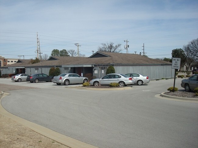
Property Detail
1203 14Th Ave Se
03-09-29-1-004-002.002
PT NW1/4 OF NE1/4 OF SEC 29 T5S R4W; BEG INT SO R/W 8TH ST SE & E R/W 13TH AVE SE; TH E ALG SO R/W OF 8TH ST 151.80', TH SO 1
Medicalbuilding
MORGAN
B and X Area of moderate flood hazard, usually the area between the limits of the 100-year and 500-year floods.
Alabama
0
1.62 AC
2024
Downtown Decatur
000700
Other Market Areas
8,506 SF
Decatur, AL
NEARBY LISTINGS FOR SALE OR LEASE
DEMOGRAPHICS near 1203 14Th Ave Se
1 mile
3 mile
5 mile
2025 Total Population
9,114
38,045
57,198
2030 Population
9,340
38,670
58,099
Pop Growth 2025-2030
+ 2.48%
+ 1.64%
+ 1.58%
Average Age
40
39
40
2025 Total Households
3,695
15,225
23,303
HH Growth 2025-2030
+ 2.73%
+ 1.77%
+ 1.67%
Median Household Inc
$52,274
$55,533
$64,798
Avg Household Size
2.20
2.30
2.30
2025 Avg HH Vehicles
2.00
2.00
2.00
Median Home Value
$143,839
$160,920
$203,341
Median Year Built
1960
1969
1977
Nearby Places
Map Layers
Map Styles
 Street
 Aerial
Layers
 Traffic
 Biking
Places
Listings with unknown addresses are not visible on the map
- Restaurants
- Banks
- Shops
- Fitness
- Groceries
PUBLIC TRANSPORTATION
AIRPORT
Huntsville International-Carl T Jones Field
Drive
Walk
Distance
Huntsville International-Carl T Jones Field
25 min
17.0 mi
Freight Ports
Port of Mobile
Drive
Walk
Distance
Port of Mobile
369 min
334.9 mi
SALE & LEASE HISTORY
LISTING DATE
SALE/LEASE

Mar 17, 2017
For Sale
Nearby Properties
Address
Land Use
TOTAL SIZE
Lot Size
Zoning
Address
Land Use
TOTAL SIZE
Lot Size
Zoning
103,569 SF
6.69 AC
Address
Land Use
TOTAL SIZE
Lot Size
Zoning
7,812 SF
162 AC
Address
Land Use
TOTAL SIZE
Lot Size
Zoning
258,250 SF
55 AC
Address
Land Use
TOTAL SIZE
Lot Size
Zoning
133,056 SF
6.29 AC
Address
Land Use
TOTAL SIZE
Lot Size
Zoning
132,156 SF
1.69 AC
Address
Land Use
TOTAL SIZE
Lot Size
Zoning
77,430 SF
19 AC
Address
Land Use
TOTAL SIZE
Lot Size
Zoning
157,720 SF
22 AC
Address
Land Use
TOTAL SIZE
Lot Size
Zoning
48,364 SF
1.80 AC
Address
Land Use
TOTAL SIZE
Lot Size
Zoning
40,212 SF
1.21 AC
Address
Land Use
TOTAL SIZE
Lot Size
Zoning
54,544 SF
6.53 AC
Address
Land Use
TOTAL SIZE
Lot Size
Zoning
128,239 SF
7.10 AC
Address
Land Use
TOTAL SIZE
Lot Size
Zoning
51,958 SF
14 AC
Address
Land Use
TOTAL SIZE
Lot Size
Zoning
106,165 SF
0.80 AC
Address
Land Use
TOTAL SIZE
Lot Size
Zoning
100,632 SF
20 AC
Address
Land Use
TOTAL SIZE
Lot Size
Zoning
2,010 SF
20 AC
Address
Land Use
TOTAL SIZE
Lot Size
Zoning
377,685 SF
17 AC
Address
Land Use
TOTAL SIZE
Lot Size
Zoning
81,682 SF
13 AC
Address
Land Use
TOTAL SIZE
Lot Size
Zoning
205,279 SF
25.45 AC
Address
Land Use
TOTAL SIZE
Lot Size
Zoning
135,440 SF
6.76 AC
Address
Land Use
TOTAL SIZE
Lot Size
Zoning
220,128 SF
34 AC
Address
Land Use
TOTAL SIZE
Lot Size
Zoning
54,352 SF
10.70 AC
Address
Land Use
TOTAL SIZE
Lot Size
Zoning
40,712 SF
12 AC
Address
Land Use
TOTAL SIZE
Lot Size
Zoning
145,413 SF
2.30 AC
Address
Land Use
TOTAL SIZE
Lot Size
Zoning
2,546 SF
9.30 AC
Address
Land Use
TOTAL SIZE
Lot Size
Zoning
64,449 SF
12 AC
Address
Land Use
TOTAL SIZE
Lot Size
Zoning
19,239 SF
4.50 AC
Address
Land Use
TOTAL SIZE
Lot Size
Zoning
4,865 SF
22 AC
Address
Land Use
TOTAL SIZE
Lot Size
Zoning
32,821 SF
1.68 AC
Address
Land Use
TOTAL SIZE
Lot Size
Zoning
49,384 SF
1.07 AC
Address
Land Use
TOTAL SIZE
Lot Size
Zoning
6.50 AC
The World's #1 Commercial Real Estate Marketplace
Connect with us
© 2026 CoStar Group
The information above has been obtained from sources believed reliable. While we do not doubt its accuracy we have not verified it and make no guarantee, warranty or representation about it. It is your responsibility to independently confirm its accuracy and completeness. Any projections, opinions, assumptions, or estimates used are for example only and do not represent the current or future performance of the property. The value of this transaction to you depends on tax and other factors which should be evaluated by your tax, financial, and legal advisors. You and your advisors should conduct a careful, independent investigation of the property to determine to your satisfaction the suitability of the property for your needs.