Property Record
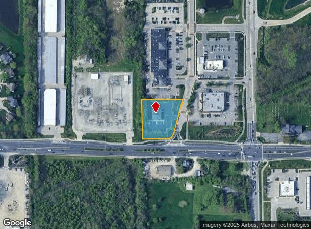
14611 N Gray Rd, Westfield, IN 46062

NEARBY LISTINGS FOR SALE OR LEASE
Property Detail
14611 N Gray Rd
29-10-17-000-006.213-015
ACREAGE 1.11, SECTION 17, TOWNSHIP 18, RANGE 4
Financialbuilding
Hamilton
X
Indiana
18057C0139G
1.11 AC
2023
Carmel
2024
Indianapolis
110515
Indianapolis-Carmel-Anderson, IN
2,916 SF
DEMOGRAPHICS near 14611 N Gray Rd
1 Mile
3 Mile
5 Mile
2024 Total Population
8,105
63,489
167,362
2029 Population
9,080
71,417
188,456
Pop Growth 2024-2029
+ 12.03%
+ 12.49%
+ 12.60%
Average Age
41
40
39
2024 Total Households
2,893
23,636
64,484
HH Growth 2024-2029
+ 12.06%
+ 12.53%
+ 12.69%
Median Household Inc
$169,970
$114,178
$99,447
Avg Household Size
2.80
2.60
2.50
2024 Avg HH Vehicles
2.00
2.00
2.00
Median Home Value
$455,936
$393,718
$332,647
Median Year Built
2004
2000
1998
Nearby Places
- Restaurants
- Banks
- Shops
- Fitness
- Groceries
PUBLIC TRANSPORTATION
AIRPORT
Indianapolis International
DRIVE
WALK
Distance
Indianapolis International
55 min
34.3 mi
Freight Ports
Port of Toledo
DRIVE
WALK
Distance
Port of Toledo
256 min
212.9 mi
SALE & LEASE HISTORY
LISTING DATE
SALE/LEASE

Jul 24, 2019
For Lease
Jul 02, 2019
For Lease
Nearby Properties
Address
Land Use
TOTAL SIZE
Lot Size
Zoning
Address
Land Use
TOTAL SIZE
Lot Size
Zoning
272,700 SF
2.10 AC
Address
Land Use
TOTAL SIZE
Lot Size
Zoning
298,290 SF
2.80 AC
Address
Land Use
TOTAL SIZE
Lot Size
Zoning
451,785 SF
13.04 AC
Address
Land Use
TOTAL SIZE
Lot Size
Zoning
115,160 SF
2.35 AC
Address
Land Use
TOTAL SIZE
Lot Size
Zoning
236,320 SF
20.74 AC
Address
Land Use
TOTAL SIZE
Lot Size
Zoning
261,003 SF
1.92 AC
Address
Land Use
TOTAL SIZE
Lot Size
Zoning
357,660 SF
22.37 AC
Address
Land Use
TOTAL SIZE
Lot Size
Zoning
318,922 SF
31.70 AC
Address
Land Use
TOTAL SIZE
Lot Size
Zoning
280,736 SF
9.06 AC
Address
Land Use
TOTAL SIZE
Lot Size
Zoning
360,178 SF
36 AC
Address
Land Use
TOTAL SIZE
Lot Size
Zoning
188,239 SF
11.15 AC
Address
Land Use
TOTAL SIZE
Lot Size
Zoning
297,641 SF
70.35 AC
Address
Land Use
TOTAL SIZE
Lot Size
Zoning
228,713 SF
7.06 AC
Address
Land Use
TOTAL SIZE
Lot Size
Zoning
113,500 SF
0.49 AC
Address
Land Use
TOTAL SIZE
Lot Size
Zoning
186,668 SF
19.09 AC
Address
Land Use
TOTAL SIZE
Lot Size
Zoning
149,492 SF
1.39 AC
Address
Land Use
TOTAL SIZE
Lot Size
Zoning
124,377 SF
5.55 AC
Address
Land Use
TOTAL SIZE
Lot Size
Zoning
173,884 SF
14.07 AC
Address
Land Use
TOTAL SIZE
Lot Size
Zoning
149,330 SF
0.61 AC
Address
Land Use
TOTAL SIZE
Lot Size
Zoning
986,299 SF
14.25 AC
Address
Land Use
TOTAL SIZE
Lot Size
Zoning
209,778 SF
24.45 AC
Address
Land Use
TOTAL SIZE
Lot Size
Zoning
141,666 SF
76.66 AC
Address
Land Use
TOTAL SIZE
Lot Size
Zoning
238,722 SF
24.27 AC
Address
Land Use
TOTAL SIZE
Lot Size
Zoning
73,680 SF
19.08 AC
Address
Land Use
TOTAL SIZE
Lot Size
Zoning
241,000 SF
15.01 AC
Address
Land Use
TOTAL SIZE
Lot Size
Zoning
238,692 SF
17.71 AC
Address
Land Use
TOTAL SIZE
Lot Size
Zoning
96,434 SF
6.05 AC
Address
Land Use
TOTAL SIZE
Lot Size
Zoning
129,005 SF
13.19 AC
Address
Land Use
TOTAL SIZE
Lot Size
Zoning
151,448 SF
10.58 AC
Address
Land Use
TOTAL SIZE
Lot Size
Zoning
82,474 SF
0.69 AC
The World's #1 Commercial Real Estate Marketplace
Connect with us
© 2025 CoStar Group
The information above has been obtained from sources believed reliable. While we do not doubt its accuracy we have not verified it and make no guarantee, warranty or representation about it. It is your responsibility to independently confirm its accuracy and completeness. Any projections, opinions, assumptions, or estimates used are for example only and do not represent the current or future performance of the property. The value of this transaction to you depends on tax and other factors which should be evaluated by your tax, financial, and legal advisors. You and your advisors should conduct a careful, independent investigation of the property to determine to your satisfaction the suitability of the property for your needs.