Property Record
401 Se 12Th St, Fort Lauderdale, FL 33316
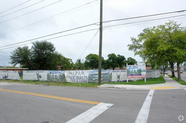


Property Detail
401 Se 12Th St
50-42-15-01-0650
LAUDERDALE 2-9 D LOTS 13,14 & 15 LESS THAT PT OF LOTS 13 & 14 DESC AS BEG SW COR LOT 13,N 35.02,SELY 31.44,E 84.98 TO E/L LOT 14,S 15,W 105 TO POB & LESS S 15 OF LOT 15 BLK 6
Officebuilding
BROWARD
RO
Florida
AE The base floodplain where base flood elevations are provided. AE Zones are now used on new format FIRMs instead of A1-A30 Zones.
13-15
2025
0.42 AC
2026
Rio Vista
042302
South Florida
19,636 SF
Fort Lauderdale-Pompano Beach-Sunrise, FL
NEARBY LISTINGS FOR SALE OR LEASE
DEMOGRAPHICS near 401 Se 12Th St
1 mile
3 mile
5 mile
2025 Total Population
24,867
126,057
291,667
2030 Population
26,971
135,312
313,229
Pop Growth 2025-2030
+ 8.46%
+ 7.34%
+ 7.39%
Average Age
44
43
43
2025 Total Households
12,462
59,093
126,666
HH Growth 2025-2030
+ 8.31%
+ 7.33%
+ 7.44%
Median Household Inc
$113,844
$90,669
$76,678
Avg Household Size
1.80
2.00
2.20
2025 Avg HH Vehicles
2.00
2.00
2.00
Median Home Value
$814,564
$711,707
$546,912
Median Year Built
1997
1974
1973
Nearby Places
Map Layers
Map Styles
 Street
 Aerial
Layers
 Traffic
 Biking
Places
Listings with unknown addresses are not visible on the map
- Restaurants
- Banks
- Shops
- Fitness
- Groceries
PUBLIC TRANSPORTATION
COMMUTER RAIL
Fort Lauderdale (Mainline - Brightline)
Drive
Walk
Distance
Fort Lauderdale (Mainline - Brightline)
4 min
1.5 mi
Fort Lauderdale (Tri-County Commuter - South Florida Regional Transportation Authority (Tri-Rail))
Drive
Walk
Distance
Fort Lauderdale (Tri-County Commuter - South Florida Regional Transportation Authority (Tri-Rail))
9 min
3.7 mi
AIRPORT
Fort Lauderdale/Hollywood International
Drive
Walk
Distance
Fort Lauderdale/Hollywood International
13 min
5.2 mi
Miami International
Drive
Walk
Distance
Miami International
50 min
31.8 mi
Freight Ports
Port Everglades
Drive
Walk
Distance
Port Everglades
4 min
1.7 mi
Nearby Properties
Address
Land Use
TOTAL SIZE
Lot Size
Zoning
Address
Land Use
TOTAL SIZE
Lot Size
Zoning
4,648,575 SF
887.02 AC
AT
Address
Land Use
TOTAL SIZE
Lot Size
Zoning
2,397,109 SF
94.56 AC
PEDD
Address
Land Use
TOTAL SIZE
Lot Size
Zoning
987,192 SF
3.74 AC
PEDD
Address
Land Use
TOTAL SIZE
Lot Size
Zoning
3,629,204 SF
159.43 AC
AT
Address
Land Use
TOTAL SIZE
Lot Size
Zoning
1,773,724 SF
13.20 AC
RAC-CC
Address
Land Use
TOTAL SIZE
Lot Size
Zoning
926,033 SF
16.27 AC
RMH-60
Address
Land Use
TOTAL SIZE
Lot Size
Zoning
725,898 SF
2.43 AC
RAC-CC
Address
Land Use
TOTAL SIZE
Lot Size
Zoning
777,237 SF
1.41 AC
RAC-CC
Address
Land Use
TOTAL SIZE
Lot Size
Zoning
964,376 SF
258.71 AC
AT
Address
Land Use
TOTAL SIZE
Lot Size
Zoning
672,167 SF
1.30 AC
RAC-CC
Address
Land Use
TOTAL SIZE
Lot Size
Zoning
1,503,015 SF
13.03 AC
CF
Address
Land Use
TOTAL SIZE
Lot Size
Zoning
987,590 SF
1.23 AC
RAC-CC
Address
Land Use
TOTAL SIZE
Lot Size
Zoning
730,297 SF
4.02 AC
B-1
Address
Land Use
TOTAL SIZE
Lot Size
Zoning
650,347 SF
0.72 AC
RAC-CC
Address
Land Use
TOTAL SIZE
Lot Size
Zoning
626,520 SF
0.80 AC
RAC-CC
Address
Land Use
TOTAL SIZE
Lot Size
Zoning
642,003 SF
1.55 AC
RAC-CC
Address
Land Use
TOTAL SIZE
Lot Size
Zoning
387,522 SF
9.83 AC
RMH-60
Address
Land Use
TOTAL SIZE
Lot Size
Zoning
285,739 SF
4 AC
PEDD
Address
Land Use
TOTAL SIZE
Lot Size
Zoning
632,970 SF
3.75 AC
RAC-UV
Address
Land Use
TOTAL SIZE
Lot Size
Zoning
734,444 SF
5.26 AC
RAC-CC
Address
Land Use
TOTAL SIZE
Lot Size
Zoning
402,360 SF
1.26 AC
PRD
Address
Land Use
TOTAL SIZE
Lot Size
Zoning
567,524 SF
3.81 AC
ABA
Address
Land Use
TOTAL SIZE
Lot Size
Zoning
656,281 SF
3.81 AC
B-1
Address
Land Use
TOTAL SIZE
Lot Size
Zoning
936,012 SF
1.41 AC
RAC-CC
Address
Land Use
TOTAL SIZE
Lot Size
Zoning
616,235 SF
1.91 AC
RAC-EMU
Address
Land Use
TOTAL SIZE
Lot Size
Zoning
678,634 SF
0.36 AC
RAC-CC
Address
Land Use
TOTAL SIZE
Lot Size
Zoning
383,964 SF
2.06 AC
RAC-EMU
Address
Land Use
TOTAL SIZE
Lot Size
Zoning
578,515 SF
1.36 AC
RAC-CC
Address
Land Use
TOTAL SIZE
Lot Size
Zoning
578,981 SF
1.25 AC
RAC-EMU
Address
Land Use
TOTAL SIZE
Lot Size
Zoning
414,522 SF
5.76 AC
RAC-AS
The World's #1 Commercial Real Estate Marketplace
Connect with us
© 2026 CoStar Group
The information above has been obtained from sources believed reliable. While we do not doubt its accuracy we have not verified it and make no guarantee, warranty or representation about it. It is your responsibility to independently confirm its accuracy and completeness. Any projections, opinions, assumptions, or estimates used are for example only and do not represent the current or future performance of the property. The value of this transaction to you depends on tax and other factors which should be evaluated by your tax, financial, and legal advisors. You and your advisors should conduct a careful, independent investigation of the property to determine to your satisfaction the suitability of the property for your needs.