Property Record
15201 S Padre Island Dr, Corpus Christi, TX 78418
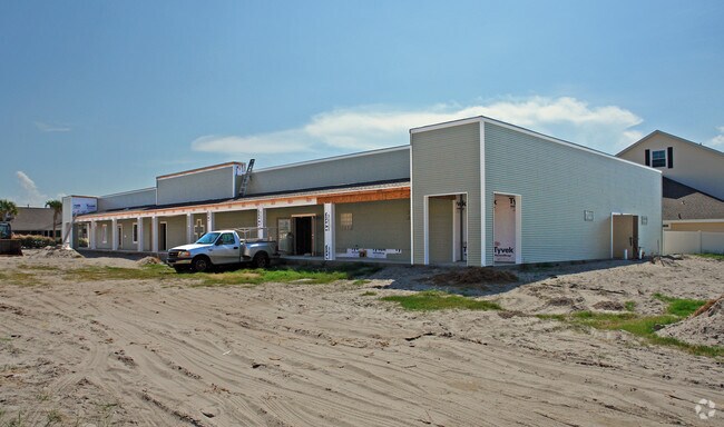
Property Detail
15201 S Padre Island Dr
278224
PADRE ISLAND NO 4 LT 15A BLK 191
Commercialnec
NUECES
B-2A
Texas
AE The base floodplain where base flood elevations are provided. AE Zones are now used on new format FIRMs instead of A1-A30 Zones.
15a
0
0.87 AC
2025
Flour Bluff/Padre Island
006205
Corpus Christi
8,640 SF
Corpus Christi, TX
NEARBY LISTINGS FOR SALE OR LEASE
-
-
View all Corpus Christi listings for sale on LoopNet.com
DEMOGRAPHICS near 15201 S Padre Island Dr
1 mile
3 mile
5 mile
2025 Total Population
6,706
12,930
16,549
2030 Population
7,096
13,587
17,235
Pop Growth 2025-2030
+ 5.82%
+ 5.08%
+ 4.15%
Average Age
44
45
45
2025 Total Households
2,893
5,577
6,968
HH Growth 2025-2030
+ 6.05%
+ 5.27%
+ 4.33%
Median Household Inc
$119,342
$130,530
$122,100
Avg Household Size
2.30
2.30
2.30
2025 Avg HH Vehicles
2.00
2.00
2.00
Median Home Value
$385,754
$444,379
$402,466
Median Year Built
2000
1999
1996
Nearby Places
Map Layers
Map Styles
 Street
 Aerial
Layers
 Traffic
 Biking
Places
Listings with unknown addresses are not visible on the map
- Restaurants
- Banks
- Shops
- Fitness
- Groceries
PUBLIC TRANSPORTATION
AIRPORT
Corpus Christi International
Drive
Walk
Distance
Corpus Christi International
34 min
24.1 mi
Nearby Properties
Address
Land Use
TOTAL SIZE
Lot Size
Zoning
Address
Land Use
TOTAL SIZE
Lot Size
Zoning
138.88 AC
ATIO
Address
Land Use
TOTAL SIZE
Lot Size
Zoning
210 AC
F-R&AT
Address
Land Use
TOTAL SIZE
Lot Size
Zoning
176.01 AC
Address
Land Use
TOTAL SIZE
Lot Size
Zoning
80,205 SF
2.90 AC
B2IO
Address
Land Use
TOTAL SIZE
Lot Size
Zoning
19.57 AC
B2
Address
Land Use
TOTAL SIZE
Lot Size
Zoning
9,941 SF
195.92 AC
FRIO
Address
Land Use
TOTAL SIZE
Lot Size
Zoning
39.82 AC
ATIO
Address
Land Use
TOTAL SIZE
Lot Size
Zoning
51,256 SF
1.43 AC
AT
Address
Land Use
TOTAL SIZE
Lot Size
Zoning
11,170 SF
16.14 AC
R1B
Address
Land Use
TOTAL SIZE
Lot Size
Zoning
30,068 SF
3.10 AC
B2A
Address
Land Use
TOTAL SIZE
Lot Size
Zoning
Address
Land Use
TOTAL SIZE
Lot Size
Zoning
14,896 SF
1.93 AC
Address
Land Use
TOTAL SIZE
Lot Size
Zoning
35,914 SF
4.91 AC
B2A
Address
Land Use
TOTAL SIZE
Lot Size
Zoning
125,343 SF
28.63 AC
Address
Land Use
TOTAL SIZE
Lot Size
Zoning
5,520 SF
20 AC
FR
Address
Land Use
TOTAL SIZE
Lot Size
Zoning
4,350 SF
7.06 AC
B-2A
Address
Land Use
TOTAL SIZE
Lot Size
Zoning
26.84 AC
R1BIO
Address
Land Use
TOTAL SIZE
Lot Size
Zoning
24,790 SF
2.75 AC
B-2A
Address
Land Use
TOTAL SIZE
Lot Size
Zoning
18,500 SF
2 AC
B2AIO
Address
Land Use
TOTAL SIZE
Lot Size
Zoning
27,381 SF
3.20 AC
R2
Address
Land Use
TOTAL SIZE
Lot Size
Zoning
24,215 SF
2.15 AC
B-2A
Address
Land Use
TOTAL SIZE
Lot Size
Zoning
6.44 AC
B-2
Address
Land Use
TOTAL SIZE
Lot Size
Zoning
14,874 SF
0.36 AC
ATPUD2
Address
Land Use
TOTAL SIZE
Lot Size
Zoning
6.39 AC
B2IO
Address
Land Use
TOTAL SIZE
Lot Size
Zoning
14,874 SF
0.36 AC
ATPUD2
Address
Land Use
TOTAL SIZE
Lot Size
Zoning
6.63 AC
B2
Address
Land Use
TOTAL SIZE
Lot Size
Zoning
17,221 SF
1.88 AC
B2AIO
Address
Land Use
TOTAL SIZE
Lot Size
Zoning
4.12 AC
B2
Address
Land Use
TOTAL SIZE
Lot Size
Zoning
22,630 SF
1.62 AC
B-2A
Address
Land Use
TOTAL SIZE
Lot Size
Zoning
12,681 SF
1.38 AC
B2AIO
The World's #1 Commercial Real Estate Marketplace
Connect with us
© 2026 CoStar Group
The information above has been obtained from sources believed reliable. While we do not doubt its accuracy we have not verified it and make no guarantee, warranty or representation about it. It is your responsibility to independently confirm its accuracy and completeness. Any projections, opinions, assumptions, or estimates used are for example only and do not represent the current or future performance of the property. The value of this transaction to you depends on tax and other factors which should be evaluated by your tax, financial, and legal advisors. You and your advisors should conduct a careful, independent investigation of the property to determine to your satisfaction the suitability of the property for your needs.