Property Record
337 New Karner Rd, Albany, NY 12205


Property Detail
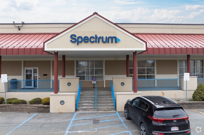
337 New Karner Rd
012689-029-003-0002-003-000-0000
N-ALB ST E-4330 S-23-62
Officebuilding
Albany
15
New York
B and X Area of moderate flood hazard, usually the area between the limits of the 100-year and 500-year floods.
3.000
2025
10.30 AC
2025
Central Avenue Corridor
013804
Albany/Schenectady/Troy
83,350 SF
Albany-Schenectady-Troy, NY
NEARBY LISTINGS FOR SALE OR LEASE
DEMOGRAPHICS near 337 New Karner Rd
1 mile
3 mile
5 mile
2024 Total Population
3,488
42,293
123,684
2029 Population
3,510
42,935
125,675
Pop Growth 2024-2029
+ 0.63%
+ 1.52%
+ 1.61%
Average Age
43
41
42
2024 Total Households
1,456
15,369
49,756
HH Growth 2024-2029
+ 0.82%
+ 1.87%
+ 1.75%
Median Household Inc
$86,961
$89,661
$95,400
Avg Household Size
2.40
2.20
2.30
2024 Avg HH Vehicles
2.00
2.00
2.00
Median Home Value
$258,691
$293,254
$304,986
Median Year Built
1963
1973
1971
Nearby Places
Map Layers
Map Styles
 Street
 Aerial
Transit
 Traffic
 Biking
Places
Listings with unknown addresses are not visible on the map
- Restaurants
- Banks
- Shops
- Fitness
- Groceries
PUBLIC TRANSPORTATION
AIRPORT
Albany International
Drive
Walk
Distance
Albany International
16 min
7.0 mi
Freight Ports
Albany, NY Port
Drive
Walk
Distance
Albany, NY Port
23 min
12.9 mi
SALE & LEASE HISTORY
LISTING DATE
SALE/LEASE

Sep 25, 2016
For Lease
May 08, 2023
For Sale
Nearby Properties
Address
Land Use
TOTAL SIZE
Lot Size
Zoning
Address
Land Use
TOTAL SIZE
Lot Size
Zoning
72,000 SF
279.23 AC
CO
Address
Land Use
TOTAL SIZE
Lot Size
Zoning
5.04 AC
CM
Address
Land Use
TOTAL SIZE
Lot Size
Zoning
Address
Land Use
TOTAL SIZE
Lot Size
Zoning
821,670 SF
803.50 AC
17
Address
Land Use
TOTAL SIZE
Lot Size
Zoning
151,305 SF
9.60 AC
R4
Address
Land Use
TOTAL SIZE
Lot Size
Zoning
812,458 SF
38.74 AC
F
Address
Land Use
TOTAL SIZE
Lot Size
Zoning
190 AC
LC
Address
Land Use
TOTAL SIZE
Lot Size
Zoning
561,128 SF
33.58 AC
GB
Address
Land Use
TOTAL SIZE
Lot Size
Zoning
47,424 SF
37.60 AC
MR
Address
Land Use
TOTAL SIZE
Lot Size
Zoning
10,216 SF
48.37 AC
16
Address
Land Use
TOTAL SIZE
Lot Size
Zoning
12,096 SF
73.12 AC
CM
Address
Land Use
TOTAL SIZE
Lot Size
Zoning
242,658 SF
29 AC
19
Address
Land Use
TOTAL SIZE
Lot Size
Zoning
373,296 SF
11.70 AC
46
Address
Land Use
TOTAL SIZE
Lot Size
Zoning
12,984 SF
19.42 AC
BNRP
Address
Land Use
TOTAL SIZE
Lot Size
Zoning
98.20 AC
LC
Address
Land Use
TOTAL SIZE
Lot Size
Zoning
213,860 SF
28.20 AC
C2
Address
Land Use
TOTAL SIZE
Lot Size
Zoning
135,000 SF
14.64 AC
R1B
Address
Land Use
TOTAL SIZE
Lot Size
Zoning
80.10 AC
LC
Address
Land Use
TOTAL SIZE
Lot Size
Zoning
279,150 SF
21.10 AC
CO
Address
Land Use
TOTAL SIZE
Lot Size
Zoning
266,600 SF
22.60 AC
47
Address
Land Use
TOTAL SIZE
Lot Size
Zoning
8,084 SF
36.30 AC
25
Address
Land Use
TOTAL SIZE
Lot Size
Zoning
31,080 SF
13.60 AC
LB
Address
Land Use
TOTAL SIZE
Lot Size
Zoning
167,222 SF
15.65 AC
14
Address
Land Use
TOTAL SIZE
Lot Size
Zoning
8,600 SF
14.80 AC
MR
Address
Land Use
TOTAL SIZE
Lot Size
Zoning
66,419 SF
2 AC
CPB
Address
Land Use
TOTAL SIZE
Lot Size
Zoning
87.50 AC
CO
Address
Land Use
TOTAL SIZE
Lot Size
Zoning
77.50 AC
M1
Address
Land Use
TOTAL SIZE
Lot Size
Zoning
256,101 SF
9 AC
12
Address
Land Use
TOTAL SIZE
Lot Size
Zoning
119,112 SF
4.13 AC
LB
Address
Land Use
TOTAL SIZE
Lot Size
Zoning
137,784 SF
2.30 AC
C2
The World's #1 Commercial Real Estate Marketplace
Connect with us
© 2026 CoStar Group
The information above has been obtained from sources believed reliable. While we do not doubt its accuracy we have not verified it and make no guarantee, warranty or representation about it. It is your responsibility to independently confirm its accuracy and completeness. Any projections, opinions, assumptions, or estimates used are for example only and do not represent the current or future performance of the property. The value of this transaction to you depends on tax and other factors which should be evaluated by your tax, financial, and legal advisors. You and your advisors should conduct a careful, independent investigation of the property to determine to your satisfaction the suitability of the property for your needs.