Your email has been sent.
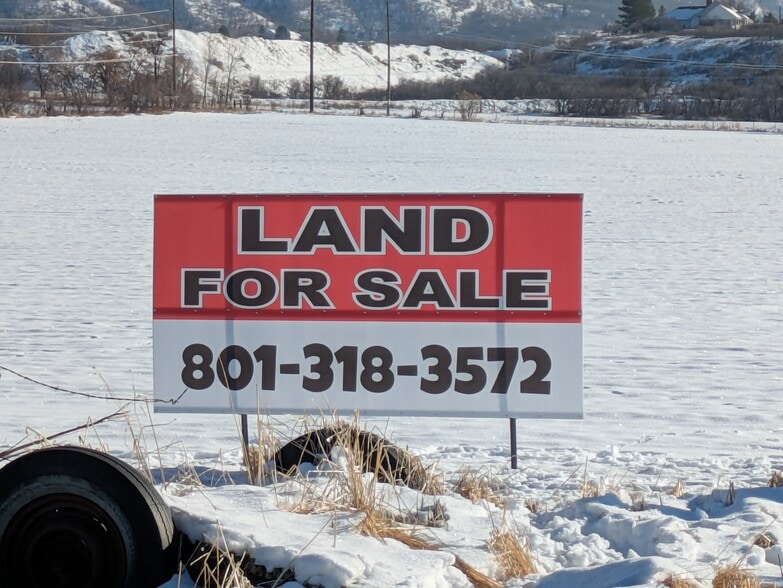
1044 E 340 S 26.72 Acres of Agricultural Land Offered at $8,016,000 in Salem, UT 84653

Investment Highlights
- Strong equestrian community.
Executive Summary
The land is located in the "historic Salem extension". Average density is projected to range from 2.0 to 2.5 units per acre.
Here is the sippet from Salem City General Plans for development on same street.
"BYU Farm — the northern development area is owned by Brigham Young University, and is envisioned to be a mixed use, planned development incorporating a range of residential and neighborhood commercial uses in addition to a range of large and small parks, all connected by a unified trail and open space system."
Property Facts
| Price | $8,016,000 | Property Subtype | Agricultural |
| Sale Type | Investment or Owner User | Proposed Use | Commercial |
| No. Lots | 1 | Total Lot Size | 26.72 AC |
| Property Type | Land | ||
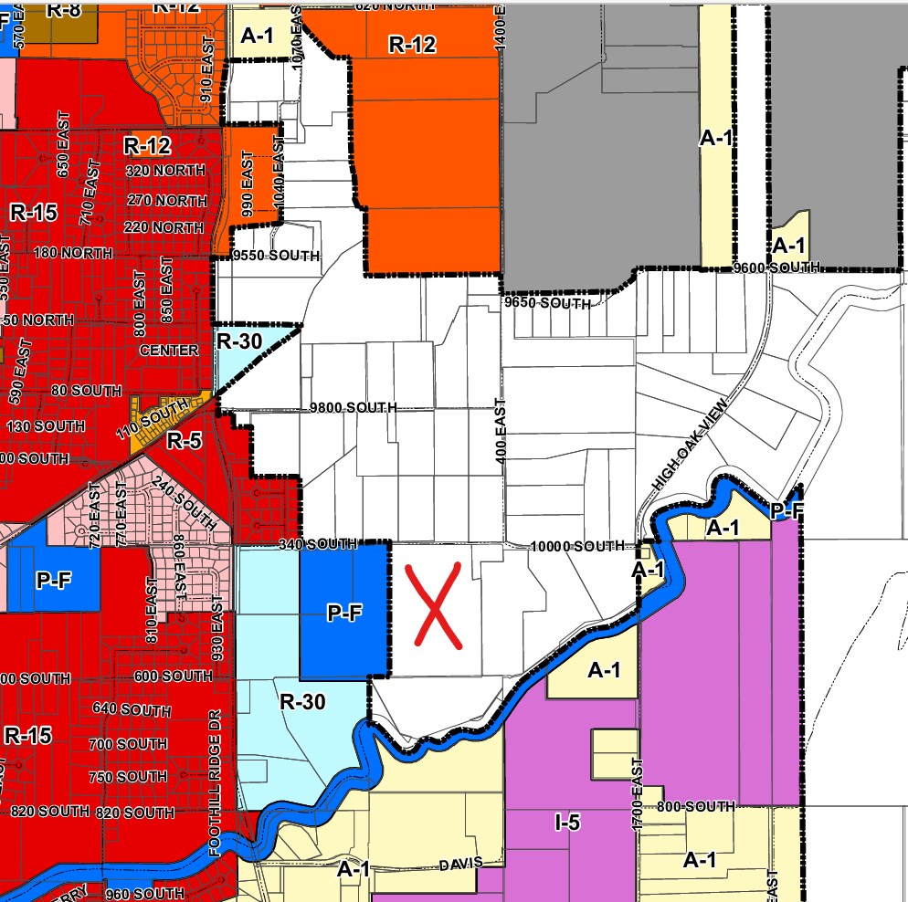
| Zoning | RA5 - Commercial Zoning | ||
| Price | $8,016,000 |
| Sale Type | Investment or Owner User |
| No. Lots | 1 |
| Property Type | Land |
| Property Subtype | Agricultural |
| Proposed Use | Commercial |
| Total Lot Size | 26.72 AC |
| Zoning | RA5 - Commercial Zoning |
1 Lot Available
Lot
| Price | $8,016,000 | Lot Size | 26.72 AC |
| Price Per AC | $300,000.00 |
| Price | $8,016,000 |
| Price Per AC | $300,000.00 |
| Lot Size | 26.72 AC |
Buyer is welcome to stay outside of Salem City. Owner is willing to submit Salem annexation and R-30 Zoning application. R-30 allows 2 horses and a residence on 30,000 sqft. Seller will not facilitate high density applications under contract.
Description
The land is located in the "historic Salem extension". Average density is projected to range from 2.0 to 2.5 units per acre. Here is the sippet from Salem City General Plans for development on same street. "BYU Farm — the northern development area is owned by Brigham Young University, and is envisioned to be a mixed use, planned development incorporating a range of residential and neighborhood commercial uses in addition to a range of large and small parks, all connected by a unified trail and open space system." Link to General Plan. https://media.rainpos.com/1443/2019_11_11_final_plan_salem_general_plan_and_land_use_update.pdf https://www.salemutah.gov/general-plan.htm Link to Salem City codes. https://www.salemutah.gov/salem-city-codes.htm https://media.rainpos.com/1443/Salem_City_MC_Title_14.Rev9_29_22_20220929090724.pdf Link to GIS maps(Shows Utilities). https://salemcity.maps.arcgis.com/apps/webappviewer/index.html?id=2121d6ca6a4c41fd854e435d280f9353 https://suvgis.spanishfork.org/Salem_maps/Salem_maps.html
Property Taxes
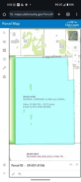
| Parcel Number | 29-051-0106 | Improvements Assessment | $0 |
| Land Assessment | $2,062,900 | Total Assessment | $14,346 |
Property Taxes

Presented by
Namaste
1044 E 340 S
Hmm, there seems to have been an error sending your message. Please try again.
Thanks! Your message was sent.