Property Record
375 Riverside Pkwy, Lithia Springs, GA 30122
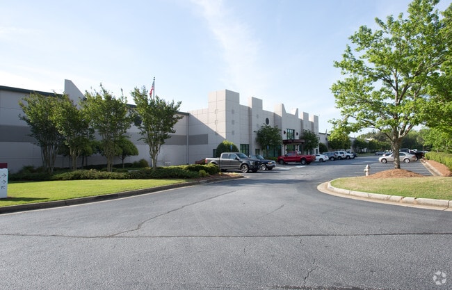

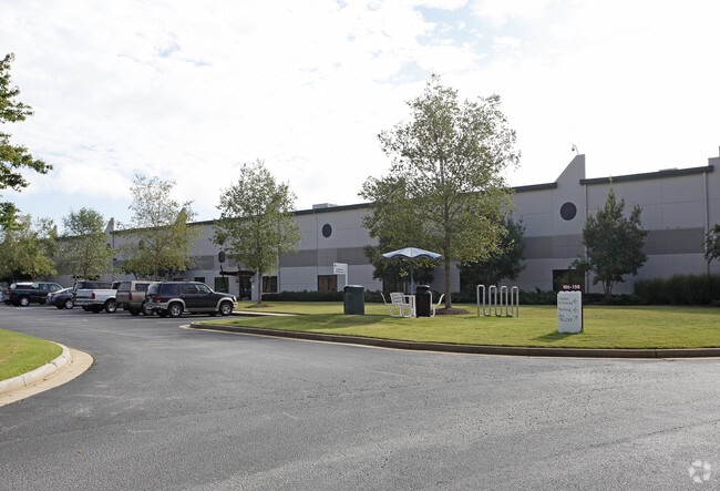

Property Detail
375 Riverside Pkwy
3182-09-4-0-001
BLDG/31.993 ACRES, RIVERSIDE PARKWAY
Warehouse
DOUGLAS
LI-R
Georgia
B and X Area of moderate flood hazard, usually the area between the limits of the 100-year and 500-year floods.
943
2025
31.99 AC
2025
I-20 W/Douglasville
080105
Atlanta
250,379 SF
Atlanta-Sandy Springs-Roswell, GA
NEARBY LISTINGS FOR SALE OR LEASE
DEMOGRAPHICS near 375 Riverside Pkwy
1 mile
3 mile
5 mile
2025 Total Population
1,423
27,360
110,028
2030 Population
1,388
28,215
113,661
Pop Growth 2025-2030
(2.46%)
+ 3.13%
+ 3.30%
Average Age
31
37
38
2025 Total Households
486
10,677
41,994
HH Growth 2025-2030
(2.47%)
+ 3.06%
+ 3.20%
Median Household Inc
$55,833
$74,016
$71,023
Avg Household Size
2.80
2.50
2.60
2025 Avg HH Vehicles
1.00
2.00
2.00
Median Home Value
$68,492
$364,320
$325,907
Median Year Built
1987
1994
1991
Nearby Places
Map Layers
Map Styles
 Street
 Aerial
Transit
 Traffic
 Biking
Places
Listings with unknown addresses are not visible on the map
- Restaurants
- Banks
- Shops
- Fitness
- Groceries
PUBLIC TRANSPORTATION
AIRPORT
Hartsfield - Jackson Atlanta International
Drive
Walk
Distance
Hartsfield - Jackson Atlanta International
31 min
19.3 mi
SALE & LEASE HISTORY
LISTING DATE
SALE/LEASE

Oct 03, 2018
For Lease
Nearby Properties
Address
Land Use
TOTAL SIZE
Lot Size
Zoning
Address
Land Use
TOTAL SIZE
Lot Size
Zoning
59.22 AC
LI-R
Address
Land Use
TOTAL SIZE
Lot Size
Zoning
279,840 SF
44 AC
DCD
Address
Land Use
TOTAL SIZE
Lot Size
Zoning
830,966 SF
23 AC
MIXU
Address
Land Use
TOTAL SIZE
Lot Size
Zoning
1,045,610 SF
110.63 AC
SUBA
Address
Land Use
TOTAL SIZE
Lot Size
Zoning
789,717 SF
68.55 AC
LI
Address
Land Use
TOTAL SIZE
Lot Size
Zoning
709,289 SF
112.06 AC
DCD
Address
Land Use
TOTAL SIZE
Lot Size
Zoning
652,500 SF
52.87 AC
LI-R
Address
Land Use
TOTAL SIZE
Lot Size
Zoning
913,620 SF
58.88 AC
Address
Land Use
TOTAL SIZE
Lot Size
Zoning
417,860 SF
40.32 AC
LI
Address
Land Use
TOTAL SIZE
Lot Size
Zoning
359,608 SF
29.73 AC
DCD
Address
Land Use
TOTAL SIZE
Lot Size
Zoning
603,096 SF
38.38 AC
HI
Address
Land Use
TOTAL SIZE
Lot Size
Zoning
310,689 SF
36.51 AC
LI
Address
Land Use
TOTAL SIZE
Lot Size
Zoning
728,121 SF
48.95 AC
LI
Address
Land Use
TOTAL SIZE
Lot Size
Zoning
340,131 SF
24.60 AC
DCD
Address
Land Use
TOTAL SIZE
Lot Size
Zoning
86.40 AC
R-A
Address
Land Use
TOTAL SIZE
Lot Size
Zoning
295,590 SF
10.25 AC
MIX
Address
Land Use
TOTAL SIZE
Lot Size
Zoning
602,400 SF
30.91 AC
DCD
Address
Land Use
TOTAL SIZE
Lot Size
Zoning
307,169 SF
30.13 AC
LI
Address
Land Use
TOTAL SIZE
Lot Size
Zoning
205,390 SF
24.28 AC
Address
Land Use
TOTAL SIZE
Lot Size
Zoning
244,480 SF
92.83 AC
DCD
Address
Land Use
TOTAL SIZE
Lot Size
Zoning
290,784 SF
21.09 AC
RM-12
Address
Land Use
TOTAL SIZE
Lot Size
Zoning
732,688 SF
47.23 AC
LI-R
Address
Land Use
TOTAL SIZE
Lot Size
Zoning
245,812 SF
30.90 AC
DCD
Address
Land Use
TOTAL SIZE
Lot Size
Zoning
538,748 SF
35.64 AC
LI
Address
Land Use
TOTAL SIZE
Lot Size
Zoning
453,106 SF
36.69 AC
DCD
Address
Land Use
TOTAL SIZE
Lot Size
Zoning
540,000 SF
35.76 AC
DCD
Address
Land Use
TOTAL SIZE
Lot Size
Zoning
523,551 SF
50.93 AC
LI
Address
Land Use
TOTAL SIZE
Lot Size
Zoning
490,726 SF
50.62 AC
LI-R
Address
Land Use
TOTAL SIZE
Lot Size
Zoning
457,703 SF
72.15 AC
DCD
The World's #1 Commercial Real Estate Marketplace
Connect with us
© 2026 CoStar Group
The information above has been obtained from sources believed reliable. While we do not doubt its accuracy we have not verified it and make no guarantee, warranty or representation about it. It is your responsibility to independently confirm its accuracy and completeness. Any projections, opinions, assumptions, or estimates used are for example only and do not represent the current or future performance of the property. The value of this transaction to you depends on tax and other factors which should be evaluated by your tax, financial, and legal advisors. You and your advisors should conduct a careful, independent investigation of the property to determine to your satisfaction the suitability of the property for your needs.