Property Record
7555 Colshire Dr, Mc Lean, VA 22102
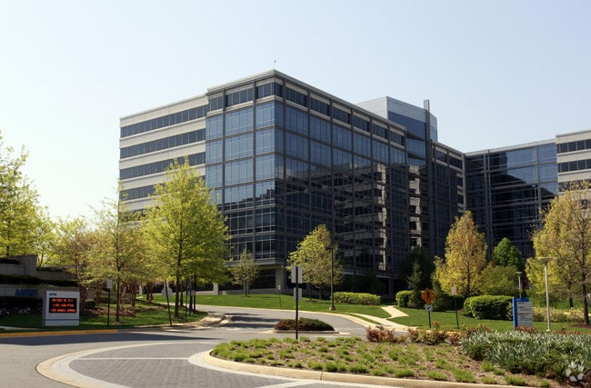


Property Detail
7555 Colshire Dr
0303-28-C2
WESTGATE INDUSTRIAL PARK PCL B1A2
Officebuilding
Fairfax
430
Virginia
A Areas with a 1% annual chance of flooding and a 26% chance of flooding over the life of a 30-year mortgage.
c
2024
11.79 AC
2025
Tysons Corner
471204
Washington, DC
602,257 SF
Washington-Arlington-Alexandria, DC-VA-MD-WV
NEARBY LISTINGS FOR SALE OR LEASE
DEMOGRAPHICS near 7555 Colshire Dr
1 mile
3 mile
5 mile
2024 Total Population
18,735
115,120
284,154
2029 Population
19,411
117,928
290,219
Pop Growth 2024-2029
+ 3.61%
+ 2.44%
+ 2.13%
Average Age
39
41
40
2024 Total Households
8,389
44,510
105,101
HH Growth 2024-2029
+ 4.04%
+ 2.63%
+ 2.25%
Median Household Inc
$131,398
$171,835
$171,344
Avg Household Size
2.20
2.50
2.60
2024 Avg HH Vehicles
2.00
2.00
2.00
Median Home Value
$855,625
$1,024,827
$1,007,102
Median Year Built
1984
1981
1976
Nearby Places
Map Layers
Map Styles
 Street
 Aerial
Transit
 Traffic
 Biking
Places
Listings with unknown addresses are not visible on the map
- Restaurants
- Banks
- Shops
- Fitness
- Groceries
Nearby Properties
Address
Land Use
TOTAL SIZE
Lot Size
Zoning
Address
Land Use
TOTAL SIZE
Lot Size
Zoning
2,385,458 SF
62.90 AC
403
Address
Land Use
TOTAL SIZE
Lot Size
Zoning
562,860 SF
23.56 AC
400
Address
Land Use
TOTAL SIZE
Lot Size
Zoning
964,537 SF
5.06 AC
360
Address
Land Use
TOTAL SIZE
Lot Size
Zoning
915,666 SF
2.77 AC
360
Address
Land Use
TOTAL SIZE
Lot Size
Zoning
729,473 SF
3.89 AC
360
Address
Land Use
TOTAL SIZE
Lot Size
Zoning
553,360 SF
1.99 AC
403
Address
Land Use
TOTAL SIZE
Lot Size
Zoning
842,366 SF
16.74 AC
400
Address
Land Use
TOTAL SIZE
Lot Size
Zoning
613,642 SF
19.08 AC
330
Address
Land Use
TOTAL SIZE
Lot Size
Zoning
929,735 SF
21.95 AC
430
Address
Land Use
TOTAL SIZE
Lot Size
Zoning
431,636 SF
3.25 AC
360
Address
Land Use
TOTAL SIZE
Lot Size
Zoning
510,357 SF
3.03 AC
360
Address
Land Use
TOTAL SIZE
Lot Size
Zoning
567,363 SF
2.39 AC
360
Address
Land Use
TOTAL SIZE
Lot Size
Zoning
475,471 SF
2.51 AC
360
Address
Land Use
TOTAL SIZE
Lot Size
Zoning
402,531 SF
0.97 AC
360
Address
Land Use
TOTAL SIZE
Lot Size
Zoning
455,583 SF
3.51 AC
400
Address
Land Use
TOTAL SIZE
Lot Size
Zoning
601,758 SF
3.70 AC
360
Address
Land Use
TOTAL SIZE
Lot Size
Zoning
601,409 SF
3.89 AC
360
Address
Land Use
TOTAL SIZE
Lot Size
Zoning
505,415 SF
1.95 AC
403
Address
Land Use
TOTAL SIZE
Lot Size
Zoning
363,805 SF
2.64 AC
350
Address
Land Use
TOTAL SIZE
Lot Size
Zoning
483,000 SF
1.98 AC
360
Address
Land Use
TOTAL SIZE
Lot Size
Zoning
B-1 LTD.BU
Address
Land Use
TOTAL SIZE
Lot Size
Zoning
584,872 SF
10.58 AC
470
Address
Land Use
TOTAL SIZE
Lot Size
Zoning
290,749 SF
1.49 AC
403
Address
Land Use
TOTAL SIZE
Lot Size
Zoning
425,118 SF
16.99 AC
320
Address
Land Use
TOTAL SIZE
Lot Size
Zoning
440,641 SF
3.11 AC
360
Address
Land Use
TOTAL SIZE
Lot Size
Zoning
346,335 SF
1.42 AC
350
Address
Land Use
TOTAL SIZE
Lot Size
Zoning
356,812 SF
0.92 AC
400
Address
Land Use
TOTAL SIZE
Lot Size
Zoning
520,200 SF
4.53 AC
360
Address
Land Use
TOTAL SIZE
Lot Size
Zoning
394,539 SF
15.87 AC
230
The World's #1 Commercial Real Estate Marketplace
Connect with us
© 2026 CoStar Group
The information above has been obtained from sources believed reliable. While we do not doubt its accuracy we have not verified it and make no guarantee, warranty or representation about it. It is your responsibility to independently confirm its accuracy and completeness. Any projections, opinions, assumptions, or estimates used are for example only and do not represent the current or future performance of the property. The value of this transaction to you depends on tax and other factors which should be evaluated by your tax, financial, and legal advisors. You and your advisors should conduct a careful, independent investigation of the property to determine to your satisfaction the suitability of the property for your needs.