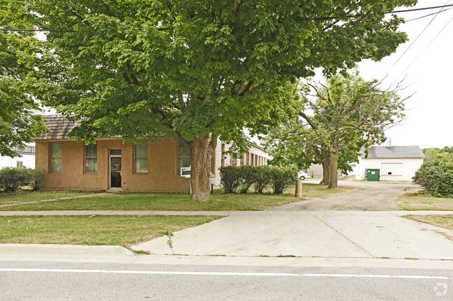
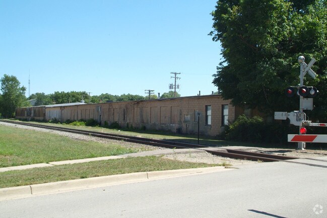
Property Record
323 Roosevelt St, Howell, MI 48843

NEARBY LISTINGS FOR SALE OR LEASE
Property Detail
323 Roosevelt St
17-36-400-014
Part Of Sec 36 T3n R4e
Commercialnec
SEC 36 T3N R4E CITY OF HOWELL,, COM E 1/4 COR SEC 36, TH S89*41'16"W 1323.96 FT TH S 260 FT, TH N77*22'50"W 8.55 FT FOR POB,
X
Livingston
26093C0306D
Michigan
2025
3.70 AC
2025
Livingston County
725000
Detroit
32,830 SF
Detroit-Warren-Dearborn, MI
DEMOGRAPHICS near 323 Roosevelt St
1 Mile
3 Mile
5 Mile
2024 Total Population
7,018
31,351
44,677
2029 Population
7,202
32,279
45,981
Pop Growth 2024-2029
+ 2.62%
+ 2.96%
+ 2.92%
Average Age
41
41
42
2024 Total Households
3,034
12,749
17,724
HH Growth 2024-2029
+ 2.60%
+ 2.94%
+ 2.90%
Median Household Inc
$64,603
$80,628
$85,322
Avg Household Size
2.30
2.40
2.50
2024 Avg HH Vehicles
2.00
2.00
2.00
Median Home Value
$226,825
$264,888
$279,023
Median Year Built
1973
1994
1993
Nearby Places
Map Layers
Map Styles
 Street
 Aerial
- Restaurants
- Banks
- Shops
- Fitness
- Groceries
PUBLIC TRANSPORTATION
AIRPORT
Bishop International
DRIVE
WALK
Distance
Bishop International
55 min
36.1 mi
Capital Region International
DRIVE
WALK
Distance
Capital Region International
54 min
42.1 mi
Nearby Properties
Address
Land Use
TOTAL SIZE
Lot Size
Zoning
Address
Land Use
TOTAL SIZE
Lot Size
Zoning
767,161 SF
127.33 AC
I-1
Address
Land Use
TOTAL SIZE
Lot Size
Zoning
344,387 SF
27.72 AC
I-1
Address
Land Use
TOTAL SIZE
Lot Size
Zoning
75,407 SF
159.26 AC
R2
Address
Land Use
TOTAL SIZE
Lot Size
Zoning
89,443 SF
10.45 AC
R-M
Address
Land Use
TOTAL SIZE
Lot Size
Zoning
102,971 SF
11.95 AC
I-1
Address
Land Use
TOTAL SIZE
Lot Size
Zoning
171,564 SF
30.98 AC
O-1
Address
Land Use
TOTAL SIZE
Lot Size
Zoning
199,635 SF
19.85 AC
RPUD
Address
Land Use
TOTAL SIZE
Lot Size
Zoning
210,003 SF
29.17 AC
MUPUD
Address
Land Use
TOTAL SIZE
Lot Size
Zoning
145,366 SF
13.60 AC
R-M
Address
Land Use
TOTAL SIZE
Lot Size
Zoning
95,252 SF
11.56 AC
R-M
Address
Land Use
TOTAL SIZE
Lot Size
Zoning
37.65 AC
MFR
Address
Land Use
TOTAL SIZE
Lot Size
Zoning
81,417 SF
13.10 AC
R-M
Address
Land Use
TOTAL SIZE
Lot Size
Zoning
15.74 AC
RM
Address
Land Use
TOTAL SIZE
Lot Size
Zoning
161,366 SF
18.67 AC
HDR
Address
Land Use
TOTAL SIZE
Lot Size
Zoning
165,868 SF
27.80 AC
HDR
Address
Land Use
TOTAL SIZE
Lot Size
Zoning
80,330 SF
10 AC
MFR
Address
Land Use
TOTAL SIZE
Lot Size
Zoning
87,349 SF
9.68 AC
C,RM,PUD
Address
Land Use
TOTAL SIZE
Lot Size
Zoning
60,900 SF
5.74 AC
NRPUD
Address
Land Use
TOTAL SIZE
Lot Size
Zoning
166,550 SF
20 AC
IND
Address
Land Use
TOTAL SIZE
Lot Size
Zoning
152,606 SF
16 AC
R-M
Address
Land Use
TOTAL SIZE
Lot Size
Zoning
220,091 SF
21.88 AC
NRPUD
Address
Land Use
TOTAL SIZE
Lot Size
Zoning
134,688 SF
14.97 AC
NRPUD
Address
Land Use
TOTAL SIZE
Lot Size
Zoning
96,896 SF
12.11 AC
HDR
Address
Land Use
TOTAL SIZE
Lot Size
Zoning
91,380 SF
11.55 AC
HDR
Address
Land Use
TOTAL SIZE
Lot Size
Zoning
35,546 SF
7.64 AC
R-M
Address
Land Use
TOTAL SIZE
Lot Size
Zoning
57,582 SF
5.32 AC
C,RM,PUD
Address
Land Use
TOTAL SIZE
Lot Size
Zoning
79,801 SF
10.60 AC
B-2
Address
Land Use
TOTAL SIZE
Lot Size
Zoning
43,959 SF
33.51 AC
IFZ
Address
Land Use
TOTAL SIZE
Lot Size
Zoning
154,040 SF
13.70 AC
I
Address
Land Use
TOTAL SIZE
Lot Size
Zoning
121,850 SF
11.85 AC
I-1
The World's #1 Commercial Real Estate Marketplace
Connect with us
© 2026 CoStar Group
The information above has been obtained from sources believed reliable. While we do not doubt its accuracy we have not verified it and make no guarantee, warranty or representation about it. It is your responsibility to independently confirm its accuracy and completeness. Any projections, opinions, assumptions, or estimates used are for example only and do not represent the current or future performance of the property. The value of this transaction to you depends on tax and other factors which should be evaluated by your tax, financial, and legal advisors. You and your advisors should conduct a careful, independent investigation of the property to determine to your satisfaction the suitability of the property for your needs.