Property Record
1000 Harrington St, Mount Clemens, MI 48043
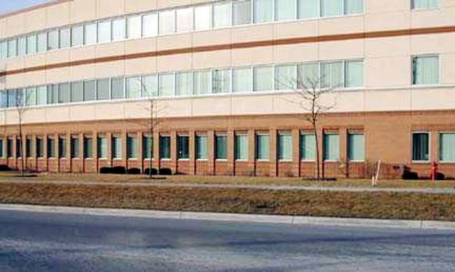

Property Detail
1000 Harrington St
Detroit-Warren-Dearborn, MI
PART PRIVATE CLAIM 138 TWP02N RNG13E & LOTS1-5 YEAMANS SUB PART PRIVATE CLAIM 137 TWP02N RNG13E
05-11-15-477-009
MACOMB
Commercialacreage
Michigan
MU
98
B and X Area of moderate flood hazard, usually the area between the limits of the 100-year and 500-year floods.
7.69 AC
2024
Macomb East
2025
Detroit
245300
NEARBY LISTINGS FOR SALE OR LEASE
DEMOGRAPHICS near 1000 Harrington St
1 mile
3 mile
5 mile
2025 Total Population
10,101
95,652
237,539
2030 Population
10,186
96,849
240,425
Pop Growth 2025-2030
+ 0.84%
+ 1.25%
+ 1.21%
Average Age
43
42
42
2025 Total Households
4,399
42,388
101,782
HH Growth 2025-2030
+ 0.84%
+ 1.33%
+ 1.29%
Median Household Inc
$70,392
$67,506
$73,626
Avg Household Size
2.20
2.20
2.30
2025 Avg HH Vehicles
2.00
2.00
2.00
Median Home Value
$229,239
$212,908
$243,722
Median Year Built
1960
1976
1979
Nearby Places
Map Layers
Map Styles
 Street
 Aerial
Layers
 Traffic
 Biking
Places
Listings with unknown addresses are not visible on the map
- Restaurants
- Banks
- Shops
- Fitness
- Groceries
PUBLIC TRANSPORTATION
AIRPORT
Detroit City
Drive
Walk
Distance
Detroit City
25 min
17.5 mi
Freight Ports
Port of Baltimore
Drive
Walk
Distance
Port of Baltimore
1 min
400.9 mi
Nearby Properties
Address
Land Use
TOTAL SIZE
Lot Size
Zoning
Address
Land Use
TOTAL SIZE
Lot Size
Zoning
122.50 AC
RML
Address
Land Use
TOTAL SIZE
Lot Size
Zoning
35 AC
RML
Address
Land Use
TOTAL SIZE
Lot Size
Zoning
40.39 AC
RML
Address
Land Use
TOTAL SIZE
Lot Size
Zoning
44.65 AC
RML
Address
Land Use
TOTAL SIZE
Lot Size
Zoning
74,382 SF
3.99 AC
OS-1
Address
Land Use
TOTAL SIZE
Lot Size
Zoning
29.33 AC
RML
Address
Land Use
TOTAL SIZE
Lot Size
Zoning
25.14 AC
RML
Address
Land Use
TOTAL SIZE
Lot Size
Zoning
20.27 AC
RML
Address
Land Use
TOTAL SIZE
Lot Size
Zoning
252,226 SF
52.79 AC
Address
Land Use
TOTAL SIZE
Lot Size
Zoning
26.92 AC
RML
Address
Land Use
TOTAL SIZE
Lot Size
Zoning
30,607 SF
17.85 AC
RM-1
Address
Land Use
TOTAL SIZE
Lot Size
Zoning
670,448 SF
37.23 AC
L-2
Address
Land Use
TOTAL SIZE
Lot Size
Zoning
196,459 SF
19.18 AC
I-1
Address
Land Use
TOTAL SIZE
Lot Size
Zoning
57,316 SF
26.07 AC
RML
Address
Land Use
TOTAL SIZE
Lot Size
Zoning
42,385 SF
25.55 AC
B-2
Address
Land Use
TOTAL SIZE
Lot Size
Zoning
37.44 AC
RML
Address
Land Use
TOTAL SIZE
Lot Size
Zoning
72,572 SF
10 AC
B-3
Address
Land Use
TOTAL SIZE
Lot Size
Zoning
6.10 AC
RM-1
Address
Land Use
TOTAL SIZE
Lot Size
Zoning
17.44 AC
RML
Address
Land Use
TOTAL SIZE
Lot Size
Zoning
214,201 SF
24.10 AC
B-3
Address
Land Use
TOTAL SIZE
Lot Size
Zoning
87.32 AC
MH
Address
Land Use
TOTAL SIZE
Lot Size
Zoning
8.31 AC
RML
Address
Land Use
TOTAL SIZE
Lot Size
Zoning
15.05 AC
RM-2
Address
Land Use
TOTAL SIZE
Lot Size
Zoning
17.85 AC
RML
Address
Land Use
TOTAL SIZE
Lot Size
Zoning
11.87 AC
RM-2
Address
Land Use
TOTAL SIZE
Lot Size
Zoning
120,360 SF
10.70 AC
GC
Address
Land Use
TOTAL SIZE
Lot Size
Zoning
149,652 SF
8.04 AC
SP-1
Address
Land Use
TOTAL SIZE
Lot Size
Zoning
99,717 SF
2.14 AC
I-1
Address
Land Use
TOTAL SIZE
Lot Size
Zoning
88.65 AC
MH
Address
Land Use
TOTAL SIZE
Lot Size
Zoning
10.43 AC
RML
The World's #1 Commercial Real Estate Marketplace
Connect with us
© 2026 CoStar Group
The information above has been obtained from sources believed reliable. While we do not doubt its accuracy we have not verified it and make no guarantee, warranty or representation about it. It is your responsibility to independently confirm its accuracy and completeness. Any projections, opinions, assumptions, or estimates used are for example only and do not represent the current or future performance of the property. The value of this transaction to you depends on tax and other factors which should be evaluated by your tax, financial, and legal advisors. You and your advisors should conduct a careful, independent investigation of the property to determine to your satisfaction the suitability of the property for your needs.