Property Record
3089 Airport Rd, La Crosse, WI 54603
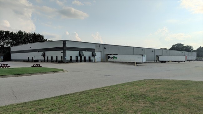


Property Detail
3089 Airport Rd
La Crosse-Onalaska, WI-MN
CERTIFIED SURVEY MAP NO. 88 VOL 17 LOT 2 DOC NO. 1703859 SUBJ TO & T/W ESMT IN DOC NO. 1713990
017-010530-052
LA CROSSE
Commercialnec
Wisconsin
B and X Area of moderate flood hazard, usually the area between the limits of the 100-year and 500-year floods.
2
2025
5.16 AC
2025
Other Market Areas
010300
NEARBY LISTINGS FOR SALE OR LEASE
DEMOGRAPHICS near 3089 Airport Rd
1 mile
3 mile
5 mile
2025 Total Population
1,335
23,619
57,784
2030 Population
1,309
23,561
57,719
Pop Growth 2025-2030
(1.95%)
(0.25%)
(0.11%)
Average Age
48
42
39
2025 Total Households
587
10,401
23,518
HH Growth 2025-2030
(2.21%)
(0.51%)
(0.29%)
Median Household Inc
$73,175
$61,609
$64,814
Avg Household Size
2.30
2.20
2.30
2025 Avg HH Vehicles
2.00
2.00
2.00
Median Home Value
$282,621
$246,785
$282,450
Median Year Built
1978
1976
1979
Nearby Places
Map Layers
Map Styles
 Street
 Aerial
Transit
 Traffic
 Biking
Places
Listings with unknown addresses are not visible on the map
- Restaurants
- Banks
- Shops
- Fitness
- Groceries
SALE & LEASE HISTORY
LISTING DATE
SALE/LEASE

Aug 08, 2018
For Lease
Nearby Properties
Address
Land Use
TOTAL SIZE
Lot Size
Zoning
Address
Land Use
TOTAL SIZE
Lot Size
Zoning
42.20 AC
MZA
Address
Land Use
TOTAL SIZE
Lot Size
Zoning
12.60 AC
MZA
Address
Land Use
TOTAL SIZE
Lot Size
Zoning
29.80 AC
MZA
Address
Land Use
TOTAL SIZE
Lot Size
Zoning
14.59 AC
MZA
Address
Land Use
TOTAL SIZE
Lot Size
Zoning
11.40 AC
MZA
Address
Land Use
TOTAL SIZE
Lot Size
Zoning
12,500 SF
5.12 AC
MZA
Address
Land Use
TOTAL SIZE
Lot Size
Zoning
2.52 AC
Address
Land Use
TOTAL SIZE
Lot Size
Zoning
15.41 AC
MZA
Address
Land Use
TOTAL SIZE
Lot Size
Zoning
4.81 AC
Address
Land Use
TOTAL SIZE
Lot Size
Zoning
5.29 AC
MZA
Address
Land Use
TOTAL SIZE
Lot Size
Zoning
19.98 AC
Address
Land Use
TOTAL SIZE
Lot Size
Zoning
3.75 AC
Address
Land Use
TOTAL SIZE
Lot Size
Zoning
6.19 AC
Address
Land Use
TOTAL SIZE
Lot Size
Zoning
1.96 AC
Address
Land Use
TOTAL SIZE
Lot Size
Zoning
11.04 AC
MZA
Address
Land Use
TOTAL SIZE
Lot Size
Zoning
8.40 AC
MZA
Address
Land Use
TOTAL SIZE
Lot Size
Zoning
7.88 AC
IND
Address
Land Use
TOTAL SIZE
Lot Size
Zoning
12.78 AC
Address
Land Use
TOTAL SIZE
Lot Size
Zoning
15.01 AC
MZA
Address
Land Use
TOTAL SIZE
Lot Size
Zoning
Address
Land Use
TOTAL SIZE
Lot Size
Zoning
3.72 AC
MZA
Address
Land Use
TOTAL SIZE
Lot Size
Zoning
2.27 AC
Address
Land Use
TOTAL SIZE
Lot Size
Zoning
Address
Land Use
TOTAL SIZE
Lot Size
Zoning
24.16 AC
COND USE
Address
Land Use
TOTAL SIZE
Lot Size
Zoning
1.98 AC
MZA
Address
Land Use
TOTAL SIZE
Lot Size
Zoning
800 SF
4.68 AC
MZA
Address
Land Use
TOTAL SIZE
Lot Size
Zoning
20.59 AC
MZA
Address
Land Use
TOTAL SIZE
Lot Size
Zoning
6.03 AC
MZA
Address
Land Use
TOTAL SIZE
Lot Size
Zoning
5.97 AC
MZA
Address
Land Use
TOTAL SIZE
Lot Size
Zoning
12.50 AC
MZA
The World's #1 Commercial Real Estate Marketplace
Connect with us
© 2026 CoStar Group
The information above has been obtained from sources believed reliable. While we do not doubt its accuracy we have not verified it and make no guarantee, warranty or representation about it. It is your responsibility to independently confirm its accuracy and completeness. Any projections, opinions, assumptions, or estimates used are for example only and do not represent the current or future performance of the property. The value of this transaction to you depends on tax and other factors which should be evaluated by your tax, financial, and legal advisors. You and your advisors should conduct a careful, independent investigation of the property to determine to your satisfaction the suitability of the property for your needs.