Property Record
285 N Palm Canyon Dr, Palm Springs, CA 92262
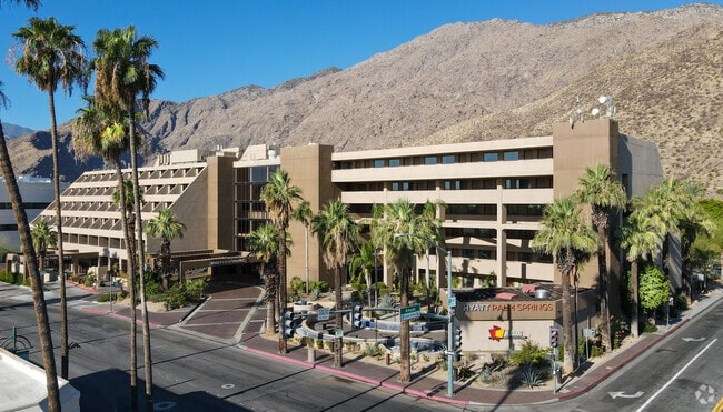

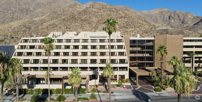

Property Detail
285 N Palm Canyon Dr
Riverside-San Bernardino-Ontario, CA
2.20 ACRES IN PAR 5 PM 133/081 PM 20326
513-560-005
Riverside
Hotel
California
B and X Area of moderate flood hazard, usually the area between the limits of the 100-year and 500-year floods.
5
2024
2.20 AC
2025
Palm Springs
044606
Inland Empire (California)
233,083 SF
NEARBY LISTINGS FOR SALE OR LEASE
DEMOGRAPHICS near 285 N Palm Canyon Dr
1 mile
3 mile
5 mile
2025 Total Population
7,807
56,160
99,597
2030 Population
8,504
61,075
107,035
Pop Growth 2025-2030
+ 8.93%
+ 8.75%
+ 7.47%
Average Age
53
52
48
2025 Total Households
4,371
29,796
46,336
HH Growth 2025-2030
+ 8.79%
+ 8.62%
+ 8.05%
Median Household Inc
$70,755
$77,192
$75,938
Avg Household Size
1.70
1.80
2.10
2025 Avg HH Vehicles
1.00
2.00
2.00
Median Home Value
$818,388
$749,607
$680,146
Median Year Built
1979
1979
1982
Nearby Places
Map Layers
Map Styles
 Street
 Aerial
Transit
 Traffic
 Biking
Places
Listings with unknown addresses are not visible on the map
- Restaurants
- Banks
- Shops
- Fitness
- Groceries
PUBLIC TRANSPORTATION
COMMUTER RAIL
Palm Springs Amtrak (Sunset Limited - Amtrak, Texas Eagle - Amtrak)
Drive
Walk
Distance
Palm Springs Amtrak (Sunset Limited - Amtrak, Texas Eagle - Amtrak)
11 min
5.2 mi
AIRPORT
Palm Springs International
Drive
Walk
Distance
Palm Springs International
10 min
4.9 mi
Freight Ports
Port of San Diego
Drive
Walk
Distance
Port of San Diego
154 min
125.3 mi
Nearby Properties
Address
Land Use
TOTAL SIZE
Lot Size
Zoning
Address
Land Use
TOTAL SIZE
Lot Size
Zoning
485,000 SF
14.71 AC
Address
Land Use
TOTAL SIZE
Lot Size
Zoning
97,065 SF
4.64 AC
R3
Address
Land Use
TOTAL SIZE
Lot Size
Zoning
197,439 SF
8.76 AC
Address
Land Use
TOTAL SIZE
Lot Size
Zoning
258,547 SF
3.84 AC
Address
Land Use
TOTAL SIZE
Lot Size
Zoning
445,755 SF
16.21 AC
R3
Address
Land Use
TOTAL SIZE
Lot Size
Zoning
332,356 SF
9.05 AC
Address
Land Use
TOTAL SIZE
Lot Size
Zoning
35,188 SF
5.98 AC
R3
Address
Land Use
TOTAL SIZE
Lot Size
Zoning
148,746 SF
6.21 AC
R3
Address
Land Use
TOTAL SIZE
Lot Size
Zoning
207,931 SF
6.34 AC
C1AA
Address
Land Use
TOTAL SIZE
Lot Size
Zoning
129,852 SF
11.17 AC
Address
Land Use
TOTAL SIZE
Lot Size
Zoning
120,754 SF
14.30 AC
Address
Land Use
TOTAL SIZE
Lot Size
Zoning
147,744 SF
3.62 AC
Address
Land Use
TOTAL SIZE
Lot Size
Zoning
120,548 SF
4.63 AC
Address
Land Use
TOTAL SIZE
Lot Size
Zoning
3.20 AC
GR5
Address
Land Use
TOTAL SIZE
Lot Size
Zoning
48,958 SF
0.96 AC
Address
Land Use
TOTAL SIZE
Lot Size
Zoning
70,670 SF
3.90 AC
R4
Address
Land Use
TOTAL SIZE
Lot Size
Zoning
31,488 SF
3.40 AC
A
Address
Land Use
TOTAL SIZE
Lot Size
Zoning
56,129 SF
2.76 AC
R3
Address
Land Use
TOTAL SIZE
Lot Size
Zoning
28,506 SF
2.30 AC
R3
Address
Land Use
TOTAL SIZE
Lot Size
Zoning
126,869 SF
6.53 AC
Address
Land Use
TOTAL SIZE
Lot Size
Zoning
114,044 SF
5.40 AC
R3
Address
Land Use
TOTAL SIZE
Lot Size
Zoning
109,231 SF
5.57 AC
R4
Address
Land Use
TOTAL SIZE
Lot Size
Zoning
86,810 SF
3.60 AC
R4VP
Address
Land Use
TOTAL SIZE
Lot Size
Zoning
51,852 SF
4.04 AC
Address
Land Use
TOTAL SIZE
Lot Size
Zoning
0.51 AC
C-B-D
Address
Land Use
TOTAL SIZE
Lot Size
Zoning
81,687 SF
4.97 AC
R3
Address
Land Use
TOTAL SIZE
Lot Size
Zoning
81,981 SF
4.07 AC
Address
Land Use
TOTAL SIZE
Lot Size
Zoning
Address
Land Use
TOTAL SIZE
Lot Size
Zoning
60,280 SF
5.51 AC
R3
The World's #1 Commercial Real Estate Marketplace
Connect with us
© 2026 CoStar Group
The information above has been obtained from sources believed reliable. While we do not doubt its accuracy we have not verified it and make no guarantee, warranty or representation about it. It is your responsibility to independently confirm its accuracy and completeness. Any projections, opinions, assumptions, or estimates used are for example only and do not represent the current or future performance of the property. The value of this transaction to you depends on tax and other factors which should be evaluated by your tax, financial, and legal advisors. You and your advisors should conduct a careful, independent investigation of the property to determine to your satisfaction the suitability of the property for your needs.