Property Record
1000 W Center St, North Salt Lake, UT 84054


Property Detail
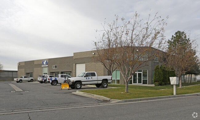
1000 W Center St
01-091-0044
PARCEL 1: BEG AT A PT N 89^36'51" E 500.00 FT & N 0^46'50" W 60.602 FT FR THE S 1/4 COR OF SEC 3-T1N-R1W, SLB&M; SD PT BEING ON THE N R/W OF CUDAHY LANE & ALSO ON THE E LINE OF A PARCEL MORE PART'LY
Distributionwarehouseregional
Davis
EUO
Utah
B and X Area of moderate flood hazard, usually the area between the limits of the 100-year and 500-year floods.
10.24 AC
2025
Davis North
2025
Salt Lake City
127002
Ogden, UT
20,053 SF
NEARBY LISTINGS FOR SALE OR LEASE
DEMOGRAPHICS near 1000 W Center St
1 mile
3 mile
5 mile
2024 Total Population
7,844
43,882
112,605
2029 Population
8,263
45,162
115,348
Pop Growth 2024-2029
+ 5.34%
+ 2.92%
+ 2.44%
Average Age
31
35
36
2024 Total Households
2,526
14,212
37,683
HH Growth 2024-2029
+ 5.66%
+ 3.10%
+ 2.64%
Median Household Inc
$102,542
$109,015
$100,602
Avg Household Size
3.10
3.10
2.90
2024 Avg HH Vehicles
2.00
2.00
2.00
Median Home Value
$493,655
$536,453
$523,345
Median Year Built
2008
1995
1979
Nearby Places
Map Layers
Map Styles
 Street
 Aerial
Transit
 Traffic
 Biking
Places
Listings with unknown addresses are not visible on the map
- Restaurants
- Banks
- Shops
- Fitness
- Groceries
PUBLIC TRANSPORTATION
COMMUTER RAIL
Warm Springs Relief Point (FrontRunner - Utah Transit Authority (UTA))
Drive
Walk
Distance
Warm Springs Relief Point (FrontRunner - Utah Transit Authority (UTA))
12 min
5.8 mi
Woods Cross (FrontRunner North - Utah Transit Authority (UTA))
Drive
Walk
Distance
Woods Cross (FrontRunner North - Utah Transit Authority (UTA))
9 min
6.3 mi
AIRPORT
Salt Lake City International
Drive
Walk
Distance
Salt Lake City International
13 min
8.9 mi
Freight Ports
Port of Stockton
Drive
Walk
Distance
Port of Stockton
713 min
699.3 mi
Nearby Properties
Address
Land Use
TOTAL SIZE
Lot Size
Zoning
Address
Land Use
TOTAL SIZE
Lot Size
Zoning
1,140,230 SF
53.87 AC
B-P
Address
Land Use
TOTAL SIZE
Lot Size
Zoning
6,673 SF
345.82 AC
Address
Land Use
TOTAL SIZE
Lot Size
Zoning
463,000 SF
25.21 AC
B-P
Address
Land Use
TOTAL SIZE
Lot Size
Zoning
354,506 SF
18.44 AC
B-P
Address
Land Use
TOTAL SIZE
Lot Size
Zoning
380,631 SF
20.34 AC
BP
Address
Land Use
TOTAL SIZE
Lot Size
Zoning
341,830 SF
17.75 AC
BP
Address
Land Use
TOTAL SIZE
Lot Size
Zoning
167,620 SF
114.91 AC
M-1
Address
Land Use
TOTAL SIZE
Lot Size
Zoning
152,165 SF
8.47 AC
4144
Address
Land Use
TOTAL SIZE
Lot Size
Zoning
181,565 SF
11.31 AC
M-1
Address
Land Use
TOTAL SIZE
Lot Size
Zoning
240,104 SF
37.03 AC
C2
Address
Land Use
TOTAL SIZE
Lot Size
Zoning
264.04 AC
B-P
Address
Land Use
TOTAL SIZE
Lot Size
Zoning
657,526 SF
35.95 AC
MD
Address
Land Use
TOTAL SIZE
Lot Size
Zoning
4,241 SF
8.67 AC
P
Address
Land Use
TOTAL SIZE
Lot Size
Zoning
208,638 SF
56.05 AC
Address
Land Use
TOTAL SIZE
Lot Size
Zoning
3,026 SF
14.42 AC
P
Address
Land Use
TOTAL SIZE
Lot Size
Zoning
240 AC
AIRPRT
Address
Land Use
TOTAL SIZE
Lot Size
Zoning
138,720 SF
8.76 AC
BP
Address
Land Use
TOTAL SIZE
Lot Size
Zoning
13,126 SF
7.83 AC
P
Address
Land Use
TOTAL SIZE
Lot Size
Zoning
77.59 AC
AIRPRT
Address
Land Use
TOTAL SIZE
Lot Size
Zoning
230,020 SF
27.33 AC
MD
Address
Land Use
TOTAL SIZE
Lot Size
Zoning
156,694 SF
7.67 AC
Address
Land Use
TOTAL SIZE
Lot Size
Zoning
259,942 SF
18.52 AC
MD
Address
Land Use
TOTAL SIZE
Lot Size
Zoning
155,896 SF
8.96 AC
Address
Land Use
TOTAL SIZE
Lot Size
Zoning
58,273 SF
3.80 AC
I1
Address
Land Use
TOTAL SIZE
Lot Size
Zoning
40,345 SF
21.52 AC
IP-M-1
Address
Land Use
TOTAL SIZE
Lot Size
Zoning
80 AC
AIRPRT
Address
Land Use
TOTAL SIZE
Lot Size
Zoning
103,430 SF
6.67 AC
BP
Address
Land Use
TOTAL SIZE
Lot Size
Zoning
161 AC
AIRPRT
Address
Land Use
TOTAL SIZE
Lot Size
Zoning
113,197 SF
3.62 AC
Address
Land Use
TOTAL SIZE
Lot Size
Zoning
119,710 SF
13.15 AC
R4
The World's #1 Commercial Real Estate Marketplace
Connect with us
© 2026 CoStar Group
The information above has been obtained from sources believed reliable. While we do not doubt its accuracy we have not verified it and make no guarantee, warranty or representation about it. It is your responsibility to independently confirm its accuracy and completeness. Any projections, opinions, assumptions, or estimates used are for example only and do not represent the current or future performance of the property. The value of this transaction to you depends on tax and other factors which should be evaluated by your tax, financial, and legal advisors. You and your advisors should conduct a careful, independent investigation of the property to determine to your satisfaction the suitability of the property for your needs.