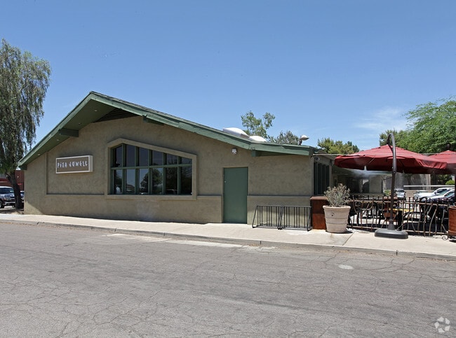
Property Record
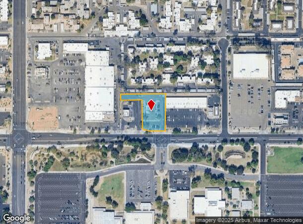
1850 W Southern Ave, Mesa, AZ 85202
Property Detail
1850 W Southern Ave
Phoenix-Mesa-Chandler, AZ
College Plaza Lots 1 Through 4
305-06-004A
COLLEGE PLAZA LOTS 1 THROUGH 4 MCR 182-12
Restaurantbuilding
Maricopa
X
Arizona
04013C2265M
2
2025
0.96 AC
2025
Red Mountain/Mesa
422103
Phoenix
5,612 SF
NEARBY LISTINGS FOR SALE OR LEASE
DEMOGRAPHICS near 1850 W Southern Ave
1 mile
3 mile
5 mile
2024 Total Population
26,759
165,298
397,769
2029 Population
29,133
178,303
428,934
Pop Growth 2024-2029
+ 8.87%
+ 7.87%
+ 7.83%
Average Age
38
36
36
2024 Total Households
11,554
67,166
155,773
HH Growth 2024-2029
+ 9.07%
+ 8.03%
+ 8.08%
Median Household Inc
$51,253
$58,609
$62,490
Avg Household Size
2.20
2.40
2.40
2024 Avg HH Vehicles
1.00
2.00
2.00
Median Home Value
$296,035
$327,048
$338,914
Median Year Built
1979
1979
1981
Nearby Places
Map Layers
Map Styles
 Street
 Aerial
Transit
 Traffic
 Biking
Places
Listings with unknown addresses are not visible on the map
- Restaurants
- Banks
- Shops
- Fitness
- Groceries
PUBLIC TRANSPORTATION
AIRPORT
Phoenix Sky Harbor International
Drive
Walk
Distance
Phoenix Sky Harbor International
18 min
10.8 mi
Phoenix-Mesa Gateway
Drive
Walk
Distance
Phoenix-Mesa Gateway
29 min
18.5 mi
Nearby Properties
Address
Land Use
TOTAL SIZE
Lot Size
Zoning
Address
Land Use
TOTAL SIZE
Lot Size
Zoning
439,211 SF
77.92 AC
C-G
Address
Land Use
TOTAL SIZE
Lot Size
Zoning
918,576 SF
22.96 AC
C-N
Address
Land Use
TOTAL SIZE
Lot Size
Zoning
127,962 SF
18.60 AC
I-1
Address
Land Use
TOTAL SIZE
Lot Size
Zoning
1,418,890 SF
39 AC
PF
Address
Land Use
TOTAL SIZE
Lot Size
Zoning
805,814 SF
115.19 AC
C-G
Address
Land Use
TOTAL SIZE
Lot Size
Zoning
8.79 AC
PF
Address
Land Use
TOTAL SIZE
Lot Size
Zoning
197,454 SF
18.97 AC
PF
Address
Land Use
TOTAL SIZE
Lot Size
Zoning
30,075 SF
6.86 AC
I-1
Address
Land Use
TOTAL SIZE
Lot Size
Zoning
377,442 SF
0.21 AC
C-DT
Address
Land Use
TOTAL SIZE
Lot Size
Zoning
937,488 SF
40.63 AC
R-4
Address
Land Use
TOTAL SIZE
Lot Size
Zoning
739,944 SF
40.02 AC
MFM
Address
Land Use
TOTAL SIZE
Lot Size
Zoning
267,023 SF
19.58 AC
PEP
Address
Land Use
TOTAL SIZE
Lot Size
Zoning
15,050 SF
1.42 AC
C-G
Address
Land Use
TOTAL SIZE
Lot Size
Zoning
459,103 SF
13.27 AC
MU4
Address
Land Use
TOTAL SIZE
Lot Size
Zoning
782,618 SF
6.70 AC
PAD
Address
Land Use
TOTAL SIZE
Lot Size
Zoning
485,625 SF
45.99 AC
PF
Address
Land Use
TOTAL SIZE
Lot Size
Zoning
32,619 SF
2.40 AC
C-G
Address
Land Use
TOTAL SIZE
Lot Size
Zoning
435,896 SF
3.40 AC
PCC2
Address
Land Use
TOTAL SIZE
Lot Size
Zoning
501,927 SF
8.13 AC
GC
Address
Land Use
TOTAL SIZE
Lot Size
Zoning
13,336 SF
1.98 AC
I-2
Address
Land Use
TOTAL SIZE
Lot Size
Zoning
411,683 SF
15.53 AC
RM3
Address
Land Use
TOTAL SIZE
Lot Size
Zoning
357,952 SF
33.73 AC
LI
Address
Land Use
TOTAL SIZE
Lot Size
Zoning
418,678 SF
18.63 AC
C-G
Address
Land Use
TOTAL SIZE
Lot Size
Zoning
23,030 SF
0.99 AC
M-H
Address
Land Use
TOTAL SIZE
Lot Size
Zoning
454,015 SF
10.03 AC
DB1
Address
Land Use
TOTAL SIZE
Lot Size
Zoning
36,180 SF
59.51 AC
AG
Address
Land Use
TOTAL SIZE
Lot Size
Zoning
572,119 SF
22.45 AC
PF
Address
Land Use
TOTAL SIZE
Lot Size
Zoning
291,833 SF
36.86 AC
R-6
Address
Land Use
TOTAL SIZE
Lot Size
Zoning
570,051 SF
4.26 AC
Address
Land Use
TOTAL SIZE
Lot Size
Zoning
322,662 SF
9.29 AC
R-6
The World's #1 Commercial Real Estate Marketplace
Connect with us
© 2026 CoStar Group
The information above has been obtained from sources believed reliable. While we do not doubt its accuracy we have not verified it and make no guarantee, warranty or representation about it. It is your responsibility to independently confirm its accuracy and completeness. Any projections, opinions, assumptions, or estimates used are for example only and do not represent the current or future performance of the property. The value of this transaction to you depends on tax and other factors which should be evaluated by your tax, financial, and legal advisors. You and your advisors should conduct a careful, independent investigation of the property to determine to your satisfaction the suitability of the property for your needs.