Property Record
2500 E Us Highway 14 Rd, Janesville, WI 53545
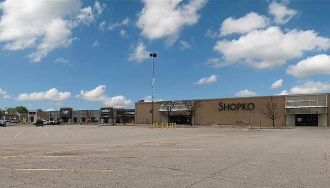


Property Detail
2500 E Us Highway 14 Rd
021-7400151
PART OF THE SW 1/4, SEC 17, T3N, R13E, 4TH PM, CITY OF JANESVILLE, ROCK COUNTY, WI DAF: LOT 2, CSM DOC NO 1632214, VOL 26, PG
Supermarket
Rock
B4
Wisconsin
B and X Area of moderate flood hazard, usually the area between the limits of the 100-year and 500-year floods.
2
2025
8.63 AC
2025
Rock County
000600
Milwaukee/Madison
98,825 SF
Janesville-Beloit, WI
NEARBY LISTINGS FOR SALE OR LEASE
DEMOGRAPHICS near 2500 E Us Highway 14 Rd
1 mile
3 mile
5 mile
2025 Total Population
5,372
42,742
68,930
2030 Population
5,369
42,937
69,345
Pop Growth 2025-2030
(0.06%)
+ 0.46%
+ 0.60%
Average Age
41
42
41
2025 Total Households
2,470
18,037
28,454
HH Growth 2025-2030
(0.16%)
+ 0.44%
+ 0.59%
Median Household Inc
$59,227
$74,744
$73,898
Avg Household Size
2.10
2.30
2.30
2025 Avg HH Vehicles
2.00
2.00
2.00
Median Home Value
$224,345
$256,129
$249,284
Median Year Built
1978
1975
1972
Nearby Places
Map Layers
Map Styles
 Street
 Aerial
Transit
 Traffic
 Biking
Places
Listings with unknown addresses are not visible on the map
- Restaurants
- Banks
- Shops
- Fitness
- Groceries
SALE & LEASE HISTORY
LISTING DATE
SALE/LEASE

Nov 11, 2019
For Lease
Nov 11, 2019
For Sale
Jun 05, 2018
For Sale
Nearby Properties
Address
Land Use
TOTAL SIZE
Lot Size
Zoning
Address
Land Use
TOTAL SIZE
Lot Size
Zoning
135,322 SF
18.41 AC
B2
Address
Land Use
TOTAL SIZE
Lot Size
Zoning
33,200 SF
69 AC
M1
Address
Land Use
TOTAL SIZE
Lot Size
Zoning
10,304 SF
14.50 AC
O1
Address
Land Use
TOTAL SIZE
Lot Size
Zoning
183,339 SF
9.97 AC
B4
Address
Land Use
TOTAL SIZE
Lot Size
Zoning
77,811 SF
8.74 AC
B4
Address
Land Use
TOTAL SIZE
Lot Size
Zoning
175,991 SF
26.17 AC
B4
Address
Land Use
TOTAL SIZE
Lot Size
Zoning
22,644 SF
7.52 AC
R3
Address
Land Use
TOTAL SIZE
Lot Size
Zoning
22,720 SF
20.70 AC
B4
Address
Land Use
TOTAL SIZE
Lot Size
Zoning
37,600 SF
3.89 AC
O1
Address
Land Use
TOTAL SIZE
Lot Size
Zoning
14,580 SF
28.75 AC
M1
Address
Land Use
TOTAL SIZE
Lot Size
Zoning
84,000 SF
26.69 AC
M1
Address
Land Use
TOTAL SIZE
Lot Size
Zoning
134,515 SF
16.08 AC
B4
Address
Land Use
TOTAL SIZE
Lot Size
Zoning
34,602 SF
6.65 AC
B3
Address
Land Use
TOTAL SIZE
Lot Size
Zoning
14,325 SF
6.46 AC
B4
Address
Land Use
TOTAL SIZE
Lot Size
Zoning
52,000 SF
8.85 AC
B4
Address
Land Use
TOTAL SIZE
Lot Size
Zoning
510,173 SF
32.64 AC
B2
Address
Land Use
TOTAL SIZE
Lot Size
Zoning
8,448 SF
17.14 AC
M1
Address
Land Use
TOTAL SIZE
Lot Size
Zoning
69,094 SF
12.42 AC
M1
Address
Land Use
TOTAL SIZE
Lot Size
Zoning
342,777 SF
17.09 AC
BT
Address
Land Use
TOTAL SIZE
Lot Size
Zoning
110,821 SF
10.62 AC
B4
Address
Land Use
TOTAL SIZE
Lot Size
Zoning
111,847 SF
11.72 AC
B4
Address
Land Use
TOTAL SIZE
Lot Size
Zoning
10,916 SF
9.14 AC
B4
Address
Land Use
TOTAL SIZE
Lot Size
Zoning
113,621 SF
9.77 AC
B4
Address
Land Use
TOTAL SIZE
Lot Size
Zoning
12,450 SF
2.30 AC
B4
Address
Land Use
TOTAL SIZE
Lot Size
Zoning
49,952 SF
4.48 AC
B4
Address
Land Use
TOTAL SIZE
Lot Size
Zoning
48,000 SF
17.55 AC
B4
Address
Land Use
TOTAL SIZE
Lot Size
Zoning
12,838 SF
25.34 AC
B4
Address
Land Use
TOTAL SIZE
Lot Size
Zoning
18.83 AC
M1
Address
Land Use
TOTAL SIZE
Lot Size
Zoning
25,678 SF
4.07 AC
R3
The World's #1 Commercial Real Estate Marketplace
Connect with us
© 2026 CoStar Group
The information above has been obtained from sources believed reliable. While we do not doubt its accuracy we have not verified it and make no guarantee, warranty or representation about it. It is your responsibility to independently confirm its accuracy and completeness. Any projections, opinions, assumptions, or estimates used are for example only and do not represent the current or future performance of the property. The value of this transaction to you depends on tax and other factors which should be evaluated by your tax, financial, and legal advisors. You and your advisors should conduct a careful, independent investigation of the property to determine to your satisfaction the suitability of the property for your needs.