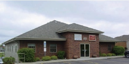
Property Record
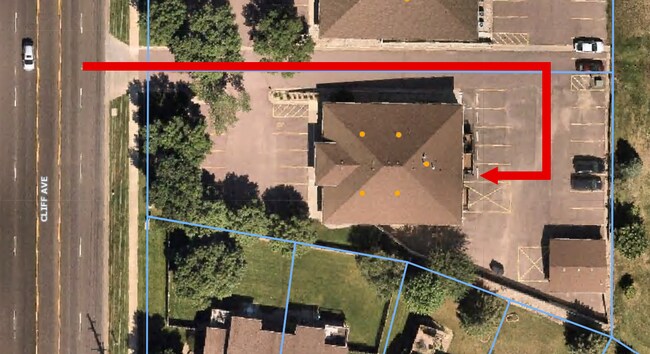
5200 S Cliff Ave, Sioux Falls, SD 57108

Property Detail
5200 S Cliff Ave
Sioux Falls, SD-MN
S.F.-BRADFELT PARK ESTATES - LOT 19 - BLK 1
280.10.01.019
Lincoln
Commercialnec
South Dakota
MUNICIPALI
19
B and X Area of moderate flood hazard, usually the area between the limits of the 100-year and 500-year floods.
0.60 AC
2025
Sioux Falls
2024
Other Market Areas
010112
NEARBY LISTINGS FOR SALE OR LEASE
DEMOGRAPHICS near 5200 S Cliff Ave
1 mile
3 mile
5 mile
2025 Total Population
12,806
70,502
173,318
2030 Population
14,103
75,848
186,072
Pop Growth 2025-2030
+ 10.13%
+ 7.58%
+ 7.36%
Average Age
43
40
38
2025 Total Households
5,360
28,758
71,583
HH Growth 2025-2030
+ 10.76%
+ 8.05%
+ 7.68%
Median Household Inc
$89,122
$83,083
$71,017
Avg Household Size
2.40
2.40
2.30
2025 Avg HH Vehicles
2.00
2.00
2.00
Median Home Value
$370,244
$354,238
$307,348
Median Year Built
1999
1996
1993
Nearby Places
Map Layers
Map Styles
 Street
 Aerial
Transit
 Traffic
 Biking
Places
Listings with unknown addresses are not visible on the map
- Restaurants
- Banks
- Shops
- Fitness
- Groceries
SALE & LEASE HISTORY
LISTING DATE
SALE/LEASE

Sep 25, 2016
For Lease
Feb 07, 2025
For Lease
Feb 01, 2018
For Lease
Nearby Properties
Address
Land Use
TOTAL SIZE
Lot Size
Zoning
Address
Land Use
TOTAL SIZE
Lot Size
Zoning
11.33 AC
MUNICIPALI
Address
Land Use
TOTAL SIZE
Lot Size
Zoning
184,821 SF
1.83 AC
NO;SPECIAL
Address
Land Use
TOTAL SIZE
Lot Size
Zoning
4,358 SF
14.79 AC
Address
Land Use
TOTAL SIZE
Lot Size
Zoning
7,252 SF
12.07 AC
Address
Land Use
TOTAL SIZE
Lot Size
Zoning
15.24 AC
MUNICIPALI
Address
Land Use
TOTAL SIZE
Lot Size
Zoning
360,262 SF
26 AC
Address
Land Use
TOTAL SIZE
Lot Size
Zoning
2,406 SF
13.76 AC
Address
Land Use
TOTAL SIZE
Lot Size
Zoning
8.02 AC
MUNICIPALI
Address
Land Use
TOTAL SIZE
Lot Size
Zoning
9.42 AC
MUNICIPALI
Address
Land Use
TOTAL SIZE
Lot Size
Zoning
9.45 AC
MUNICIPALI
Address
Land Use
TOTAL SIZE
Lot Size
Zoning
7.59 AC
MUNICIPALI
Address
Land Use
TOTAL SIZE
Lot Size
Zoning
11.91 AC
MUNICIPALI
Address
Land Use
TOTAL SIZE
Lot Size
Zoning
18.88 AC
MUNICIPALI
Address
Land Use
TOTAL SIZE
Lot Size
Zoning
7.91 AC
MUNICIPALI
Address
Land Use
TOTAL SIZE
Lot Size
Zoning
10.24 AC
MUNICIPALI
Address
Land Use
TOTAL SIZE
Lot Size
Zoning
8.09 AC
MUNICIPALI
Address
Land Use
TOTAL SIZE
Lot Size
Zoning
9.15 AC
MUNICIPALI
Address
Land Use
TOTAL SIZE
Lot Size
Zoning
9.15 AC
MUNICIPALI
Address
Land Use
TOTAL SIZE
Lot Size
Zoning
4.61 AC
MUNICIPALI
Address
Land Use
TOTAL SIZE
Lot Size
Zoning
9.82 AC
MUNICIPALI
Address
Land Use
TOTAL SIZE
Lot Size
Zoning
86,019 SF
3.60 AC
NO;SPECIAL
Address
Land Use
TOTAL SIZE
Lot Size
Zoning
106,064 SF
35.38 AC
Address
Land Use
TOTAL SIZE
Lot Size
Zoning
89,935 SF
4.81 AC
Address
Land Use
TOTAL SIZE
Lot Size
Zoning
7.63 AC
MUNICIPALI
Address
Land Use
TOTAL SIZE
Lot Size
Zoning
4.64 AC
MUNICIPALI
Address
Land Use
TOTAL SIZE
Lot Size
Zoning
5.99 AC
MUNICIPALI
Address
Land Use
TOTAL SIZE
Lot Size
Zoning
3.04 AC
MUNICIPALI
Address
Land Use
TOTAL SIZE
Lot Size
Zoning
3.97 AC
MUNICIPALI
Address
Land Use
TOTAL SIZE
Lot Size
Zoning
6 AC
MUNICIPALI
Address
Land Use
TOTAL SIZE
Lot Size
Zoning
47,611 SF
12.14 AC
The World's #1 Commercial Real Estate Marketplace
Connect with us
© 2026 CoStar Group
The information above has been obtained from sources believed reliable. While we do not doubt its accuracy we have not verified it and make no guarantee, warranty or representation about it. It is your responsibility to independently confirm its accuracy and completeness. Any projections, opinions, assumptions, or estimates used are for example only and do not represent the current or future performance of the property. The value of this transaction to you depends on tax and other factors which should be evaluated by your tax, financial, and legal advisors. You and your advisors should conduct a careful, independent investigation of the property to determine to your satisfaction the suitability of the property for your needs.