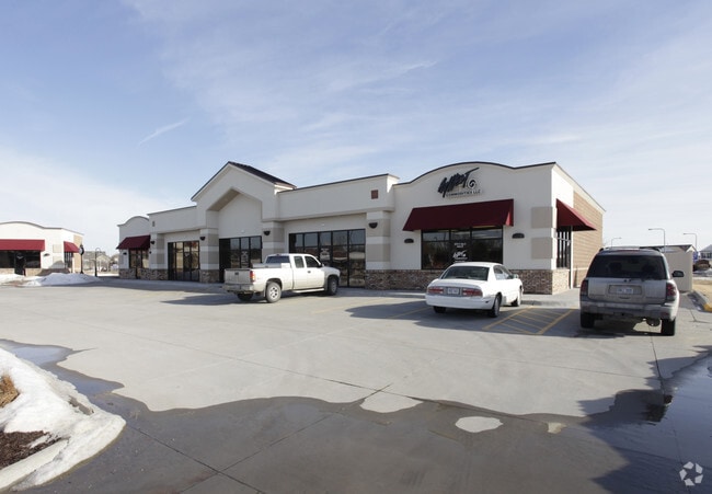
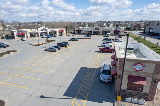
Property Record
11757 S Highway 6, Gretna, NE 68028

Property Detail
11757 S Highway 6
Omaha, NE-IA
LOT PT 1 STANDING STONE REPLAT 11 (2.231 AC) (2 CARDS/2 SECTIONS)
011610931
SARPY
Commercialnec
Nebraska
GC
1
2024
0.13 AC
2025
Southwest Omaha
010632
Omaha/Council Bluffs
6,480 SF
NEARBY LISTINGS FOR SALE OR LEASE
DEMOGRAPHICS near 11757 S Highway 6
1 mile
3 mile
5 mile
2025 Total Population
6,224
15,181
44,689
2030 Population
6,676
16,615
48,551
Pop Growth 2025-2030
+ 7.26%
+ 9.45%
+ 8.64%
Average Age
38
37
36
2025 Total Households
2,170
5,116
14,865
HH Growth 2025-2030
+ 7.33%
+ 9.46%
+ 8.78%
Median Household Inc
$112,003
$126,928
$132,266
Avg Household Size
2.80
2.90
3.00
2025 Avg HH Vehicles
2.00
2.00
2.00
Median Home Value
$373,045
$410,667
$391,140
Median Year Built
2001
2007
2010
Nearby Places
Map Layers
Map Styles
 Street
 Aerial
Layers
 Traffic
 Biking
Places
Listings with unknown addresses are not visible on the map
- Restaurants
- Banks
- Shops
- Fitness
- Groceries
PUBLIC TRANSPORTATION
AIRPORT
Eppley Airfield
Drive
Walk
Distance
Eppley Airfield
39 min
26.0 mi
Lincoln
Drive
Walk
Distance
Lincoln
43 min
37.7 mi
SALE & LEASE HISTORY
LISTING DATE
SALE/LEASE

Apr 10, 2024
For Sale
Nearby Properties
Address
Land Use
TOTAL SIZE
Lot Size
Zoning
Address
Land Use
TOTAL SIZE
Lot Size
Zoning
46,338 SF
25.95 AC
Address
Land Use
TOTAL SIZE
Lot Size
Zoning
72.91 AC
Address
Land Use
TOTAL SIZE
Lot Size
Zoning
12.60 AC
Address
Land Use
TOTAL SIZE
Lot Size
Zoning
30.87 AC
Address
Land Use
TOTAL SIZE
Lot Size
Zoning
13,312 SF
9.27 AC
Address
Land Use
TOTAL SIZE
Lot Size
Zoning
38,154 SF
10.65 AC
Address
Land Use
TOTAL SIZE
Lot Size
Zoning
1,288 SF
157.59 AC
AG
Address
Land Use
TOTAL SIZE
Lot Size
Zoning
15.85 AC
Address
Land Use
TOTAL SIZE
Lot Size
Zoning
36,145 SF
2 AC
Address
Land Use
TOTAL SIZE
Lot Size
Zoning
37,589 SF
6.76 AC
Address
Land Use
TOTAL SIZE
Lot Size
Zoning
13.44 AC
Address
Land Use
TOTAL SIZE
Lot Size
Zoning
6,404 SF
4.61 AC
Address
Land Use
TOTAL SIZE
Lot Size
Zoning
6.78 AC
Address
Land Use
TOTAL SIZE
Lot Size
Zoning
8,800 SF
0.34 AC
AG
Address
Land Use
TOTAL SIZE
Lot Size
Zoning
67,737 SF
4.01 AC
Address
Land Use
TOTAL SIZE
Lot Size
Zoning
11,666 SF
4.15 AC
Address
Land Use
TOTAL SIZE
Lot Size
Zoning
1.65 AC
I1
Address
Land Use
TOTAL SIZE
Lot Size
Zoning
Address
Land Use
TOTAL SIZE
Lot Size
Zoning
1,344 SF
10.41 AC
Address
Land Use
TOTAL SIZE
Lot Size
Zoning
9,560 SF
2.99 AC
Address
Land Use
TOTAL SIZE
Lot Size
Zoning
44,001 SF
3.93 AC
Address
Land Use
TOTAL SIZE
Lot Size
Zoning
5.33 AC
Address
Land Use
TOTAL SIZE
Lot Size
Zoning
32,763 SF
3 AC
Address
Land Use
TOTAL SIZE
Lot Size
Zoning
21,122 SF
3.68 AC
Address
Land Use
TOTAL SIZE
Lot Size
Zoning
3,500 SF
3.34 AC
Address
Land Use
TOTAL SIZE
Lot Size
Zoning
2.05 AC
Address
Land Use
TOTAL SIZE
Lot Size
Zoning
41,075 SF
1.04 AC
Address
Land Use
TOTAL SIZE
Lot Size
Zoning
5.20 AC
Address
Land Use
TOTAL SIZE
Lot Size
Zoning
3,082 SF
10.70 AC
Address
Land Use
TOTAL SIZE
Lot Size
Zoning
66,758 SF
10.55 AC
I1
The World's #1 Commercial Real Estate Marketplace
Connect with us
© 2026 CoStar Group
The information above has been obtained from sources believed reliable. While we do not doubt its accuracy we have not verified it and make no guarantee, warranty or representation about it. It is your responsibility to independently confirm its accuracy and completeness. Any projections, opinions, assumptions, or estimates used are for example only and do not represent the current or future performance of the property. The value of this transaction to you depends on tax and other factors which should be evaluated by your tax, financial, and legal advisors. You and your advisors should conduct a careful, independent investigation of the property to determine to your satisfaction the suitability of the property for your needs.