Property Record
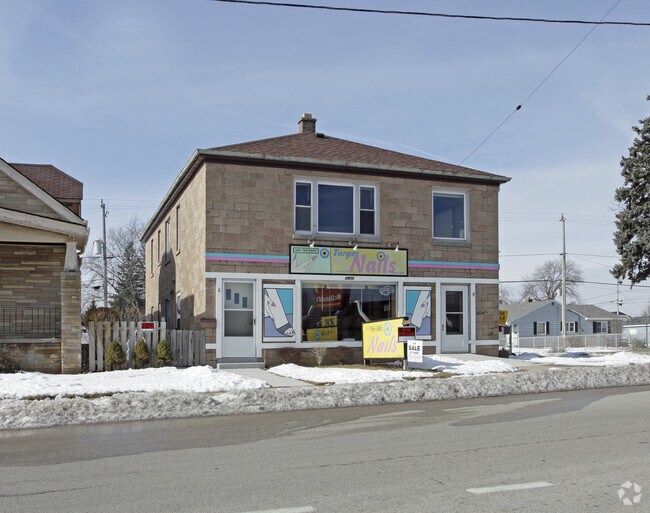
2800 S Chicago Ave, South Milwaukee, WI 53172


Property Detail
2800 S Chicago Ave
Milwaukee-Waukesha, WI
PARCEL 1 OF CSM 4007 SW 1/4 SEC 11 5 22 39.04 X 120
777-0014-001
Milwaukee
Commercialnec
Wisconsin
B and X Area of moderate flood hazard, usually the area between the limits of the 100-year and 500-year floods.
1
2024
0.11 AC
2024
Milwaukee SE
170400
Milwaukee/Madison
NEARBY LISTINGS FOR SALE OR LEASE
DEMOGRAPHICS near 2800 S Chicago Ave
1 mile
3 mile
5 mile
2025 Total Population
15,795
46,119
102,248
2030 Population
15,613
45,814
101,532
Pop Growth 2025-2030
(1.15%)
(0.66%)
(0.70%)
Average Age
41
42
41
2025 Total Households
6,729
19,846
43,571
HH Growth 2025-2030
(1.38%)
(0.78%)
(0.77%)
Median Household Inc
$78,106
$82,489
$82,323
Avg Household Size
2.30
2.30
2.30
2025 Avg HH Vehicles
2.00
2.00
2.00
Median Home Value
$240,423
$254,866
$261,257
Median Year Built
1957
1968
1969
Nearby Places
Map Layers
Map Styles
 Street
 Aerial
Transit
 Traffic
 Biking
Places
Listings with unknown addresses are not visible on the map
- Restaurants
- Banks
- Shops
- Fitness
- Groceries
PUBLIC TRANSPORTATION
COMMUTER RAIL
General Mitchell Intl. Airport Amtrak Station (Hiawatha Service - Amtrak)
Drive
Walk
Distance
General Mitchell Intl. Airport Amtrak Station (Hiawatha Service - Amtrak)
14 min
5.8 mi
AIRPORT
General Mitchell International
Drive
Walk
Distance
General Mitchell International
14 min
6.0 mi
Freight Ports
Port Milwaukee
Drive
Walk
Distance
Port Milwaukee
19 min
8.6 mi
Nearby Properties
Address
Land Use
TOTAL SIZE
Lot Size
Zoning
Address
Land Use
TOTAL SIZE
Lot Size
Zoning
3.15 AC
Address
Land Use
TOTAL SIZE
Lot Size
Zoning
6.90 AC
Address
Land Use
TOTAL SIZE
Lot Size
Zoning
3.45 AC
Address
Land Use
TOTAL SIZE
Lot Size
Zoning
2.53 AC
Address
Land Use
TOTAL SIZE
Lot Size
Zoning
27.30 AC
RESIDENTIA
Address
Land Use
TOTAL SIZE
Lot Size
Zoning
26.21 AC
Address
Land Use
TOTAL SIZE
Lot Size
Zoning
9.24 AC
RESIDENTIA
Address
Land Use
TOTAL SIZE
Lot Size
Zoning
15.92 AC
Address
Land Use
TOTAL SIZE
Lot Size
Zoning
14.03 AC
RESIDENTIA
Address
Land Use
TOTAL SIZE
Lot Size
Zoning
378,000 SF
19.24 AC
M-1PUD
Address
Land Use
TOTAL SIZE
Lot Size
Zoning
9.55 AC
RESIDENTIA
Address
Land Use
TOTAL SIZE
Lot Size
Zoning
2.39 AC
Address
Land Use
TOTAL SIZE
Lot Size
Zoning
216,281 SF
5.99 AC
RESIDENTIA
Address
Land Use
TOTAL SIZE
Lot Size
Zoning
Address
Land Use
TOTAL SIZE
Lot Size
Zoning
9.36 AC
RESIDENTIA
Address
Land Use
TOTAL SIZE
Lot Size
Zoning
7.22 AC
RESIDENTIA
Address
Land Use
TOTAL SIZE
Lot Size
Zoning
18.52 AC
Address
Land Use
TOTAL SIZE
Lot Size
Zoning
Address
Land Use
TOTAL SIZE
Lot Size
Zoning
Address
Land Use
TOTAL SIZE
Lot Size
Zoning
Address
Land Use
TOTAL SIZE
Lot Size
Zoning
3.40 AC
Address
Land Use
TOTAL SIZE
Lot Size
Zoning
1,125 SF
13.50 AC
Address
Land Use
TOTAL SIZE
Lot Size
Zoning
5.61 AC
RESIDENTIA
Address
Land Use
TOTAL SIZE
Lot Size
Zoning
8.80 AC
RESIDENTIA
Address
Land Use
TOTAL SIZE
Lot Size
Zoning
Address
Land Use
TOTAL SIZE
Lot Size
Zoning
10.57 AC
Address
Land Use
TOTAL SIZE
Lot Size
Zoning
36.60 AC
Address
Land Use
TOTAL SIZE
Lot Size
Zoning
12.60 AC
Address
Land Use
TOTAL SIZE
Lot Size
Zoning
405,764 SF
12.70 AC
M-2
Address
Land Use
TOTAL SIZE
Lot Size
Zoning
1.17 AC
The World's #1 Commercial Real Estate Marketplace
Connect with us
© 2026 CoStar Group
The information above has been obtained from sources believed reliable. While we do not doubt its accuracy we have not verified it and make no guarantee, warranty or representation about it. It is your responsibility to independently confirm its accuracy and completeness. Any projections, opinions, assumptions, or estimates used are for example only and do not represent the current or future performance of the property. The value of this transaction to you depends on tax and other factors which should be evaluated by your tax, financial, and legal advisors. You and your advisors should conduct a careful, independent investigation of the property to determine to your satisfaction the suitability of the property for your needs.