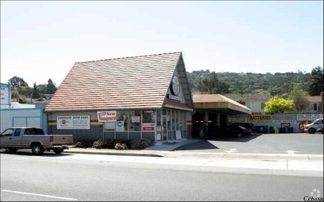
Property Record
1444 El Camino Real, Belmont, CA 94002


NEARBY LISTINGS FOR SALE OR LEASE
Property Detail
1444 El Camino Real
San Francisco-Redwood City-South San Francisco, CA
Bay View Heights
045-248-280
LOTS 9 10 11 & 12 BLK 2 BAY VIEW HEIGHTS RSM 14/39 40
Commercialnec
San Mateo
X
California
06081C0169G
9
2024
0.21 AC
2025
Belmont/San Carlos
609000
San Francisco
2,552 SF
DEMOGRAPHICS near 1444 El Camino Real
1 Mile
3 Mile
5 Mile
2024 Total Population
15,840
140,268
281,315
2029 Population
15,098
133,837
268,587
Pop Growth 2024-2029
(4.68%)
(4.58%)
(4.52%)
Average Age
41
41
41
2024 Total Households
6,119
53,784
103,979
HH Growth 2024-2029
(4.80%)
(4.77%)
(4.68%)
Median Household Inc
$161,384
$173,012
$151,236
Avg Household Size
2.50
2.50
2.60
2024 Avg HH Vehicles
2.00
2.00
2.00
Median Home Value
$1,136,493
$1,133,297
$1,128,219
Median Year Built
1961
1971
1968
Nearby Places
Map Layers
Map Styles
 Street
 Aerial
- Restaurants
- Banks
- Shops
- Fitness
- Groceries
PUBLIC TRANSPORTATION
COMMUTER RAIL
DRIVE
WALK
Distance
2 min
7 min
0.4 mi
Belmont (Caltrain - Caltrain (Caltrain))
DRIVE
WALK
Distance
Belmont (Caltrain - Caltrain (Caltrain))
2 min
8 min
0.4 mi
AIRPORT
San Francisco International
DRIVE
WALK
Distance
San Francisco International
18 min
11.4 mi
Norman Y Mineta San Jose International
DRIVE
WALK
Distance
Norman Y Mineta San Jose International
30 min
23.1 mi
Metro Oakland International
DRIVE
WALK
Distance
Metro Oakland International
36 min
27.2 mi
Freight Ports
Port of Redwood City
DRIVE
WALK
Distance
Port of Redwood City
11 min
5.9 mi
Nearby Properties
Address
Land Use
TOTAL SIZE
Lot Size
Zoning
Address
Land Use
TOTAL SIZE
Lot Size
Zoning
1,068,445 SF
39.82 AC
Address
Land Use
TOTAL SIZE
Lot Size
Zoning
738,000 SF
56.46 AC
TP0000
Address
Land Use
TOTAL SIZE
Lot Size
Zoning
568,423 SF
16.07 AC
Address
Land Use
TOTAL SIZE
Lot Size
Zoning
491,030 SF
2.74 AC
Address
Land Use
TOTAL SIZE
Lot Size
Zoning
399,422 SF
5.94 AC
Address
Land Use
TOTAL SIZE
Lot Size
Zoning
Address
Land Use
TOTAL SIZE
Lot Size
Zoning
223,321 SF
8.39 AC
M10000
Address
Land Use
TOTAL SIZE
Lot Size
Zoning
Address
Land Use
TOTAL SIZE
Lot Size
Zoning
400,000 SF
4.39 AC
C10000
Address
Land Use
TOTAL SIZE
Lot Size
Zoning
417,200 SF
29.07 AC
R300PD
Address
Land Use
TOTAL SIZE
Lot Size
Zoning
40,000 SF
1.60 AC
Address
Land Use
TOTAL SIZE
Lot Size
Zoning
190,245 SF
16.88 AC
M10000
Address
Land Use
TOTAL SIZE
Lot Size
Zoning
2,020 SF
2.64 AC
Address
Land Use
TOTAL SIZE
Lot Size
Zoning
2,024 SF
2.07 AC
Address
Land Use
TOTAL SIZE
Lot Size
Zoning
245,260 SF
9.08 AC
Address
Land Use
TOTAL SIZE
Lot Size
Zoning
395,625 SF
5.08 AC
Address
Land Use
TOTAL SIZE
Lot Size
Zoning
218,249 SF
2.15 AC
Address
Land Use
TOTAL SIZE
Lot Size
Zoning
177,000 SF
6.24 AC
Address
Land Use
TOTAL SIZE
Lot Size
Zoning
1,849 SF
4.72 AC
CB0000
Address
Land Use
TOTAL SIZE
Lot Size
Zoning
395,010 SF
15.11 AC
R003S3
Address
Land Use
TOTAL SIZE
Lot Size
Zoning
Address
Land Use
TOTAL SIZE
Lot Size
Zoning
12,944 SF
12.37 AC
Address
Land Use
TOTAL SIZE
Lot Size
Zoning
366,384 SF
3.63 AC
Address
Land Use
TOTAL SIZE
Lot Size
Zoning
196,504 SF
1.98 AC
Address
Land Use
TOTAL SIZE
Lot Size
Zoning
187,781 SF
6.67 AC
CP0000
Address
Land Use
TOTAL SIZE
Lot Size
Zoning
12.14 AC
Address
Land Use
TOTAL SIZE
Lot Size
Zoning
55,422 SF
2.41 AC
PM0002
Address
Land Use
TOTAL SIZE
Lot Size
Zoning
188,303 SF
1.76 AC
Address
Land Use
TOTAL SIZE
Lot Size
Zoning
239,430 SF
17.78 AC
CB0000
Address
Land Use
TOTAL SIZE
Lot Size
Zoning
373,151 SF
6.64 AC
The World's #1 Commercial Real Estate Marketplace
Connect with us
© 2025 CoStar Group
The information above has been obtained from sources believed reliable. While we do not doubt its accuracy we have not verified it and make no guarantee, warranty or representation about it. It is your responsibility to independently confirm its accuracy and completeness. Any projections, opinions, assumptions, or estimates used are for example only and do not represent the current or future performance of the property. The value of this transaction to you depends on tax and other factors which should be evaluated by your tax, financial, and legal advisors. You and your advisors should conduct a careful, independent investigation of the property to determine to your satisfaction the suitability of the property for your needs.