Property Record
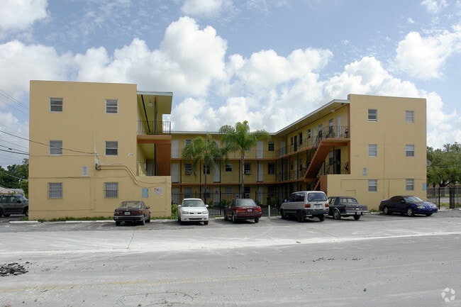
2295 Nw 46Th St, Miami, FL 33142


Property Detail
2295 Nw 46Th St
30-3122-000-0683
22 53 41 .51 AC W191FT OF S1/2 OF S1/2 OF SE1/4 OF SE1/4 OF NW1/4 LESS S35FT & LOT SIZE 166.000 X 130 OR 19822-1292 0701 1 COC 21825-0663 11 2003 2
Multifamilydwelling
Miami-Dade
6051
Florida
B and X Area of moderate flood hazard, usually the area between the limits of the 100-year and 500-year floods.
0.50 AC
2024
Brownsville
2025
South Florida
001803
Miami-Miami Beach-Kendall, FL
19,758 SF
NEARBY LISTINGS FOR SALE OR LEASE
DEMOGRAPHICS near 2295 Nw 46Th St
1 mile
3 mile
5 mile
2024 Total Population
32,434
248,823
673,511
2029 Population
34,990
267,738
723,905
Pop Growth 2024-2029
+ 7.88%
+ 7.60%
+ 7.48%
Average Age
40
41
41
2024 Total Households
11,335
90,101
265,194
HH Growth 2024-2029
+ 7.82%
+ 7.87%
+ 7.78%
Median Household Inc
$39,763
$48,711
$63,192
Avg Household Size
2.70
2.60
2.40
2024 Avg HH Vehicles
1.00
1.00
1.00
Median Home Value
$360,306
$427,975
$498,723
Median Year Built
1962
1966
1973
Nearby Places
Map Layers
Map Styles
 Street
 Aerial
Transit
 Traffic
 Biking
Places
Listings with unknown addresses are not visible on the map
- Restaurants
- Banks
- Shops
- Fitness
- Groceries
PUBLIC TRANSPORTATION
COMMUTER RAIL
Earlington Heights (Metrorail Green Line - Miami-Dade Transit (Metrorail/Metromover))
Drive
Walk
Distance
Earlington Heights (Metrorail Green Line - Miami-Dade Transit (Metrorail/Metromover))
10 min
10 min
0.5 mi
Brownsville (Metrorail Green Line - Miami-Dade Transit (Metrorail/Metromover))
Drive
Walk
Distance
Brownsville (Metrorail Green Line - Miami-Dade Transit (Metrorail/Metromover))
2 min
15 min
0.8 mi
AIRPORT
Miami International
Drive
Walk
Distance
Miami International
17 min
7.2 mi
Fort Lauderdale/Hollywood International
Drive
Walk
Distance
Fort Lauderdale/Hollywood International
32 min
22.3 mi
Freight Ports
Port of Miami
Drive
Walk
Distance
Port of Miami
14 min
6.6 mi
Nearby Properties
Address
Land Use
TOTAL SIZE
Lot Size
Zoning
Address
Land Use
TOTAL SIZE
Lot Size
Zoning
955,966 SF
38.91 AC
9600
Address
Land Use
TOTAL SIZE
Lot Size
Zoning
928,000 SF
14.30 AC
8000
Address
Land Use
TOTAL SIZE
Lot Size
Zoning
16.13 AC
6100
Address
Land Use
TOTAL SIZE
Lot Size
Zoning
2,789,683 SF
33.23 AC
7300
Address
Land Use
TOTAL SIZE
Lot Size
Zoning
2,403,353 SF
7.37 AC
6100
Address
Land Use
TOTAL SIZE
Lot Size
Zoning
1,938,271 SF
6.62 AC
6402
Address
Land Use
TOTAL SIZE
Lot Size
Zoning
1,075,124 SF
1.61 AC
6405
Address
Land Use
TOTAL SIZE
Lot Size
Zoning
256,089 SF
20.35 AC
7600
Address
Land Use
TOTAL SIZE
Lot Size
Zoning
585,775 SF
1.86 AC
6101
Address
Land Use
TOTAL SIZE
Lot Size
Zoning
868,860 SF
2.14 AC
6402
Address
Land Use
TOTAL SIZE
Lot Size
Zoning
790,139 SF
1.80 AC
6110
Address
Land Use
TOTAL SIZE
Lot Size
Zoning
570,694 SF
1.37 AC
4604
Address
Land Use
TOTAL SIZE
Lot Size
Zoning
566,165 SF
2.09 AC
6101
Address
Land Use
TOTAL SIZE
Lot Size
Zoning
701,056 SF
1.58 AC
6402
Address
Land Use
TOTAL SIZE
Lot Size
Zoning
996,100 SF
3.58 AC
9600
Address
Land Use
TOTAL SIZE
Lot Size
Zoning
600,250 SF
2.03 AC
6402
Address
Land Use
TOTAL SIZE
Lot Size
Zoning
627,685 SF
2.06 AC
6100
Address
Land Use
TOTAL SIZE
Lot Size
Zoning
595,100 SF
0.92 AC
4604
Address
Land Use
TOTAL SIZE
Lot Size
Zoning
428,154 SF
1.39 AC
6101
Address
Land Use
TOTAL SIZE
Lot Size
Zoning
221,570 SF
1.79 AC
6100
Address
Land Use
TOTAL SIZE
Lot Size
Zoning
596,081 SF
4.33 AC
9600
Address
Land Use
TOTAL SIZE
Lot Size
Zoning
264,272 SF
2.18 AC
6110
Address
Land Use
TOTAL SIZE
Lot Size
Zoning
545,562 SF
1.71 AC
6110
Address
Land Use
TOTAL SIZE
Lot Size
Zoning
469,492 SF
2.06 AC
4604
Address
Land Use
TOTAL SIZE
Lot Size
Zoning
1,212,604 SF
10.50 AC
9600
Address
Land Use
TOTAL SIZE
Lot Size
Zoning
648,350 SF
9.78 AC
6118
Address
Land Use
TOTAL SIZE
Lot Size
Zoning
526,358 SF
3.62 AC
6100
Address
Land Use
TOTAL SIZE
Lot Size
Zoning
545,220 SF
15.32 AC
6100
Address
Land Use
TOTAL SIZE
Lot Size
Zoning
498,242 SF
2.69 AC
6100
Address
Land Use
TOTAL SIZE
Lot Size
Zoning
480,664 SF
26.03 AC
9600
The World's #1 Commercial Real Estate Marketplace
Connect with us
© 2026 CoStar Group
The information above has been obtained from sources believed reliable. While we do not doubt its accuracy we have not verified it and make no guarantee, warranty or representation about it. It is your responsibility to independently confirm its accuracy and completeness. Any projections, opinions, assumptions, or estimates used are for example only and do not represent the current or future performance of the property. The value of this transaction to you depends on tax and other factors which should be evaluated by your tax, financial, and legal advisors. You and your advisors should conduct a careful, independent investigation of the property to determine to your satisfaction the suitability of the property for your needs.