Property Record
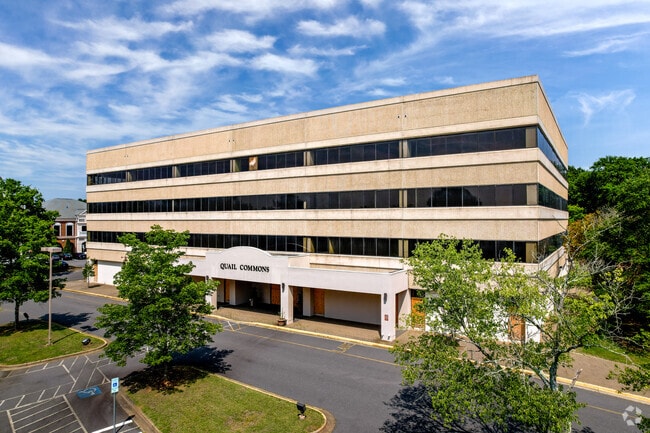
11525 Carmel Commons Blvd, Charlotte, NC 28226


Property Detail
11525 Carmel Commons Blvd
221-202-02
L2 M24-916
Officebuilding
Mecklenburg
MUDD-O
North Carolina
B and X Area of moderate flood hazard, usually the area between the limits of the 100-year and 500-year floods.
2
2024
4.47 AC
2025
South Charlotte
005853
Charlotte
85,301 SF
Charlotte-Concord-Gastonia, NC-SC
NEARBY LISTINGS FOR SALE OR LEASE
DEMOGRAPHICS near 11525 Carmel Commons Blvd
1 mile
3 mile
5 mile
2024 Total Population
12,016
80,081
227,690
2029 Population
12,881
86,059
245,305
Pop Growth 2024-2029
+ 7.20%
+ 7.46%
+ 7.74%
Average Age
40
40
39
2024 Total Households
5,456
34,182
91,773
HH Growth 2024-2029
+ 7.28%
+ 7.57%
+ 7.82%
Median Household Inc
$76,984
$100,259
$113,091
Avg Household Size
2.20
2.30
2.40
2024 Avg HH Vehicles
2.00
2.00
2.00
Median Home Value
$472,458
$585,746
$607,292
Median Year Built
1988
1989
1994
Nearby Places
Map Layers
Map Styles
 Street
 Aerial
Transit
 Traffic
 Biking
Places
Listings with unknown addresses are not visible on the map
- Restaurants
- Banks
- Shops
- Fitness
- Groceries
PUBLIC TRANSPORTATION
AIRPORT
Charlotte/Douglas International
Drive
Walk
Distance
Charlotte/Douglas International
23 min
12.6 mi
Concord-Padgett Regional
Drive
Walk
Distance
Concord-Padgett Regional
44 min
35.6 mi
Nearby Properties
Address
Land Use
TOTAL SIZE
Lot Size
Zoning
Address
Land Use
TOTAL SIZE
Lot Size
Zoning
922,476 SF
49.91 AC
BP
Address
Land Use
TOTAL SIZE
Lot Size
Zoning
244,692 SF
264.29 AC
I2
Address
Land Use
TOTAL SIZE
Lot Size
Zoning
654,693 SF
51.50 AC
O1
Address
Land Use
TOTAL SIZE
Lot Size
Zoning
646,209 SF
72.24 AC
CC
Address
Land Use
TOTAL SIZE
Lot Size
Zoning
306,928 SF
53.98 AC
Address
Land Use
TOTAL SIZE
Lot Size
Zoning
720,470 SF
5.45 AC
Address
Land Use
TOTAL SIZE
Lot Size
Zoning
339,072 SF
20.65 AC
B1SCD
Address
Land Use
TOTAL SIZE
Lot Size
Zoning
430,352 SF
40.09 AC
R12MFCD
Address
Land Use
TOTAL SIZE
Lot Size
Zoning
425,591 SF
31.58 AC
MX1
Address
Land Use
TOTAL SIZE
Lot Size
Zoning
361,910 SF
3.60 AC
Address
Land Use
TOTAL SIZE
Lot Size
Zoning
465,462 SF
23.76 AC
CC
Address
Land Use
TOTAL SIZE
Lot Size
Zoning
295,548 SF
43.48 AC
CC
Address
Land Use
TOTAL SIZE
Lot Size
Zoning
326,013 SF
25.59 AC
RMF
Address
Land Use
TOTAL SIZE
Lot Size
Zoning
217,826 SF
82.89 AC
R3
Address
Land Use
TOTAL SIZE
Lot Size
Zoning
305,449 SF
17.90 AC
R17MFCD
Address
Land Use
TOTAL SIZE
Lot Size
Zoning
539,429 SF
5.37 AC
Address
Land Use
TOTAL SIZE
Lot Size
Zoning
480,041 SF
4.76 AC
Address
Land Use
TOTAL SIZE
Lot Size
Zoning
3,183 SF
3.82 AC
Address
Land Use
TOTAL SIZE
Lot Size
Zoning
381,729 SF
22.37 AC
R17MF
Address
Land Use
TOTAL SIZE
Lot Size
Zoning
698,101 SF
5 AC
Address
Land Use
TOTAL SIZE
Lot Size
Zoning
291,482 SF
23.12 AC
R12MFCD
Address
Land Use
TOTAL SIZE
Lot Size
Zoning
357,068 SF
28.04 AC
R15MFCD
Address
Land Use
TOTAL SIZE
Lot Size
Zoning
321,129 SF
23.59 AC
MX2
Address
Land Use
TOTAL SIZE
Lot Size
Zoning
452,964 SF
9.19 AC
OCCD
Address
Land Use
TOTAL SIZE
Lot Size
Zoning
324,998 SF
16.60 AC
OICD
Address
Land Use
TOTAL SIZE
Lot Size
Zoning
279,674 SF
18.28 AC
CC
Address
Land Use
TOTAL SIZE
Lot Size
Zoning
518,080 SF
5.44 AC
Address
Land Use
TOTAL SIZE
Lot Size
Zoning
312,194 SF
24.88 AC
R12MFCD
Address
Land Use
TOTAL SIZE
Lot Size
Zoning
364,274 SF
3.50 AC
CC
Address
Land Use
TOTAL SIZE
Lot Size
Zoning
293,128 SF
22.70 AC
MX2
The World's #1 Commercial Real Estate Marketplace
Connect with us
© 2026 CoStar Group
The information above has been obtained from sources believed reliable. While we do not doubt its accuracy we have not verified it and make no guarantee, warranty or representation about it. It is your responsibility to independently confirm its accuracy and completeness. Any projections, opinions, assumptions, or estimates used are for example only and do not represent the current or future performance of the property. The value of this transaction to you depends on tax and other factors which should be evaluated by your tax, financial, and legal advisors. You and your advisors should conduct a careful, independent investigation of the property to determine to your satisfaction the suitability of the property for your needs.