Property Record
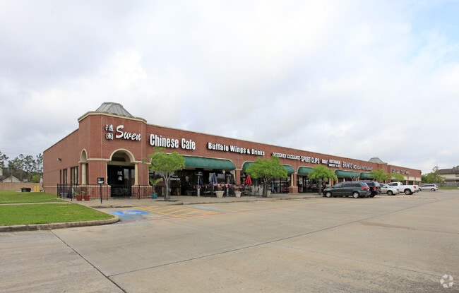
4610 Highway 6 Pkwy, Sugar Land, TX 77478


Property Detail
4610 Highway 6 Pkwy
4762-02-000-0020-907
LAKEFIELD SEC 2, ACRES 10.495, (PT) RESERVE B (RESERVE A OF RANDALLS CENTER AUSTIN PARKWAY)
Commercialnec
FORT BEND
SY
Texas
2024
10.50 AC
2025
Far New Territory
674301
Houston
111,865 SF
Houston-Pasadena-The Woodlands, TX
NEARBY LISTINGS FOR SALE OR LEASE
DEMOGRAPHICS near 4610 Highway 6 Pkwy
1 mile
3 mile
5 mile
2025 Total Population
14,252
110,838
235,317
2030 Population
15,975
124,997
265,224
Pop Growth 2025-2030
+ 12.09%
+ 12.77%
+ 12.71%
Average Age
42
41
41
2025 Total Households
4,946
38,982
82,071
HH Growth 2025-2030
+ 12.56%
+ 13.19%
+ 13.14%
Median Household Inc
$107,299
$109,437
$106,308
Avg Household Size
2.80
2.80
2.80
2025 Avg HH Vehicles
2.00
2.00
2.00
Median Home Value
$342,073
$399,006
$390,838
Median Year Built
1989
1994
1996
Nearby Places
Map Layers
Map Styles
 Street
 Aerial
Transit
 Traffic
 Biking
Places
Listings with unknown addresses are not visible on the map
- Restaurants
- Banks
- Shops
- Fitness
- Groceries
PUBLIC TRANSPORTATION
AIRPORT
William P Hobby
Drive
Walk
Distance
William P Hobby
40 min
24.0 mi
George Bush Intcntl/Houston
Drive
Walk
Distance
George Bush Intcntl/Houston
55 min
42.0 mi
SALE & LEASE HISTORY
LISTING DATE
SALE/LEASE

Oct 01, 2019
For Lease
Jun 05, 2017
For Lease
Nearby Properties
Address
Land Use
TOTAL SIZE
Lot Size
Zoning
Address
Land Use
TOTAL SIZE
Lot Size
Zoning
448,502 SF
35.66 AC
Address
Land Use
TOTAL SIZE
Lot Size
Zoning
171,425 SF
29.96 AC
Address
Land Use
TOTAL SIZE
Lot Size
Zoning
221,618 SF
6.50 AC
Address
Land Use
TOTAL SIZE
Lot Size
Zoning
109,083 SF
20.81 AC
Address
Land Use
TOTAL SIZE
Lot Size
Zoning
16.84 AC
Address
Land Use
TOTAL SIZE
Lot Size
Zoning
365,915 SF
57.06 AC
AT
Address
Land Use
TOTAL SIZE
Lot Size
Zoning
254,919 SF
12.46 AC
Address
Land Use
TOTAL SIZE
Lot Size
Zoning
85,273 SF
11.63 AC
Y
Address
Land Use
TOTAL SIZE
Lot Size
Zoning
14,038 SF
23.83 AC
Address
Land Use
TOTAL SIZE
Lot Size
Zoning
6.70 AC
Address
Land Use
TOTAL SIZE
Lot Size
Zoning
Address
Land Use
TOTAL SIZE
Lot Size
Zoning
129,813 SF
8.53 AC
Address
Land Use
TOTAL SIZE
Lot Size
Zoning
127,458 SF
14.21 AC
Address
Land Use
TOTAL SIZE
Lot Size
Zoning
88,682 SF
10.52 AC
ASY
Address
Land Use
TOTAL SIZE
Lot Size
Zoning
149,261 SF
12.15 AC
SJ
Address
Land Use
TOTAL SIZE
Lot Size
Zoning
254,210 SF
10.59 AC
JT
Address
Land Use
TOTAL SIZE
Lot Size
Zoning
49,976 SF
0.79 AC
X
Address
Land Use
TOTAL SIZE
Lot Size
Zoning
194,593 SF
2.29 AC
X
Address
Land Use
TOTAL SIZE
Lot Size
Zoning
190,152 SF
13.17 AC
I
Address
Land Use
TOTAL SIZE
Lot Size
Zoning
Address
Land Use
TOTAL SIZE
Lot Size
Zoning
88,560 SF
10.25 AC
QZ
Address
Land Use
TOTAL SIZE
Lot Size
Zoning
172,513 SF
10.26 AC
Y
Address
Land Use
TOTAL SIZE
Lot Size
Zoning
53,533 SF
10.98 AC
Address
Land Use
TOTAL SIZE
Lot Size
Zoning
9.10 AC
Address
Land Use
TOTAL SIZE
Lot Size
Zoning
412,620 SF
53.34 AC
Y
Address
Land Use
TOTAL SIZE
Lot Size
Zoning
153,036 SF
0.93 AC
Address
Land Use
TOTAL SIZE
Lot Size
Zoning
279,112 SF
7.86 AC
Z
Address
Land Use
TOTAL SIZE
Lot Size
Zoning
189,336 SF
42.18 AC
MJT
Address
Land Use
TOTAL SIZE
Lot Size
Zoning
128,226 SF
11.40 AC
S
Address
Land Use
TOTAL SIZE
Lot Size
Zoning
189,336 SF
25.53 AC
S
The World's #1 Commercial Real Estate Marketplace
Connect with us
© 2026 CoStar Group
The information above has been obtained from sources believed reliable. While we do not doubt its accuracy we have not verified it and make no guarantee, warranty or representation about it. It is your responsibility to independently confirm its accuracy and completeness. Any projections, opinions, assumptions, or estimates used are for example only and do not represent the current or future performance of the property. The value of this transaction to you depends on tax and other factors which should be evaluated by your tax, financial, and legal advisors. You and your advisors should conduct a careful, independent investigation of the property to determine to your satisfaction the suitability of the property for your needs.