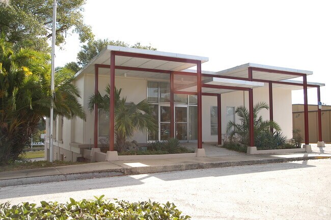
Property Record
1 Westgate Plz, Clermont, FL 34711


NEARBY LISTINGS FOR SALE OR LEASE
Property Detail
1 Westgate Plz
Orlando-Kissimmee-Sanford, FL
Clermont
24-22-25-0100-099-00000
CLERMONT BEG AT INTERSECTION OF SLY LINE OF HWY 50 WITH W LINE OF WEST AVE RUN S ALONG WEST AVE 142.7 FT N 77DEG 15MIN 30SEC W 338.2 FT N 11DEG 18MIN 30SEC E 128.3 FT TO SLY R/W OF HWY 50 SELY ALONG HWY 310 FT TO POB BEING PART OF BLOCKS 99 & 100 PB
Storemultistory
Lake
X
Florida
12069C0570E
1
2024
1.28 AC
2026
Lake County
031313
Orlando
5,060 SF
DEMOGRAPHICS near 1 Westgate Plz
1 Mile
3 Mile
5 Mile
2024 Total Population
4,344
36,939
95,798
2029 Population
5,061
42,859
112,003
Pop Growth 2024-2029
+ 16.51%
+ 16.03%
+ 16.92%
Average Age
42
40
42
2024 Total Households
1,748
13,855
35,227
HH Growth 2024-2029
+ 16.42%
+ 15.78%
+ 16.67%
Median Household Inc
$69,710
$79,049
$81,394
Avg Household Size
2.40
2.60
2.70
2024 Avg HH Vehicles
2.00
2.00
2.00
Median Home Value
$318,791
$297,885
$315,458
Median Year Built
1975
1999
2003
Nearby Places
Map Layers
Map Styles
 Street
 Aerial
- Restaurants
- Banks
- Shops
- Fitness
- Groceries
PUBLIC TRANSPORTATION
AIRPORT
Orlando International
DRIVE
WALK
Distance
Orlando International
47 min
34.3 mi
Nearby Properties
Address
Land Use
TOTAL SIZE
Lot Size
Zoning
Address
Land Use
TOTAL SIZE
Lot Size
Zoning
403,970 SF
30.99 AC
PUD
Address
Land Use
TOTAL SIZE
Lot Size
Zoning
285,581 SF
19.34 AC
CFD
Address
Land Use
TOTAL SIZE
Lot Size
Zoning
321,012 SF
22.55 AC
PUD
Address
Land Use
TOTAL SIZE
Lot Size
Zoning
269,594 SF
25.23 AC
PUD
Address
Land Use
TOTAL SIZE
Lot Size
Zoning
179,290 SF
23.79 AC
Address
Land Use
TOTAL SIZE
Lot Size
Zoning
212,649 SF
4.20 AC
Address
Land Use
TOTAL SIZE
Lot Size
Zoning
192,907 SF
16.43 AC
PUD
Address
Land Use
TOTAL SIZE
Lot Size
Zoning
204,472 SF
43.52 AC
Address
Land Use
TOTAL SIZE
Lot Size
Zoning
Address
Land Use
TOTAL SIZE
Lot Size
Zoning
124,634 SF
18.57 AC
Address
Land Use
TOTAL SIZE
Lot Size
Zoning
142,824 SF
9.90 AC
C2
Address
Land Use
TOTAL SIZE
Lot Size
Zoning
126,067 SF
9.34 AC
Address
Land Use
TOTAL SIZE
Lot Size
Zoning
203,762 SF
18.28 AC
R1
Address
Land Use
TOTAL SIZE
Lot Size
Zoning
227,034 SF
29.20 AC
Address
Land Use
TOTAL SIZE
Lot Size
Zoning
95,182 SF
12.34 AC
PUD
Address
Land Use
TOTAL SIZE
Lot Size
Zoning
158,351 SF
19.10 AC
C2
Address
Land Use
TOTAL SIZE
Lot Size
Zoning
87,951 SF
5.88 AC
Address
Land Use
TOTAL SIZE
Lot Size
Zoning
80,774 SF
6.61 AC
Address
Land Use
TOTAL SIZE
Lot Size
Zoning
74,375 SF
6.69 AC
Address
Land Use
TOTAL SIZE
Lot Size
Zoning
90,469 SF
5.99 AC
PUD
Address
Land Use
TOTAL SIZE
Lot Size
Zoning
61,515 SF
9.92 AC
R6
Address
Land Use
TOTAL SIZE
Lot Size
Zoning
99,348 SF
34.10 AC
R1A
Address
Land Use
TOTAL SIZE
Lot Size
Zoning
72,336 SF
13.62 AC
C2
Address
Land Use
TOTAL SIZE
Lot Size
Zoning
123,387 SF
47.51 AC
R3
Address
Land Use
TOTAL SIZE
Lot Size
Zoning
48,496 SF
3.35 AC
C2
Address
Land Use
TOTAL SIZE
Lot Size
Zoning
30,415 SF
3.47 AC
Address
Land Use
TOTAL SIZE
Lot Size
Zoning
46,996 SF
7.93 AC
CP
Address
Land Use
TOTAL SIZE
Lot Size
Zoning
41,006 SF
8.43 AC
A
Address
Land Use
TOTAL SIZE
Lot Size
Zoning
30,926 SF
0.38 AC
Address
Land Use
TOTAL SIZE
Lot Size
Zoning
81,188 SF
7.70 AC
C2
The World's #1 Commercial Real Estate Marketplace
Connect with us
© 2026 CoStar Group
The information above has been obtained from sources believed reliable. While we do not doubt its accuracy we have not verified it and make no guarantee, warranty or representation about it. It is your responsibility to independently confirm its accuracy and completeness. Any projections, opinions, assumptions, or estimates used are for example only and do not represent the current or future performance of the property. The value of this transaction to you depends on tax and other factors which should be evaluated by your tax, financial, and legal advisors. You and your advisors should conduct a careful, independent investigation of the property to determine to your satisfaction the suitability of the property for your needs.