Property Record
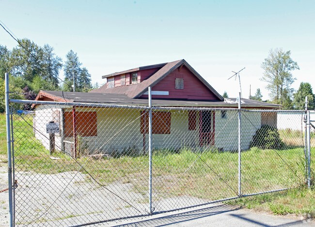
16530 State Route 9 Se, Snohomish, WA 98296


NEARBY LISTINGS FOR SALE OR LEASE
Property Detail
16530 State Route 9 Se
Seattle-Tacoma-Bellevue, WA
Pointe At Crosswater Condominium
270512-002-015-00
Snohomish
Sfr
Washington
X
1.89 AC
53061C1355G
Mill Creek/N Creek
1,500 SF
Seattle/Puget Sound
DEMOGRAPHICS near 16530 State Route 9 Se
1 Mile
3 Mile
5 Mile
2024 Total Population
2,665
37,081
132,794
2029 Population
2,757
38,641
138,286
Pop Growth 2024-2029
+ 3.45%
+ 4.21%
+ 4.14%
Average Age
41
38
38
2024 Total Households
930
12,106
46,185
HH Growth 2024-2029
+ 3.55%
+ 4.28%
+ 4.21%
Median Household Inc
$146,874
$160,232
$141,258
Avg Household Size
2.80
3.00
2.80
2024 Avg HH Vehicles
3.00
3.00
2.00
Median Home Value
$776,647
$762,308
$754,728
Median Year Built
1984
1996
1995
Nearby Places
Map Layers
Map Styles
 Street
 Aerial
- Restaurants
- Banks
- Shops
- Fitness
- Groceries
PUBLIC TRANSPORTATION
AIRPORT
Seattle Paine Field International
DRIVE
WALK
Distance
Seattle Paine Field International
22 min
11.5 mi
Seattle-Tacoma International
DRIVE
WALK
Distance
Seattle-Tacoma International
50 min
34.6 mi
Freight Ports
Port of Everett
DRIVE
WALK
Distance
Port of Everett
22 min
14.1 mi
Nearby Properties
Address
Land Use
TOTAL SIZE
Lot Size
Zoning
Address
Land Use
TOTAL SIZE
Lot Size
Zoning
379,588 SF
36.08 AC
R-5
Address
Land Use
TOTAL SIZE
Lot Size
Zoning
137,746 SF
157.88 AC
LI
Address
Land Use
TOTAL SIZE
Lot Size
Zoning
57.84 AC
R-9,600
Address
Land Use
TOTAL SIZE
Lot Size
Zoning
261,105 SF
50.87 AC
LDMR
Address
Land Use
TOTAL SIZE
Lot Size
Zoning
71,281 SF
11.28 AC
LDMR
Address
Land Use
TOTAL SIZE
Lot Size
Zoning
80,320 SF
2.54 AC
R-7,200(PR
Address
Land Use
TOTAL SIZE
Lot Size
Zoning
104,881 SF
9.96 AC
IP
Address
Land Use
TOTAL SIZE
Lot Size
Zoning
68,653 SF
5 AC
LDMR
Address
Land Use
TOTAL SIZE
Lot Size
Zoning
87,200 SF
1.95 AC
PCB
Address
Land Use
TOTAL SIZE
Lot Size
Zoning
66,790 SF
4.87 AC
LI
Address
Land Use
TOTAL SIZE
Lot Size
Zoning
2,328 SF
15.42 AC
IP
Address
Land Use
TOTAL SIZE
Lot Size
Zoning
12.02 AC
PRD-9,600
Address
Land Use
TOTAL SIZE
Lot Size
Zoning
62,857 SF
4.02 AC
IP
Address
Land Use
TOTAL SIZE
Lot Size
Zoning
52,460 SF
5.35 AC
IP
Address
Land Use
TOTAL SIZE
Lot Size
Zoning
76,645 SF
7.66 AC
CRC
Address
Land Use
TOTAL SIZE
Lot Size
Zoning
18.25 AC
PCB
Address
Land Use
TOTAL SIZE
Lot Size
Zoning
40,040 SF
5.49 AC
R-9,600
Address
Land Use
TOTAL SIZE
Lot Size
Zoning
60,532 SF
5.89 AC
CB
Address
Land Use
TOTAL SIZE
Lot Size
Zoning
29,679 SF
3.63 AC
NB
Address
Land Use
TOTAL SIZE
Lot Size
Zoning
67,714 SF
1.73 AC
NB
Address
Land Use
TOTAL SIZE
Lot Size
Zoning
51,619 SF
4.99 AC
CRC
Address
Land Use
TOTAL SIZE
Lot Size
Zoning
47,800 SF
2.81 AC
PIP
Address
Land Use
TOTAL SIZE
Lot Size
Zoning
54,530 SF
3.67 AC
LI
Address
Land Use
TOTAL SIZE
Lot Size
Zoning
10 AC
PRD-9,600
Address
Land Use
TOTAL SIZE
Lot Size
Zoning
44,200 SF
2.84 AC
PIP
Address
Land Use
TOTAL SIZE
Lot Size
Zoning
26,747 SF
5.35 AC
LI
Address
Land Use
TOTAL SIZE
Lot Size
Zoning
48,972 SF
1.10 AC
MR
Address
Land Use
TOTAL SIZE
Lot Size
Zoning
36,000 SF
4.43 AC
IP
The World's #1 Commercial Real Estate Marketplace
Connect with us
© 2026 CoStar Group
The information above has been obtained from sources believed reliable. While we do not doubt its accuracy we have not verified it and make no guarantee, warranty or representation about it. It is your responsibility to independently confirm its accuracy and completeness. Any projections, opinions, assumptions, or estimates used are for example only and do not represent the current or future performance of the property. The value of this transaction to you depends on tax and other factors which should be evaluated by your tax, financial, and legal advisors. You and your advisors should conduct a careful, independent investigation of the property to determine to your satisfaction the suitability of the property for your needs.