Property Record
4615 Missouri Flat Rd, Placerville, CA 95667
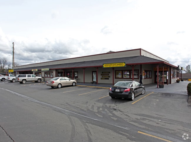

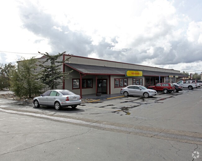
Property Detail
4615 Missouri Flat Rd
329-261-023-000
PM 37/132/2
Storebuilding
EL DORADO
I
California
B and X Area of moderate flood hazard, usually the area between the limits of the 100-year and 500-year floods.
2.40 AC
2024
El Dorado
2025
Sacramento
031506
Sacramento-Roseville-Folsom, CA
23,200 SF
NEARBY LISTINGS FOR SALE OR LEASE
DEMOGRAPHICS near 4615 Missouri Flat Rd
1 mile
3 mile
5 mile
2024 Total Population
4,238
19,506
32,099
2029 Population
4,182
19,263
31,542
Pop Growth 2024-2029
(1.32%)
(1.25%)
(1.74%)
Average Age
47
46
46
2024 Total Households
1,809
8,090
13,298
HH Growth 2024-2029
(1.33%)
(1.26%)
(1.71%)
Median Household Inc
$85,450
$85,258
$92,362
Avg Household Size
2.30
2.30
2.30
2024 Avg HH Vehicles
2.00
2.00
2.00
Median Home Value
$450,303
$489,278
$571,097
Median Year Built
1981
1979
1979
Nearby Places
Map Layers
Map Styles
 Street
 Aerial
Transit
 Traffic
 Biking
Places
Listings with unknown addresses are not visible on the map
- Restaurants
- Banks
- Shops
- Fitness
- Groceries
SALE & LEASE HISTORY
LISTING DATE
SALE/LEASE

Sep 06, 2023
For Sale
Nearby Properties
Address
Land Use
TOTAL SIZE
Lot Size
Zoning
Address
Land Use
TOTAL SIZE
Lot Size
Zoning
201,296 SF
13 AC
Address
Land Use
TOTAL SIZE
Lot Size
Zoning
45,900 SF
6.43 AC
R1A
Address
Land Use
TOTAL SIZE
Lot Size
Zoning
55,043 SF
2.57 AC
RE
Address
Land Use
TOTAL SIZE
Lot Size
Zoning
131,146 SF
18.51 AC
C
Address
Land Use
TOTAL SIZE
Lot Size
Zoning
97,000 SF
17.05 AC
R1A
Address
Land Use
TOTAL SIZE
Lot Size
Zoning
47,760 SF
3.60 AC
R1A
Address
Land Use
TOTAL SIZE
Lot Size
Zoning
55,216 SF
6.60 AC
R106
Address
Land Use
TOTAL SIZE
Lot Size
Zoning
56,609 SF
4.52 AC
CG
Address
Land Use
TOTAL SIZE
Lot Size
Zoning
8,100 SF
10.60 AC
Address
Land Use
TOTAL SIZE
Lot Size
Zoning
86,414 SF
6.06 AC
Address
Land Use
TOTAL SIZE
Lot Size
Zoning
7.13 AC
Address
Land Use
TOTAL SIZE
Lot Size
Zoning
69,157 SF
3.13 AC
CP
Address
Land Use
TOTAL SIZE
Lot Size
Zoning
58,175 SF
6.62 AC
C
Address
Land Use
TOTAL SIZE
Lot Size
Zoning
4,399 SF
1.44 AC
I
Address
Land Use
TOTAL SIZE
Lot Size
Zoning
Address
Land Use
TOTAL SIZE
Lot Size
Zoning
88,976 SF
6.34 AC
R2
Address
Land Use
TOTAL SIZE
Lot Size
Zoning
4.81 AC
R1A
Address
Land Use
TOTAL SIZE
Lot Size
Zoning
212,572 SF
4.99 AC
R1A
Address
Land Use
TOTAL SIZE
Lot Size
Zoning
26,903 SF
6.47 AC
Address
Land Use
TOTAL SIZE
Lot Size
Zoning
68,277 SF
4.65 AC
R2
Address
Land Use
TOTAL SIZE
Lot Size
Zoning
14,820 SF
1.69 AC
CG
Address
Land Use
TOTAL SIZE
Lot Size
Zoning
3.81 AC
C
Address
Land Use
TOTAL SIZE
Lot Size
Zoning
59,265 SF
7.65 AC
R2
Address
Land Use
TOTAL SIZE
Lot Size
Zoning
118,091 SF
2.71 AC
I
Address
Land Use
TOTAL SIZE
Lot Size
Zoning
12,250 SF
1.57 AC
Address
Land Use
TOTAL SIZE
Lot Size
Zoning
1,350 SF
12.58 AC
R1A
Address
Land Use
TOTAL SIZE
Lot Size
Zoning
32,450 SF
2.71 AC
I
Address
Land Use
TOTAL SIZE
Lot Size
Zoning
1,380 SF
4.96 AC
I
Address
Land Use
TOTAL SIZE
Lot Size
Zoning
2.35 AC
Address
Land Use
TOTAL SIZE
Lot Size
Zoning
64,504 SF
3.67 AC
R1A
The World's #1 Commercial Real Estate Marketplace
Connect with us
© 2026 CoStar Group
The information above has been obtained from sources believed reliable. While we do not doubt its accuracy we have not verified it and make no guarantee, warranty or representation about it. It is your responsibility to independently confirm its accuracy and completeness. Any projections, opinions, assumptions, or estimates used are for example only and do not represent the current or future performance of the property. The value of this transaction to you depends on tax and other factors which should be evaluated by your tax, financial, and legal advisors. You and your advisors should conduct a careful, independent investigation of the property to determine to your satisfaction the suitability of the property for your needs.