Property Record
290 University Ave Sw, Atlanta, GA 30310
NEARBY LISTINGS FOR SALE OR LEASE
Property Detail
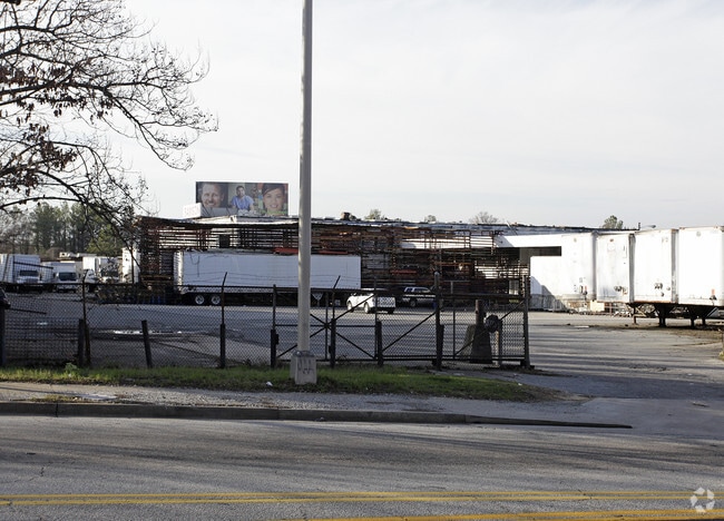
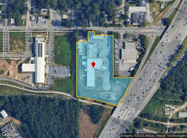
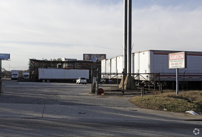
290 University Ave Sw
Atlanta-Sandy Springs-Roswell, GA
Sam & Son Wholesale Group Inc
14-0073-0001-004-4
SAMSON WHLSALE FOOD 404-658-1111 FC 3/24
Warehouse
Fulton
X
Georgia
13121C0357F
73
2024
6.65 AC
2025
Central Atlanta
006300
Atlanta
71,948 SF
DEMOGRAPHICS near 290 University Ave Sw
1 Mile
3 Mile
5 Mile
2024 Total Population
15,778
128,450
336,616
2029 Population
16,535
134,540
349,987
Pop Growth 2024-2029
+ 4.80%
+ 4.74%
+ 3.97%
Average Age
36
36
37
2024 Total Households
6,732
52,877
150,700
HH Growth 2024-2029
+ 4.77%
+ 5.21%
+ 4.20%
Median Household Inc
$40,327
$50,259
$65,634
Avg Household Size
2.30
2.10
2.00
2024 Avg HH Vehicles
1.00
1.00
1.00
Median Home Value
$257,758
$323,996
$346,914
Median Year Built
1982
1976
1984
Nearby Places
Map Layers
Map Styles
 Street
 Aerial
- Restaurants
- Banks
- Shops
- Fitness
- Groceries
PUBLIC TRANSPORTATION
COMMUTER RAIL
DRIVE
WALK
Distance
11 min
6.7 mi
AIRPORT
Hartsfield - Jackson Atlanta International
DRIVE
WALK
Distance
Hartsfield - Jackson Atlanta International
13 min
7.2 mi
Nearby Properties
Address
Land Use
TOTAL SIZE
Lot Size
Zoning
Address
Land Use
TOTAL SIZE
Lot Size
Zoning
19.94 AC
SPI1
Address
Land Use
TOTAL SIZE
Lot Size
Zoning
11.74 AC
I1
Address
Land Use
TOTAL SIZE
Lot Size
Zoning
9.80 AC
C5
Address
Land Use
TOTAL SIZE
Lot Size
Zoning
3.16 AC
SPI1
Address
Land Use
TOTAL SIZE
Lot Size
Zoning
9 AC
C5
Address
Land Use
TOTAL SIZE
Lot Size
Zoning
10.27 AC
C5
Address
Land Use
TOTAL SIZE
Lot Size
Zoning
1,300,309 SF
4.81 AC
SPI1
Address
Land Use
TOTAL SIZE
Lot Size
Zoning
1,434,872 SF
1.89 AC
SPI1
Address
Land Use
TOTAL SIZE
Lot Size
Zoning
61.57 AC
C5
Address
Land Use
TOTAL SIZE
Lot Size
Zoning
1.55 AC
SPI1
Address
Land Use
TOTAL SIZE
Lot Size
Zoning
7 AC
C3
Address
Land Use
TOTAL SIZE
Lot Size
Zoning
1,314,183 SF
2.61 AC
SPI1
Address
Land Use
TOTAL SIZE
Lot Size
Zoning
2,577,342 SF
2.04 AC
SPI1
Address
Land Use
TOTAL SIZE
Lot Size
Zoning
13,340,229 SF
3.68 AC
SPI1
Address
Land Use
TOTAL SIZE
Lot Size
Zoning
1,589,465 SF
3.41 AC
SPI1
Address
Land Use
TOTAL SIZE
Lot Size
Zoning
3.62 AC
SPI1
Address
Land Use
TOTAL SIZE
Lot Size
Zoning
543,748 SF
3.86 AC
I2
Address
Land Use
TOTAL SIZE
Lot Size
Zoning
3,588,720 SF
1.32 AC
SPI1
Address
Land Use
TOTAL SIZE
Lot Size
Zoning
631,858 SF
1.33 AC
C5C
Address
Land Use
TOTAL SIZE
Lot Size
Zoning
1,975,400 SF
9.58 AC
RG4
Address
Land Use
TOTAL SIZE
Lot Size
Zoning
510,561 SF
87 SF
SPI1
Address
Land Use
TOTAL SIZE
Lot Size
Zoning
34 AC
OI
Address
Land Use
TOTAL SIZE
Lot Size
Zoning
1,553,747 SF
2 AC
SPI1
Address
Land Use
TOTAL SIZE
Lot Size
Zoning
400,311 SF
4.45 AC
I2
Address
Land Use
TOTAL SIZE
Lot Size
Zoning
541,092 SF
0.53 AC
SPI1
Address
Land Use
TOTAL SIZE
Lot Size
Zoning
498,515 SF
3.41 AC
C1
Address
Land Use
TOTAL SIZE
Lot Size
Zoning
595,658 SF
4.09 AC
I1
Address
Land Use
TOTAL SIZE
Lot Size
Zoning
757,962 SF
0.36 AC
SPI1
Address
Land Use
TOTAL SIZE
Lot Size
Zoning
632,090 SF
1.01 AC
SPI1
Address
Land Use
TOTAL SIZE
Lot Size
Zoning
351,438 SF
0.44 AC
SPI1
The World's #1 Commercial Real Estate Marketplace
Connect with us
© 2026 CoStar Group
The information above has been obtained from sources believed reliable. While we do not doubt its accuracy we have not verified it and make no guarantee, warranty or representation about it. It is your responsibility to independently confirm its accuracy and completeness. Any projections, opinions, assumptions, or estimates used are for example only and do not represent the current or future performance of the property. The value of this transaction to you depends on tax and other factors which should be evaluated by your tax, financial, and legal advisors. You and your advisors should conduct a careful, independent investigation of the property to determine to your satisfaction the suitability of the property for your needs.