Property Record
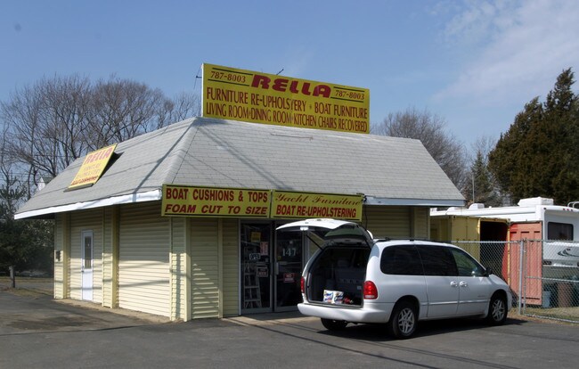
147 State Route 36 E, North Middletown, NJ 07748


Property Detail
147 State Route 36 E
32-00184-0000-00006
ALSO LOTS 21/25 NIT 1A
Storemultistory
MONMOUTH
C125
New Jersey
C and X Area of minimal flood hazard, usually depicted on FIRMs as above the 500-year flood level.
6
2024
0.18 AC
2025
Eastern Monmouth
800601
Northern New Jersey
690 SF
Lakewood-New Brunswick, NJ
NEARBY LISTINGS FOR SALE OR LEASE
DEMOGRAPHICS near 147 State Route 36 E
1 mile
3 mile
5 mile
2024 Total Population
6,319
20,352
42,774
2029 Population
6,581
20,634
43,129
Pop Growth 2024-2029
+ 4.15%
+ 1.39%
+ 0.83%
Average Age
47
45
44
2024 Total Households
3,247
8,834
17,315
HH Growth 2024-2029
+ 4.19%
+ 1.61%
+ 1.05%
Median Household Inc
$89,546
$126,315
$142,573
Avg Household Size
1.90
2.30
2.40
2024 Avg HH Vehicles
2.00
2.00
2.00
Median Home Value
$562,573
$815,655
$839,737
Median Year Built
1974
1970
1966
Nearby Places
Map Layers
Map Styles
 Street
 Aerial
Transit
 Traffic
 Biking
Places
Listings with unknown addresses are not visible on the map
- Restaurants
- Banks
- Shops
- Fitness
- Groceries
PUBLIC TRANSPORTATION
COMMUTER RAIL
Middletown Nj (North Jersey Coast Line - NJ TRANSIT RAIL)
Drive
Walk
Distance
Middletown Nj (North Jersey Coast Line - NJ TRANSIT RAIL)
11 min
5.1 mi
Hazlet (North Jersey Coast Line - NJ Transit Commuter Rail (NJ Transit))
Drive
Walk
Distance
Hazlet (North Jersey Coast Line - NJ Transit Commuter Rail (NJ Transit))
7 min
5.3 mi
AIRPORT
Newark Liberty International
Drive
Walk
Distance
Newark Liberty International
43 min
32.2 mi
LaGuardia
Drive
Walk
Distance
LaGuardia
72 min
49.5 mi
Freight Ports
New York Container Terminal
Drive
Walk
Distance
New York Container Terminal
36 min
27.3 mi
Nearby Properties
Address
Land Use
TOTAL SIZE
Lot Size
Zoning
Address
Land Use
TOTAL SIZE
Lot Size
Zoning
838,137 SF
253 AC
R45
Address
Land Use
TOTAL SIZE
Lot Size
Zoning
596.51 AC
CONREC
Address
Land Use
TOTAL SIZE
Lot Size
Zoning
2.91 AC
Address
Land Use
TOTAL SIZE
Lot Size
Zoning
6,500 SF
48.71 AC
CI
Address
Land Use
TOTAL SIZE
Lot Size
Zoning
37.83 AC
PUD
Address
Land Use
TOTAL SIZE
Lot Size
Zoning
10.44 AC
TMHO
Address
Land Use
TOTAL SIZE
Lot Size
Zoning
147,236 SF
20.01 AC
MU15
Address
Land Use
TOTAL SIZE
Lot Size
Zoning
29.59 AC
CI
Address
Land Use
TOTAL SIZE
Lot Size
Zoning
118,375 SF
18.20 AC
MU15
Address
Land Use
TOTAL SIZE
Lot Size
Zoning
151,463 SF
20.58 AC
M-2
Address
Land Use
TOTAL SIZE
Lot Size
Zoning
39,965 SF
17.14 AC
BH
Address
Land Use
TOTAL SIZE
Lot Size
Zoning
83,449 SF
0.57 AC
SF05
Address
Land Use
TOTAL SIZE
Lot Size
Zoning
3,641 SF
22.58 AC
C1
Address
Land Use
TOTAL SIZE
Lot Size
Zoning
237,821 SF
38.92 AC
SF20
Address
Land Use
TOTAL SIZE
Lot Size
Zoning
133,184 SF
14.10 AC
MU15
Address
Land Use
TOTAL SIZE
Lot Size
Zoning
42,314 SF
52 AC
IA
Address
Land Use
TOTAL SIZE
Lot Size
Zoning
127,410 SF
6.02 AC
MF15
Address
Land Use
TOTAL SIZE
Lot Size
Zoning
3,864 SF
260 AC
R15
Address
Land Use
TOTAL SIZE
Lot Size
Zoning
96.54 AC
I10
Address
Land Use
TOTAL SIZE
Lot Size
Zoning
83,416 SF
44.01 AC
R22
Address
Land Use
TOTAL SIZE
Lot Size
Zoning
5 AC
PUD
Address
Land Use
TOTAL SIZE
Lot Size
Zoning
141,313 SF
23.19 AC
SF20
Address
Land Use
TOTAL SIZE
Lot Size
Zoning
69,541 SF
2.39 AC
B-2
Address
Land Use
TOTAL SIZE
Lot Size
Zoning
9,904 SF
135.45 AC
M-2
Address
Land Use
TOTAL SIZE
Lot Size
Zoning
67,832 SF
10.46 AC
RGA
Address
Land Use
TOTAL SIZE
Lot Size
Zoning
132,885 SF
3.15 AC
SF05
Address
Land Use
TOTAL SIZE
Lot Size
Zoning
28 AC
RO3
Address
Land Use
TOTAL SIZE
Lot Size
Zoning
4,078 SF
15.14 AC
SC2
Address
Land Use
TOTAL SIZE
Lot Size
Zoning
124,651 SF
25.02 AC
CD
Address
Land Use
TOTAL SIZE
Lot Size
Zoning
200,514 SF
37.60 AC
R100
The World's #1 Commercial Real Estate Marketplace
Connect with us
© 2026 CoStar Group
The information above has been obtained from sources believed reliable. While we do not doubt its accuracy we have not verified it and make no guarantee, warranty or representation about it. It is your responsibility to independently confirm its accuracy and completeness. Any projections, opinions, assumptions, or estimates used are for example only and do not represent the current or future performance of the property. The value of this transaction to you depends on tax and other factors which should be evaluated by your tax, financial, and legal advisors. You and your advisors should conduct a careful, independent investigation of the property to determine to your satisfaction the suitability of the property for your needs.