Property Record
20 Kansas St, Frankfort, IL 60423
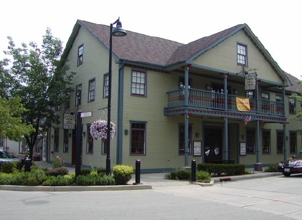

Property Detail
20 Kansas St
Chicago-Naperville-Elgin, IL-IN
Original Town Of Frankport
19-09-28-207-004
THE E 1/2 OF LOT 3, ALL IN BLK 2 IN THE ORIGINAL TOWN OF FRANKFORT, BEING A SUB OF PRT OF THE E1/2 OF THE NE1/4 OF SEC 28, T3
Commercialacreage
Will
X
Illinois
17197C0326G
3
2024
0.02 AC
2024
Joliet/Central Will
883504
Chicago
NEARBY LISTINGS FOR SALE OR LEASE
DEMOGRAPHICS near 20 Kansas St
1 mile
3 mile
5 mile
2024 Total Population
4,860
41,854
93,928
2029 Population
4,866
41,984
93,560
Pop Growth 2024-2029
+ 0.12%
+ 0.31%
(0.39%)
Average Age
47
41
42
2024 Total Households
1,864
14,271
32,815
HH Growth 2024-2029
+ 0.11%
+ 0.20%
(0.57%)
Median Household Inc
$116,158
$124,800
$118,602
Avg Household Size
2.60
2.90
2.80
2024 Avg HH Vehicles
2.00
2.00
2.00
Median Home Value
$374,654
$373,741
$340,944
Median Year Built
1992
1995
1995
Nearby Places
Map Layers
Map Styles
 Street
 Aerial
Transit
 Traffic
 Biking
Places
Listings with unknown addresses are not visible on the map
- Restaurants
- Banks
- Shops
- Fitness
- Groceries
PUBLIC TRANSPORTATION
COMMUTER RAIL
Drive
Walk
Distance
10 min
4.0 mi
Mokena/Front Street Station (Rock Island District Line - Northeast Illinois Regional Commuter Railroad (Metra))
Drive
Walk
Distance
Mokena/Front Street Station (Rock Island District Line - Northeast Illinois Regional Commuter Railroad (Metra))
10 min
4.9 mi
AIRPORT
Chicago Midway International
Drive
Walk
Distance
Chicago Midway International
42 min
25.6 mi
Chicago O'Hare International
Drive
Walk
Distance
Chicago O'Hare International
62 min
36.1 mi
Nearby Properties
Address
Land Use
TOTAL SIZE
Lot Size
Zoning
Address
Land Use
TOTAL SIZE
Lot Size
Zoning
11.40 AC
Address
Land Use
TOTAL SIZE
Lot Size
Zoning
570,796 SF
39.64 AC
Address
Land Use
TOTAL SIZE
Lot Size
Zoning
17.19 AC
Address
Land Use
TOTAL SIZE
Lot Size
Zoning
103,663 SF
13.06 AC
Address
Land Use
TOTAL SIZE
Lot Size
Zoning
209,485 SF
9.79 AC
Address
Land Use
TOTAL SIZE
Lot Size
Zoning
3.73 AC
Address
Land Use
TOTAL SIZE
Lot Size
Zoning
85,037 SF
8.21 AC
Address
Land Use
TOTAL SIZE
Lot Size
Zoning
126,480 SF
10.58 AC
Address
Land Use
TOTAL SIZE
Lot Size
Zoning
26,240 SF
2.89 AC
Address
Land Use
TOTAL SIZE
Lot Size
Zoning
97,318 SF
9.80 AC
Address
Land Use
TOTAL SIZE
Lot Size
Zoning
4.62 AC
Address
Land Use
TOTAL SIZE
Lot Size
Zoning
Address
Land Use
TOTAL SIZE
Lot Size
Zoning
2.06 AC
Address
Land Use
TOTAL SIZE
Lot Size
Zoning
107,631 SF
6.82 AC
Address
Land Use
TOTAL SIZE
Lot Size
Zoning
18,824 SF
9.56 AC
Address
Land Use
TOTAL SIZE
Lot Size
Zoning
Address
Land Use
TOTAL SIZE
Lot Size
Zoning
74,045 SF
4.70 AC
Address
Land Use
TOTAL SIZE
Lot Size
Zoning
18.65 AC
Address
Land Use
TOTAL SIZE
Lot Size
Zoning
8,192 SF
1.34 AC
Address
Land Use
TOTAL SIZE
Lot Size
Zoning
19,238 SF
2.50 AC
Address
Land Use
TOTAL SIZE
Lot Size
Zoning
1.29 AC
Address
Land Use
TOTAL SIZE
Lot Size
Zoning
3.66 AC
Address
Land Use
TOTAL SIZE
Lot Size
Zoning
87,360 SF
9.53 AC
Address
Land Use
TOTAL SIZE
Lot Size
Zoning
Address
Land Use
TOTAL SIZE
Lot Size
Zoning
50,821 SF
2.96 AC
Address
Land Use
TOTAL SIZE
Lot Size
Zoning
26.14 AC
Address
Land Use
TOTAL SIZE
Lot Size
Zoning
45,470 SF
3.13 AC
Address
Land Use
TOTAL SIZE
Lot Size
Zoning
27,472 SF
3.78 AC
Address
Land Use
TOTAL SIZE
Lot Size
Zoning
51,900 SF
4.12 AC
Address
Land Use
TOTAL SIZE
Lot Size
Zoning
28,848 SF
3.29 AC
The World's #1 Commercial Real Estate Marketplace
Connect with us
© 2026 CoStar Group
The information above has been obtained from sources believed reliable. While we do not doubt its accuracy we have not verified it and make no guarantee, warranty or representation about it. It is your responsibility to independently confirm its accuracy and completeness. Any projections, opinions, assumptions, or estimates used are for example only and do not represent the current or future performance of the property. The value of this transaction to you depends on tax and other factors which should be evaluated by your tax, financial, and legal advisors. You and your advisors should conduct a careful, independent investigation of the property to determine to your satisfaction the suitability of the property for your needs.