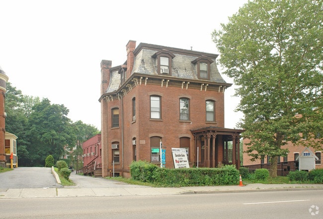
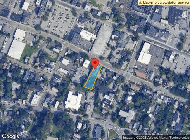
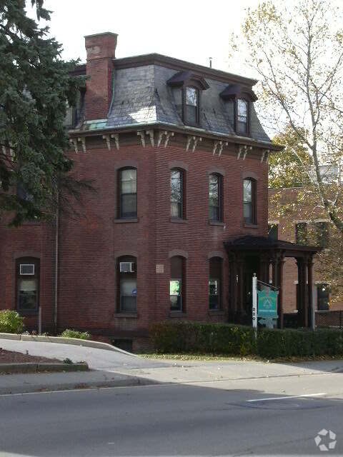
Property Record
220 Church St, Poughkeepsie, NY 12601
Property Detail
220 Church St
131300-6161-21-120964-0000
.39 AC 1730 0699 1580 0216
Commercialnec
Dutchess
X
New York
36027C0358E
120
2025
0.39 AC
2024
Downtown Poughkeepsie
220801
Westchester/So Connecticut
11,424 SF
Kiryas Joel-Poughkeepsie-Newburgh, NY
NEARBY LISTINGS FOR SALE OR LEASE
DEMOGRAPHICS near 220 Church St
1 mile
3 mile
5 mile
2024 Total Population
23,702
65,636
98,669
2029 Population
23,564
65,717
98,755
Pop Growth 2024-2029
(0.58%)
+ 0.12%
+ 0.09%
Average Age
39
39
40
2024 Total Households
9,817
25,094
36,849
HH Growth 2024-2029
(0.44%)
+ 0.24%
+ 0.15%
Median Household Inc
$43,434
$61,485
$74,294
Avg Household Size
2.20
2.20
2.40
2024 Avg HH Vehicles
1.00
1.00
2.00
Median Home Value
$222,171
$258,696
$291,780
Median Year Built
1948
1963
1965
Nearby Places
Map Layers
Map Styles
 Street
 Aerial
Transit
 Traffic
 Biking
Places
Listings with unknown addresses are not visible on the map
- Restaurants
- Banks
- Shops
- Fitness
- Groceries
PUBLIC TRANSPORTATION
COMMUTER RAIL
New Hamburg Station (Hudson Line - Metro-North Commuter Railroad Company (Metro-North))
Drive
Walk
Distance
New Hamburg Station (Hudson Line - Metro-North Commuter Railroad Company (Metro-North))
18 min
9.7 mi
AIRPORT
New York Stewart International
Drive
Walk
Distance
New York Stewart International
40 min
24.7 mi
Freight Ports
Port of New Haven
Drive
Walk
Distance
Port of New Haven
120 min
78.0 mi
Nearby Properties
Address
Land Use
TOTAL SIZE
Lot Size
Zoning
Address
Land Use
TOTAL SIZE
Lot Size
Zoning
640,854 SF
21.22 AC
H-M
Address
Land Use
TOTAL SIZE
Lot Size
Zoning
1,279,884 SF
255.89 AC
IN
Address
Land Use
TOTAL SIZE
Lot Size
Zoning
539,228 SF
62.57 AC
IN
Address
Land Use
TOTAL SIZE
Lot Size
Zoning
314,927 SF
24.59 AC
IN
Address
Land Use
TOTAL SIZE
Lot Size
Zoning
4.99 AC
R2A
Address
Land Use
TOTAL SIZE
Lot Size
Zoning
488,904 SF
12.90 AC
R-3
Address
Land Use
TOTAL SIZE
Lot Size
Zoning
246,913 SF
43.93 AC
IN
Address
Land Use
TOTAL SIZE
Lot Size
Zoning
181,295 SF
20.48 AC
IN
Address
Land Use
TOTAL SIZE
Lot Size
Zoning
127,976 SF
6.57 AC
OR
Address
Land Use
TOTAL SIZE
Lot Size
Zoning
3 AC
R-D
Address
Land Use
TOTAL SIZE
Lot Size
Zoning
4.49 AC
IH
Address
Land Use
TOTAL SIZE
Lot Size
Zoning
2.11 AC
IN
Address
Land Use
TOTAL SIZE
Lot Size
Zoning
39.21 AC
R-1
Address
Land Use
TOTAL SIZE
Lot Size
Zoning
108,096 SF
2.50 AC
C-2
Address
Land Use
TOTAL SIZE
Lot Size
Zoning
105,762 SF
2.41 AC
H-M
Address
Land Use
TOTAL SIZE
Lot Size
Zoning
12,638 SF
159.73 AC
R2A
Address
Land Use
TOTAL SIZE
Lot Size
Zoning
5.29 AC
I-2
Address
Land Use
TOTAL SIZE
Lot Size
Zoning
17,306 SF
87.01 AC
RMH
Address
Land Use
TOTAL SIZE
Lot Size
Zoning
4 AC
R-1
Address
Land Use
TOTAL SIZE
Lot Size
Zoning
296,400 SF
0.66 AC
C-2
Address
Land Use
TOTAL SIZE
Lot Size
Zoning
218,118 SF
13.15 AC
FC
Address
Land Use
TOTAL SIZE
Lot Size
Zoning
49,282 SF
467.80 AC
RA
Address
Land Use
TOTAL SIZE
Lot Size
Zoning
102,798 SF
16.71 AC
IN
Address
Land Use
TOTAL SIZE
Lot Size
Zoning
167,456 SF
18.50 AC
RM
Address
Land Use
TOTAL SIZE
Lot Size
Zoning
119,832 SF
18.20 AC
RM
Address
Land Use
TOTAL SIZE
Lot Size
Zoning
2.53 AC
R-D
Address
Land Use
TOTAL SIZE
Lot Size
Zoning
23,044 SF
12.60 AC
R-5
Address
Land Use
TOTAL SIZE
Lot Size
Zoning
103,108 SF
24.31 AC
HRDD
Address
Land Use
TOTAL SIZE
Lot Size
Zoning
126,616 SF
25.57 AC
R20
Address
Land Use
TOTAL SIZE
Lot Size
Zoning
82,739 SF
6.16 AC
IN
The World's #1 Commercial Real Estate Marketplace
Connect with us
© 2026 CoStar Group
The information above has been obtained from sources believed reliable. While we do not doubt its accuracy we have not verified it and make no guarantee, warranty or representation about it. It is your responsibility to independently confirm its accuracy and completeness. Any projections, opinions, assumptions, or estimates used are for example only and do not represent the current or future performance of the property. The value of this transaction to you depends on tax and other factors which should be evaluated by your tax, financial, and legal advisors. You and your advisors should conduct a careful, independent investigation of the property to determine to your satisfaction the suitability of the property for your needs.