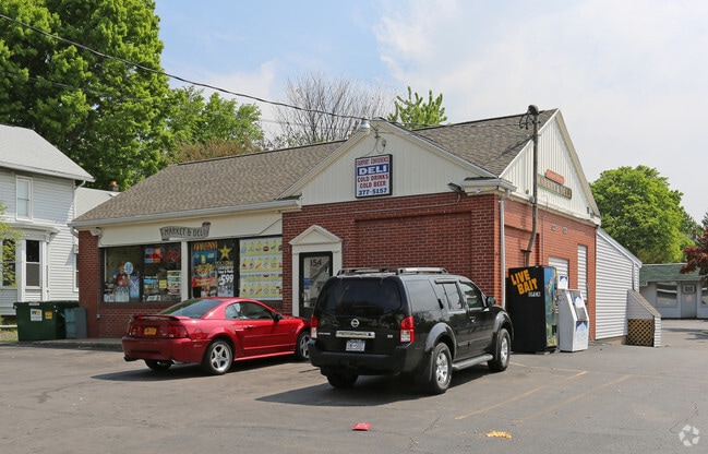
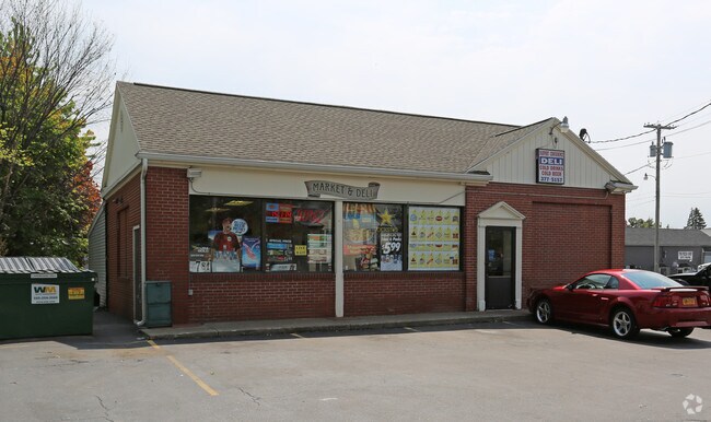
Property Record
154 N Main St, Fairport, NY 14450

Property Detail
154 N Main St
264403-153-090-0002-002-000
LOT 41 TWP 12 RNG 4
Storesoffices
Monroe
B-1
New York
B and X Area of moderate flood hazard, usually the area between the limits of the 100-year and 500-year floods.
2.000
2025
0.22 AC
2024
Southeast
011800
Rochester
2,115 SF
Rochester, NY
NEARBY LISTINGS FOR SALE OR LEASE
DEMOGRAPHICS near 154 N Main St
1 mile
3 mile
5 mile
2024 Total Population
9,512
57,848
101,354
2029 Population
9,400
57,344
100,709
Pop Growth 2024-2029
(1.18%)
(0.87%)
(0.64%)
Average Age
45
44
44
2024 Total Households
4,414
24,670
41,460
HH Growth 2024-2029
(1.31%)
(0.95%)
(0.70%)
Median Household Inc
$85,727
$95,734
$105,538
Avg Household Size
2.10
2.30
2.30
2024 Avg HH Vehicles
2.00
2.00
2.00
Median Home Value
$285,777
$273,932
$294,656
Median Year Built
1973
1973
1973
Nearby Places
Map Layers
Map Styles
 Street
 Aerial
Transit
 Traffic
 Biking
Places
Listings with unknown addresses are not visible on the map
- Restaurants
- Banks
- Shops
- Fitness
- Groceries
PUBLIC TRANSPORTATION
AIRPORT
Frederick Douglass/Greater Rochester International
Drive
Walk
Distance
Frederick Douglass/Greater Rochester International
28 min
14.9 mi
Nearby Properties
Address
Land Use
TOTAL SIZE
Lot Size
Zoning
Address
Land Use
TOTAL SIZE
Lot Size
Zoning
640 SF
84.10 AC
RA-2
Address
Land Use
TOTAL SIZE
Lot Size
Zoning
295,482 SF
83.23 AC
RES B
Address
Land Use
TOTAL SIZE
Lot Size
Zoning
408,790 SF
31.90 AC
02 - SINGL
Address
Land Use
TOTAL SIZE
Lot Size
Zoning
3,752 SF
36.50 AC
MR
Address
Land Use
TOTAL SIZE
Lot Size
Zoning
146,539 SF
18.59 AC
RES A
Address
Land Use
TOTAL SIZE
Lot Size
Zoning
251,359 SF
46.83 AC
GB
Address
Land Use
TOTAL SIZE
Lot Size
Zoning
2,902 SF
127.70 AC
CEMETERY
Address
Land Use
TOTAL SIZE
Lot Size
Zoning
364,800 SF
28.40 AC
R-1-15
Address
Land Use
TOTAL SIZE
Lot Size
Zoning
65,750 SF
42.60 AC
APT
Address
Land Use
TOTAL SIZE
Lot Size
Zoning
193,120 SF
10.83 AC
INDUSTRIAL
Address
Land Use
TOTAL SIZE
Lot Size
Zoning
105,768 SF
51.10 AC
R-B
Address
Land Use
TOTAL SIZE
Lot Size
Zoning
64,733 SF
10.53 AC
GB
Address
Land Use
TOTAL SIZE
Lot Size
Zoning
74,490 SF
16.20 AC
MIXED USE
Address
Land Use
TOTAL SIZE
Lot Size
Zoning
88,859 SF
82.38 AC
RES B
Address
Land Use
TOTAL SIZE
Lot Size
Zoning
90,684 SF
20.51 AC
LI
Address
Land Use
TOTAL SIZE
Lot Size
Zoning
196,411 SF
23.40 AC
COMMERCIAL
Address
Land Use
TOTAL SIZE
Lot Size
Zoning
4,210 SF
14.85 AC
PDD
Address
Land Use
TOTAL SIZE
Lot Size
Zoning
7,282 SF
24.04 AC
APT
Address
Land Use
TOTAL SIZE
Lot Size
Zoning
114,692 SF
27.10 AC
RES B
Address
Land Use
TOTAL SIZE
Lot Size
Zoning
48,582 SF
18.08 AC
APT
Address
Land Use
TOTAL SIZE
Lot Size
Zoning
50,387 SF
4.10 AC
02 - SINGL
Address
Land Use
TOTAL SIZE
Lot Size
Zoning
95,800 SF
7.26 AC
MR
Address
Land Use
TOTAL SIZE
Lot Size
Zoning
6,768 SF
14.32 AC
APT
Address
Land Use
TOTAL SIZE
Lot Size
Zoning
11,630 SF
15.80 AC
APT
Address
Land Use
TOTAL SIZE
Lot Size
Zoning
122,000 SF
11.39 AC
COMMERCIAL
Address
Land Use
TOTAL SIZE
Lot Size
Zoning
130,674 SF
42 AC
RES B
Address
Land Use
TOTAL SIZE
Lot Size
Zoning
86,200 SF
4.76 AC
PD
Address
Land Use
TOTAL SIZE
Lot Size
Zoning
123,630 SF
11.72 AC
GB
Address
Land Use
TOTAL SIZE
Lot Size
Zoning
75,677 SF
47.69 AC
RES B
Address
Land Use
TOTAL SIZE
Lot Size
Zoning
85,838 SF
3.70 AC
R-C
The World's #1 Commercial Real Estate Marketplace
Connect with us
© 2026 CoStar Group
The information above has been obtained from sources believed reliable. While we do not doubt its accuracy we have not verified it and make no guarantee, warranty or representation about it. It is your responsibility to independently confirm its accuracy and completeness. Any projections, opinions, assumptions, or estimates used are for example only and do not represent the current or future performance of the property. The value of this transaction to you depends on tax and other factors which should be evaluated by your tax, financial, and legal advisors. You and your advisors should conduct a careful, independent investigation of the property to determine to your satisfaction the suitability of the property for your needs.