Property Record
945 Bethlehem Dr, Bethlehem, PA 18017
NEARBY LISTINGS FOR SALE OR LEASE
Property Detail
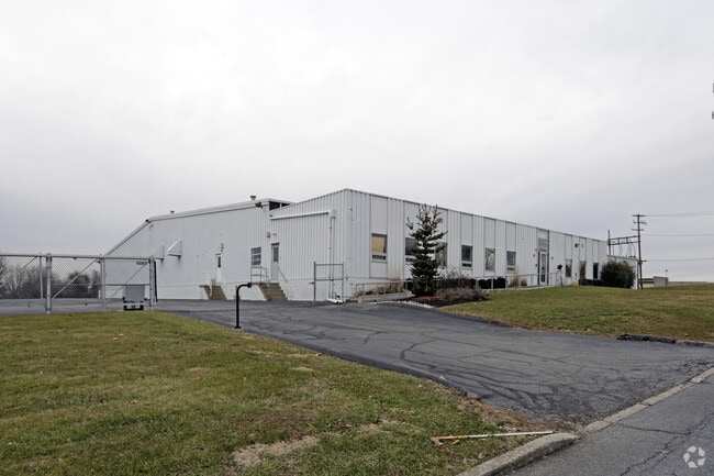
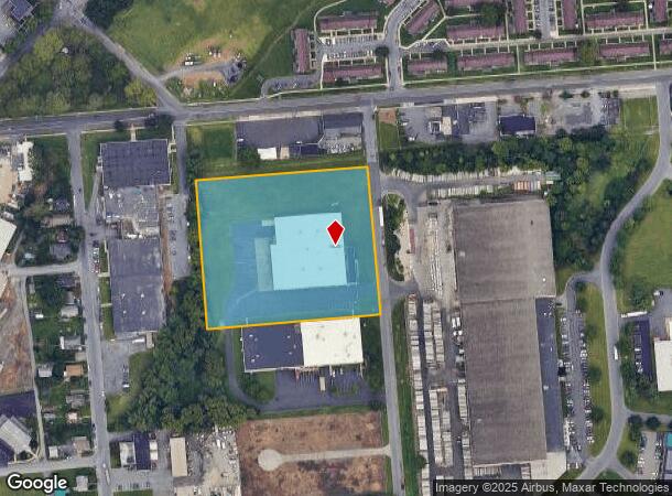
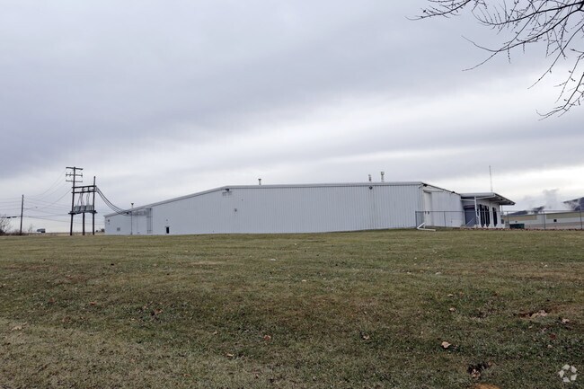
945 Bethlehem Dr
N7-5-1C-0204
#1 Quarry Industrial Sites
Manufacturinglight
Northampton
X
Pennsylvania
42095C0263E
4.31 AC
2025
Lehigh Valley
2025
Philadelphia
010500
Allentown-Bethlehem-Easton, PA-NJ
37,440 SF
DEMOGRAPHICS near 945 Bethlehem Dr
1 Mile
3 Mile
5 Mile
2024 Total Population
16,116
94,780
161,592
2029 Population
16,091
94,983
162,336
Pop Growth 2024-2029
(0.16%)
+ 0.21%
+ 0.46%
Average Age
40
40
41
2024 Total Households
6,662
36,767
62,856
HH Growth 2024-2029
+ 0.03%
+ 0.29%
+ 0.53%
Median Household Inc
$66,569
$67,020
$71,003
Avg Household Size
2.40
2.30
2.40
2024 Avg HH Vehicles
2.00
2.00
2.00
Median Home Value
$184,657
$227,707
$246,411
Median Year Built
1952
1957
1964
Nearby Places
Map Layers
Map Styles
 Street
 Aerial
- Restaurants
- Banks
- Shops
- Fitness
- Groceries
PUBLIC TRANSPORTATION
AIRPORT
Lehigh Valley International
DRIVE
WALK
Distance
Lehigh Valley International
14 min
6.5 mi
Freight Ports
Port of Philadelphia
DRIVE
WALK
Distance
Port of Philadelphia
88 min
53.6 mi
Nearby Properties
Address
Land Use
TOTAL SIZE
Lot Size
Zoning
Address
Land Use
TOTAL SIZE
Lot Size
Zoning
541,843 SF
35.82 AC
INST
Address
Land Use
TOTAL SIZE
Lot Size
Zoning
425,507 SF
52.58 AC
HI
Address
Land Use
TOTAL SIZE
Lot Size
Zoning
649,498 SF
22.51 AC
I
Address
Land Use
TOTAL SIZE
Lot Size
Zoning
184,739 SF
6.75 AC
I
Address
Land Use
TOTAL SIZE
Lot Size
Zoning
29,982 SF
14.39 AC
RT
Address
Land Use
TOTAL SIZE
Lot Size
Zoning
1,197,396 SF
57.03 AC
HI
Address
Land Use
TOTAL SIZE
Lot Size
Zoning
104,379 SF
21.57 AC
CS
Address
Land Use
TOTAL SIZE
Lot Size
Zoning
12,838 SF
36.50 AC
IP
Address
Land Use
TOTAL SIZE
Lot Size
Zoning
1,200,000 SF
107.27 AC
HI
Address
Land Use
TOTAL SIZE
Lot Size
Zoning
1,710,800 SF
68.08 AC
HI
Address
Land Use
TOTAL SIZE
Lot Size
Zoning
26,653 SF
13.51 AC
HI
Address
Land Use
TOTAL SIZE
Lot Size
Zoning
11,856 SF
454.48 AC
CM
Address
Land Use
TOTAL SIZE
Lot Size
Zoning
800,280 SF
18.20 AC
HI
Address
Land Use
TOTAL SIZE
Lot Size
Zoning
332,641 SF
2.27 AC
HI
Address
Land Use
TOTAL SIZE
Lot Size
Zoning
800,250 SF
40.07 AC
HI
Address
Land Use
TOTAL SIZE
Lot Size
Zoning
80,277 SF
3.23 AC
MHDR
Address
Land Use
TOTAL SIZE
Lot Size
Zoning
676,788 SF
39.39 AC
HI
Address
Land Use
TOTAL SIZE
Lot Size
Zoning
3,400 SF
65.07 AC
RM
Address
Land Use
TOTAL SIZE
Lot Size
Zoning
10,572 SF
54.17 AC
IP
Address
Land Use
TOTAL SIZE
Lot Size
Zoning
230,780 SF
14.48 AC
I
Address
Land Use
TOTAL SIZE
Lot Size
Zoning
421,883 SF
34.66 AC
HI
Address
Land Use
TOTAL SIZE
Lot Size
Zoning
347,514 SF
10.27 AC
RM
Address
Land Use
TOTAL SIZE
Lot Size
Zoning
2,726 SF
13.40 AC
RG
Address
Land Use
TOTAL SIZE
Lot Size
Zoning
168,984 SF
20.31 AC
I
Address
Land Use
TOTAL SIZE
Lot Size
Zoning
31,442 SF
9.87 AC
IP
Address
Land Use
TOTAL SIZE
Lot Size
Zoning
319,788 SF
60 AC
IN
Address
Land Use
TOTAL SIZE
Lot Size
Zoning
63,711 SF
31.56 AC
RR
Address
Land Use
TOTAL SIZE
Lot Size
Zoning
24,354 SF
11.16 AC
HI
Address
Land Use
TOTAL SIZE
Lot Size
Zoning
50,036 SF
1.03 AC
I
Address
Land Use
TOTAL SIZE
Lot Size
Zoning
103,214 SF
2.55 AC
RT
The World's #1 Commercial Real Estate Marketplace
Connect with us
© 2025 CoStar Group
The information above has been obtained from sources believed reliable. While we do not doubt its accuracy we have not verified it and make no guarantee, warranty or representation about it. It is your responsibility to independently confirm its accuracy and completeness. Any projections, opinions, assumptions, or estimates used are for example only and do not represent the current or future performance of the property. The value of this transaction to you depends on tax and other factors which should be evaluated by your tax, financial, and legal advisors. You and your advisors should conduct a careful, independent investigation of the property to determine to your satisfaction the suitability of the property for your needs.