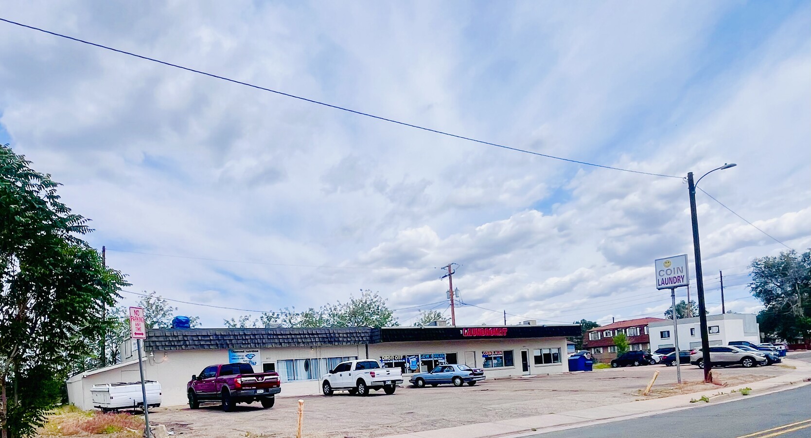
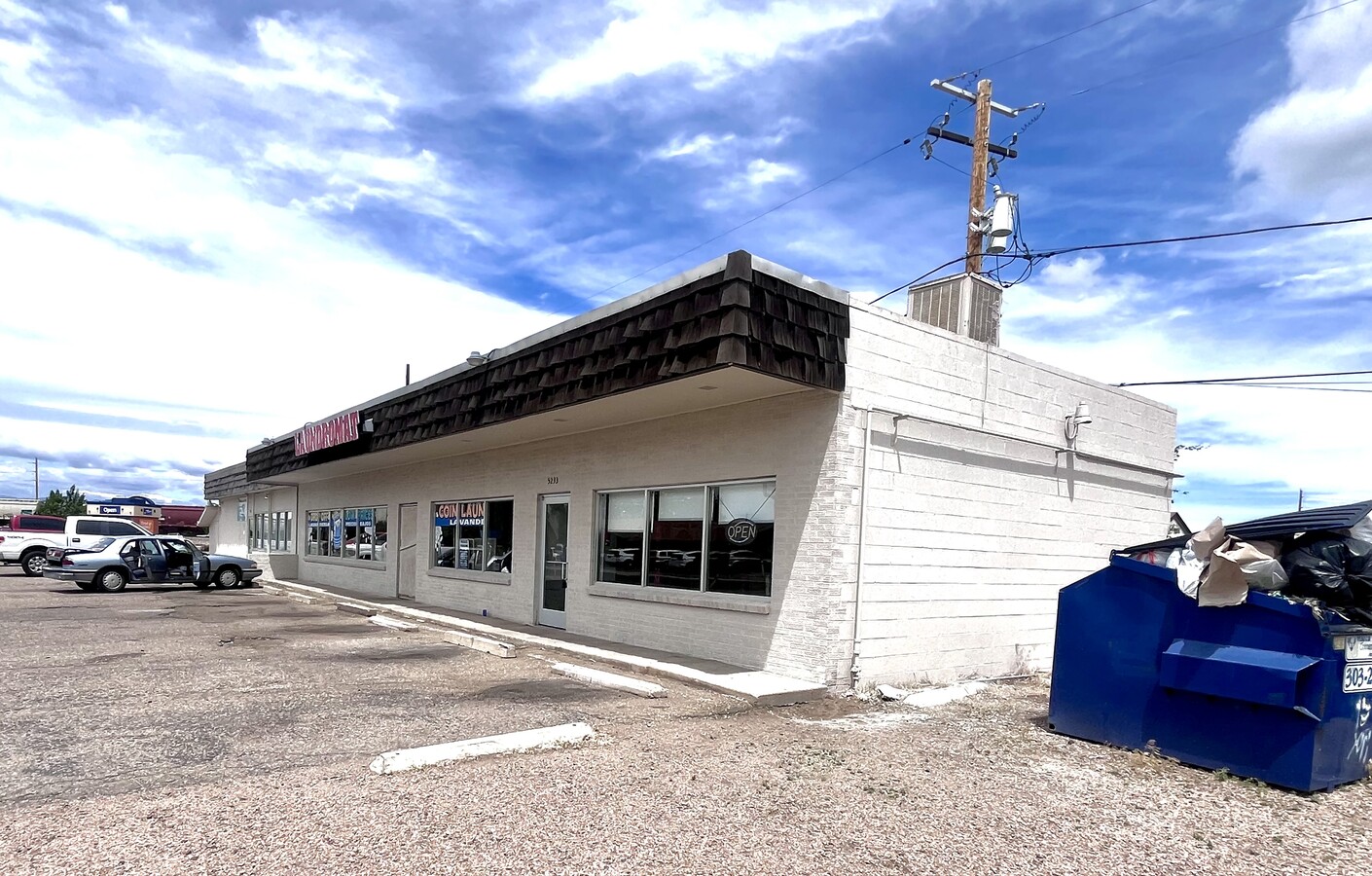
Property Record
5231 E 66Th Way, Commerce City, CO 80022

NEARBY LISTINGS FOR SALE OR LEASE
Property Detail
5231 E 66Th Way
1823-06-4-04-044
Roberts Gardens
Storebuilding
SUB:ROBERTS GARDENS DESC: PT OF TRACT 2 DESC AS FOLS BEG AT THE NE COR OF SD TRACT 2 TH N 90D 00M 00S W ON AN ASSUMED BRNG ALG THE N LN OF SD TRACT 2 A DIST OF 226/30 FT TO THE TRUE POB TH CONT N 90D 00M 00S W 57/65 FT TO A PT TH S 00D 00M 00S E TO T
X
Adams
08005C0025K
Colorado
2023
0.13 AC
2024
Northeast
008705
Denver
1,316 SF
Denver-Aurora-Lakewood, CO
DEMOGRAPHICS near 5231 E 66Th Way
1 Mile
3 Mile
5 Mile
2024 Total Population
12,508
50,791
218,096
2029 Population
12,895
52,112
223,911
Pop Growth 2024-2029
+ 3.09%
+ 2.60%
+ 2.67%
Average Age
35
35
36
2024 Total Households
3,767
16,029
77,104
HH Growth 2024-2029
+ 3.00%
+ 2.53%
+ 2.62%
Median Household Inc
$61,516
$65,787
$78,162
Avg Household Size
3.10
3.00
2.70
2024 Avg HH Vehicles
2.00
2.00
2.00
Median Home Value
$311,508
$337,601
$429,844
Median Year Built
1958
1975
1975
Nearby Places
- Restaurants
- Banks
- Shops
- Fitness
- Groceries
PUBLIC TRANSPORTATION
COMMUTER RAIL
Commerce City - 72Nd Station Track 1 (Union Station to Eastlake & 124th Station - Regional Transportation District)
DRIVE
WALK
Distance
Commerce City - 72Nd Station Track 1 (Union Station to Eastlake & 124th Station - Regional Transportation District)
5 min
2.4 mi
40Th & Colorado Station Track 1 (Union Station to Denver Airport Station - Regional Transportation District)
DRIVE
WALK
Distance
40Th & Colorado Station Track 1 (Union Station to Denver Airport Station - Regional Transportation District)
6 min
3.4 mi
AIRPORT
Denver International
DRIVE
WALK
Distance
Denver International
28 min
21.3 mi
Freight Ports
Tulsa Port Of Catoosa
DRIVE
WALK
Distance
Tulsa Port Of Catoosa
725 min
706.8 mi
SALE & LEASE HISTORY
LISTING DATE
SALE/LEASE

Sep 20, 2024
For Sale
Mar 04, 2021
For Sale
Jul 28, 2021
For Lease
Nearby Properties
Address
Land Use
TOTAL SIZE
Lot Size
Zoning
Address
Land Use
TOTAL SIZE
Lot Size
Zoning
396,741 SF
8.12 AC
A1
Address
Land Use
TOTAL SIZE
Lot Size
Zoning
106,680 SF
17.39 AC
Address
Land Use
TOTAL SIZE
Lot Size
Zoning
17,063 SF
2.01 AC
Address
Land Use
TOTAL SIZE
Lot Size
Zoning
269,025 SF
18.86 AC
M-RX-5
Address
Land Use
TOTAL SIZE
Lot Size
Zoning
649,540 SF
33.65 AC
Address
Land Use
TOTAL SIZE
Lot Size
Zoning
551,915 SF
25.76 AC
Address
Land Use
TOTAL SIZE
Lot Size
Zoning
3,573.98 AC
A3
Address
Land Use
TOTAL SIZE
Lot Size
Zoning
296,000 SF
52.44 AC
A3
Address
Land Use
TOTAL SIZE
Lot Size
Zoning
268,268 SF
29.99 AC
I-B
Address
Land Use
TOTAL SIZE
Lot Size
Zoning
599,680 SF
43.94 AC
Address
Land Use
TOTAL SIZE
Lot Size
Zoning
277,200 SF
16.43 AC
Address
Land Use
TOTAL SIZE
Lot Size
Zoning
419,745 SF
24.75 AC
Address
Land Use
TOTAL SIZE
Lot Size
Zoning
1,048,207 SF
57.91 AC
I-B
Address
Land Use
TOTAL SIZE
Lot Size
Zoning
277,869 SF
12.76 AC
Address
Land Use
TOTAL SIZE
Lot Size
Zoning
374,592 SF
15.23 AC
I-B
Address
Land Use
TOTAL SIZE
Lot Size
Zoning
370,741 SF
19.53 AC
I3
Address
Land Use
TOTAL SIZE
Lot Size
Zoning
617,615 SF
29.43 AC
Address
Land Use
TOTAL SIZE
Lot Size
Zoning
97,626 SF
14.18 AC
Address
Land Use
TOTAL SIZE
Lot Size
Zoning
125,844 SF
7.61 AC
I-B
Address
Land Use
TOTAL SIZE
Lot Size
Zoning
70,692 SF
10.38 AC
M-RX-5
Address
Land Use
TOTAL SIZE
Lot Size
Zoning
219,959 SF
10 AC
Address
Land Use
TOTAL SIZE
Lot Size
Zoning
329,903 SF
21.96 AC
Address
Land Use
TOTAL SIZE
Lot Size
Zoning
195,600 SF
11.18 AC
Address
Land Use
TOTAL SIZE
Lot Size
Zoning
761,622 SF
47.43 AC
I-B
Address
Land Use
TOTAL SIZE
Lot Size
Zoning
312,218 SF
31.14 AC
Address
Land Use
TOTAL SIZE
Lot Size
Zoning
109,372 SF
13.18 AC
Address
Land Use
TOTAL SIZE
Lot Size
Zoning
187,893 SF
6.58 AC
I-B
Address
Land Use
TOTAL SIZE
Lot Size
Zoning
153,300 SF
11.29 AC
Address
Land Use
TOTAL SIZE
Lot Size
Zoning
170,071 SF
6.34 AC
I-B
Address
Land Use
TOTAL SIZE
Lot Size
Zoning
91,711 SF
124.64 AC
The World's #1 Commercial Real Estate Marketplace
Connect with us
© 2025 CoStar Group
The information above has been obtained from sources believed reliable. While we do not doubt its accuracy we have not verified it and make no guarantee, warranty or representation about it. It is your responsibility to independently confirm its accuracy and completeness. Any projections, opinions, assumptions, or estimates used are for example only and do not represent the current or future performance of the property. The value of this transaction to you depends on tax and other factors which should be evaluated by your tax, financial, and legal advisors. You and your advisors should conduct a careful, independent investigation of the property to determine to your satisfaction the suitability of the property for your needs.