Property Record
2829 Lakeland Dr, Flowood, MS 39232


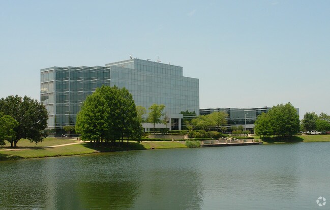
Property Detail
2829 Lakeland Dr
E10L-000002-00020
5.02A IN S2 SE4 S OF HWY 25 DB 499 PG 0550 0012086 DB 499- 499 PG 0607-0614 0012286 DB 500- 500 PG 0047-0062 0012786 DB 500-
Multipleuses
Rankin
AE The base floodplain where base flood elevations are provided. AE Zones are now used on new format FIRMs instead of A1-A30 Zones.
Mississippi
2024
5.02 AC
2025
Brandon/Flowood/Pearl
020304
Jackson
73,795 SF
Jackson, MS
NEARBY LISTINGS FOR SALE OR LEASE
DEMOGRAPHICS near 2829 Lakeland Dr
1 mile
3 mile
5 mile
2025 Total Population
1,222
15,006
83,187
2030 Population
1,231
14,719
81,523
Pop Growth 2025-2030
+ 0.74%
(1.91%)
(2.00%)
Average Age
35
39
39
2025 Total Households
758
6,457
36,437
HH Growth 2025-2030
+ 0.79%
(1.73%)
(2.20%)
Median Household Inc
$38,201
$80,758
$56,144
Avg Household Size
1.60
2.20
2.20
2025 Avg HH Vehicles
2.00
2.00
2.00
Median Home Value
$179,999
$271,653
$207,769
Median Year Built
1987
1977
1975
Nearby Places
Map Layers
Map Styles
 Street
 Aerial
Transit
 Traffic
 Biking
Places
Listings with unknown addresses are not visible on the map
- Restaurants
- Banks
- Shops
- Fitness
- Groceries
PUBLIC TRANSPORTATION
COMMUTER RAIL
Jackson (City of New Orleans - Amtrak)
Drive
Walk
Distance
Jackson (City of New Orleans - Amtrak)
10 min
6.9 mi
AIRPORT
Jackson-Medgar Wiley Evers International
Drive
Walk
Distance
Jackson-Medgar Wiley Evers International
14 min
6.6 mi
Freight Ports
Port of Greater Baton Rouge
Drive
Walk
Distance
Port of Greater Baton Rouge
205 min
183.1 mi
Nearby Properties
Address
Land Use
TOTAL SIZE
Lot Size
Zoning
Address
Land Use
TOTAL SIZE
Lot Size
Zoning
14,236 SF
7.38 AC
Address
Land Use
TOTAL SIZE
Lot Size
Zoning
48,134 SF
6.62 AC
Address
Land Use
TOTAL SIZE
Lot Size
Zoning
Address
Land Use
TOTAL SIZE
Lot Size
Zoning
117,983 SF
7.01 AC
Address
Land Use
TOTAL SIZE
Lot Size
Zoning
19,639 SF
4.07 AC
Address
Land Use
TOTAL SIZE
Lot Size
Zoning
33,960 SF
19,602 AC
Address
Land Use
TOTAL SIZE
Lot Size
Zoning
236.80 AC
Address
Land Use
TOTAL SIZE
Lot Size
Zoning
136,355 SF
26.65 AC
Address
Land Use
TOTAL SIZE
Lot Size
Zoning
121,590 SF
Address
Land Use
TOTAL SIZE
Lot Size
Zoning
6,639 SF
35.63 AC
Address
Land Use
TOTAL SIZE
Lot Size
Zoning
125,008 SF
18 AC
Address
Land Use
TOTAL SIZE
Lot Size
Zoning
109,720 SF
8.50 AC
Address
Land Use
TOTAL SIZE
Lot Size
Zoning
59,840 SF
2.72 AC
Address
Land Use
TOTAL SIZE
Lot Size
Zoning
30,925 SF
38.73 AC
Address
Land Use
TOTAL SIZE
Lot Size
Zoning
64,949 SF
3 AC
Address
Land Use
TOTAL SIZE
Lot Size
Zoning
81,649 SF
5.60 AC
Address
Land Use
TOTAL SIZE
Lot Size
Zoning
15,115 SF
2.48 AC
Address
Land Use
TOTAL SIZE
Lot Size
Zoning
1,787 SF
16.82 AC
Address
Land Use
TOTAL SIZE
Lot Size
Zoning
40.72 AC
Address
Land Use
TOTAL SIZE
Lot Size
Zoning
74,153 SF
4.52 AC
Address
Land Use
TOTAL SIZE
Lot Size
Zoning
5,354 SF
0.68 AC
Address
Land Use
TOTAL SIZE
Lot Size
Zoning
66,102 SF
6.21 AC
Address
Land Use
TOTAL SIZE
Lot Size
Zoning
93,897 SF
7.29 AC
Address
Land Use
TOTAL SIZE
Lot Size
Zoning
230,401 SF
643,381.54 AC
Address
Land Use
TOTAL SIZE
Lot Size
Zoning
90,610 SF
Address
Land Use
TOTAL SIZE
Lot Size
Zoning
2,457 SF
11.42 AC
Address
Land Use
TOTAL SIZE
Lot Size
Zoning
23,589 SF
110,808.08 AC
Address
Land Use
TOTAL SIZE
Lot Size
Zoning
11,578 SF
0.89 AC
Address
Land Use
TOTAL SIZE
Lot Size
Zoning
15,645 SF
1.10 AC
The World's #1 Commercial Real Estate Marketplace
Connect with us
© 2026 CoStar Group
The information above has been obtained from sources believed reliable. While we do not doubt its accuracy we have not verified it and make no guarantee, warranty or representation about it. It is your responsibility to independently confirm its accuracy and completeness. Any projections, opinions, assumptions, or estimates used are for example only and do not represent the current or future performance of the property. The value of this transaction to you depends on tax and other factors which should be evaluated by your tax, financial, and legal advisors. You and your advisors should conduct a careful, independent investigation of the property to determine to your satisfaction the suitability of the property for your needs.