Property Record
4780 Highway 5, Douglasville, GA 30135
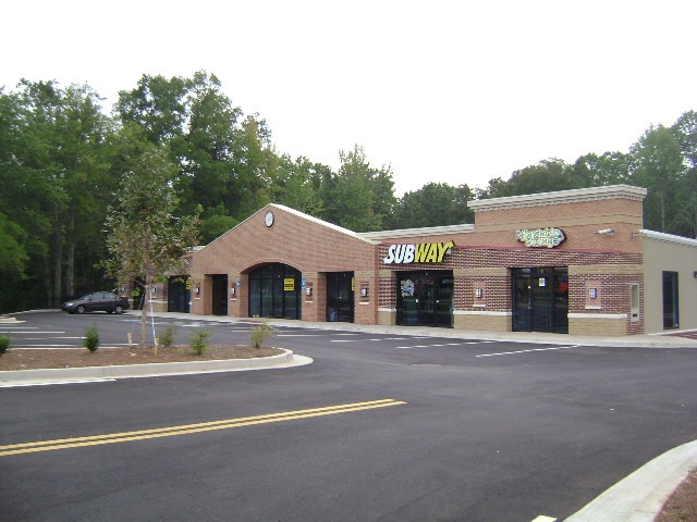


Property Detail
4780 Highway 5
9025-00-5-0-002
2 BLDGS/2.793 AC, PT OF LOT 4, C. P. STOVALL
Regionalshoppingcenterormallwithanchorstore
DOUGLAS
C-G
Georgia
B and X Area of moderate flood hazard, usually the area between the limits of the 100-year and 500-year floods.
4
2025
2.79 AC
2025
Villa Rica/W Outlying
080506
Atlanta
30,850 SF
Atlanta-Sandy Springs-Roswell, GA
NEARBY LISTINGS FOR SALE OR LEASE
-
-
View all Douglasville listings for sale on LoopNet.com
DEMOGRAPHICS near 4780 Highway 5
1 mile
3 mile
5 mile
2025 Total Population
2,880
19,060
43,795
2030 Population
3,006
19,888
45,788
Pop Growth 2025-2030
+ 4.38%
+ 4.34%
+ 4.55%
Average Age
41
40
39
2025 Total Households
978
6,455
15,337
HH Growth 2025-2030
+ 4.50%
+ 4.45%
+ 4.60%
Median Household Inc
$86,033
$87,798
$90,020
Avg Household Size
2.90
2.90
2.80
2025 Avg HH Vehicles
2.00
2.00
2.00
Median Home Value
$329,529
$309,566
$331,174
Median Year Built
1980
1985
1990
Nearby Places
Map Layers
Map Styles
 Street
 Aerial
Transit
 Traffic
 Biking
Places
Listings with unknown addresses are not visible on the map
- Restaurants
- Banks
- Shops
- Fitness
- Groceries
PUBLIC TRANSPORTATION
AIRPORT
Hartsfield - Jackson Atlanta International
Drive
Walk
Distance
Hartsfield - Jackson Atlanta International
49 min
36.2 mi
Freight Ports
Georgia Ports - Savannah
Drive
Walk
Distance
Georgia Ports - Savannah
312 min
275.5 mi
Nearby Properties
Address
Land Use
TOTAL SIZE
Lot Size
Zoning
Address
Land Use
TOTAL SIZE
Lot Size
Zoning
3,500 SF
51.89 AC
DCD
Address
Land Use
TOTAL SIZE
Lot Size
Zoning
46,996 SF
25.77 AC
R-LD
Address
Land Use
TOTAL SIZE
Lot Size
Zoning
71,186 SF
10.15 AC
C-G
Address
Land Use
TOTAL SIZE
Lot Size
Zoning
10,898 SF
10.91 AC
R-A
Address
Land Use
TOTAL SIZE
Lot Size
Zoning
13,416 SF
2.19 AC
Address
Land Use
TOTAL SIZE
Lot Size
Zoning
9,211 SF
18.32 AC
R-LD
Address
Land Use
TOTAL SIZE
Lot Size
Zoning
4,968 SF
1.50 AC
B-COMM
Address
Land Use
TOTAL SIZE
Lot Size
Zoning
11,180 SF
1.92 AC
C-H
Address
Land Use
TOTAL SIZE
Lot Size
Zoning
16,250 SF
1.17 AC
C-H
Address
Land Use
TOTAL SIZE
Lot Size
Zoning
11,121 SF
2.11 AC
C-G
Address
Land Use
TOTAL SIZE
Lot Size
Zoning
7,308 SF
30.37 AC
R-A
Address
Land Use
TOTAL SIZE
Lot Size
Zoning
6,127 SF
81.37 AC
R-LD
Address
Land Use
TOTAL SIZE
Lot Size
Zoning
5,155 SF
72.15 AC
R-LD
Address
Land Use
TOTAL SIZE
Lot Size
Zoning
8,213 SF
15.50 AC
R-A
Address
Land Use
TOTAL SIZE
Lot Size
Zoning
5,207 SF
74.70 AC
R-A
Address
Land Use
TOTAL SIZE
Lot Size
Zoning
6,224 SF
0.66 AC
C-N
Address
Land Use
TOTAL SIZE
Lot Size
Zoning
6,766 SF
24.92 AC
R-A
Address
Land Use
TOTAL SIZE
Lot Size
Zoning
8,400 SF
1.52 AC
Address
Land Use
TOTAL SIZE
Lot Size
Zoning
6,690 SF
0.51 AC
C-G
Address
Land Use
TOTAL SIZE
Lot Size
Zoning
9,004 SF
26.33 AC
Address
Land Use
TOTAL SIZE
Lot Size
Zoning
5,367 SF
30.48 AC
Address
Land Use
TOTAL SIZE
Lot Size
Zoning
6,992 SF
1 AC
C-G
Address
Land Use
TOTAL SIZE
Lot Size
Zoning
2,907 SF
93.83 AC
R-A
Address
Land Use
TOTAL SIZE
Lot Size
Zoning
2,890 SF
25.26 AC
Address
Land Use
TOTAL SIZE
Lot Size
Zoning
5,151 SF
55.14 AC
R-A
Address
Land Use
TOTAL SIZE
Lot Size
Zoning
19,980 SF
1.35 AC
C-H
Address
Land Use
TOTAL SIZE
Lot Size
Zoning
8,500 SF
1.11 AC
C-N
Address
Land Use
TOTAL SIZE
Lot Size
Zoning
4,808 SF
56.88 AC
R-LD
Address
Land Use
TOTAL SIZE
Lot Size
Zoning
3,274 SF
3.45 AC
C-N
The World's #1 Commercial Real Estate Marketplace
Connect with us
© 2026 CoStar Group
The information above has been obtained from sources believed reliable. While we do not doubt its accuracy we have not verified it and make no guarantee, warranty or representation about it. It is your responsibility to independently confirm its accuracy and completeness. Any projections, opinions, assumptions, or estimates used are for example only and do not represent the current or future performance of the property. The value of this transaction to you depends on tax and other factors which should be evaluated by your tax, financial, and legal advisors. You and your advisors should conduct a careful, independent investigation of the property to determine to your satisfaction the suitability of the property for your needs.