Property Record
701 Route 1, Yarmouth, ME 04096
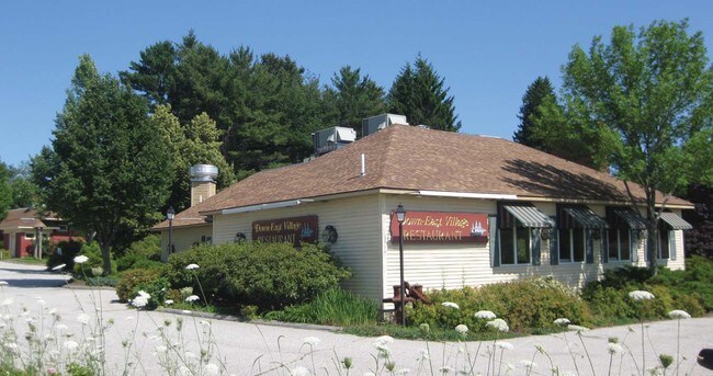


Property Detail
701 Route 1
YMTH-000038-000000-000024
CUMBERLAND
Officebuilding
Maine
CD4-C1
24
AE The base floodplain where base flood elevations are provided. AE Zones are now used on new format FIRMs instead of A1-A30 Zones.
7.10 AC
2025
NE Cumberland County
2025
Portland/South Portland
004402
Portland-South Portland, ME
28,536 SF
NEARBY LISTINGS FOR SALE OR LEASE
DEMOGRAPHICS near 701 Route 1
1 mile
3 mile
5 mile
2025 Total Population
4,998
11,511
22,732
2030 Population
5,089
11,719
23,192
Pop Growth 2025-2030
+ 1.82%
+ 1.81%
+ 2.02%
Average Age
43
44
44
2025 Total Households
2,007
4,497
8,836
HH Growth 2025-2030
+ 1.99%
+ 1.98%
+ 2.20%
Median Household Inc
$109,162
$123,015
$127,793
Avg Household Size
2.40
2.50
2.50
2025 Avg HH Vehicles
2.00
2.00
2.00
Median Home Value
$666,774
$698,781
$685,348
Median Year Built
1973
1976
1976
Nearby Places
Map Layers
Map Styles
 Street
 Aerial
Transit
 Traffic
 Biking
Places
Listings with unknown addresses are not visible on the map
- Restaurants
- Banks
- Shops
- Fitness
- Groceries
PUBLIC TRANSPORTATION
COMMUTER RAIL
Freeport Amtrak Station (Downeaster - Amtrak)
Drive
Walk
Distance
Freeport Amtrak Station (Downeaster - Amtrak)
9 min
5.7 mi
AIRPORT
Portland International Jetport
Drive
Walk
Distance
Portland International Jetport
24 min
16.1 mi
Freight Ports
Portland, ME
Drive
Walk
Distance
Portland, ME
17 min
13.0 mi
Nearby Properties
Address
Land Use
TOTAL SIZE
Lot Size
Zoning
Address
Land Use
TOTAL SIZE
Lot Size
Zoning
Address
Land Use
TOTAL SIZE
Lot Size
Zoning
187,437 SF
62.84 AC
23
Address
Land Use
TOTAL SIZE
Lot Size
Zoning
152,724 SF
46.80 AC
13
Address
Land Use
TOTAL SIZE
Lot Size
Zoning
21.49 AC
13
Address
Land Use
TOTAL SIZE
Lot Size
Zoning
66.50 AC
RR2
Address
Land Use
TOTAL SIZE
Lot Size
Zoning
31.38 AC
CD4-C1
Address
Land Use
TOTAL SIZE
Lot Size
Zoning
83,378 SF
42 AC
13
Address
Land Use
TOTAL SIZE
Lot Size
Zoning
9.69 AC
CD4-C1
Address
Land Use
TOTAL SIZE
Lot Size
Zoning
93,752 SF
10.86 AC
21
Address
Land Use
TOTAL SIZE
Lot Size
Zoning
7.42 AC
17
Address
Land Use
TOTAL SIZE
Lot Size
Zoning
47,488 SF
15.14 AC
CIVIC
Address
Land Use
TOTAL SIZE
Lot Size
Zoning
60,698 SF
11.60 AC
CD4-C2
Address
Land Use
TOTAL SIZE
Lot Size
Zoning
40.37 AC
13
Address
Land Use
TOTAL SIZE
Lot Size
Zoning
49,513 SF
4.05 AC
21
Address
Land Use
TOTAL SIZE
Lot Size
Zoning
17.99 AC
13
Address
Land Use
TOTAL SIZE
Lot Size
Zoning
5.10 AC
24
Address
Land Use
TOTAL SIZE
Lot Size
Zoning
2.10 AC
21
Address
Land Use
TOTAL SIZE
Lot Size
Zoning
31,293 SF
7.20 AC
OC
Address
Land Use
TOTAL SIZE
Lot Size
Zoning
45,879 SF
6.62 AC
CM04
Address
Land Use
TOTAL SIZE
Lot Size
Zoning
62,857 SF
23.10 AC
CM04
Address
Land Use
TOTAL SIZE
Lot Size
Zoning
36,374 SF
5.80 AC
SD1
Address
Land Use
TOTAL SIZE
Lot Size
Zoning
100,815 SF
3 AC
22
Address
Land Use
TOTAL SIZE
Lot Size
Zoning
24,960 SF
2.60 AC
13
Address
Land Use
TOTAL SIZE
Lot Size
Zoning
1.25 AC
CD4-C1
Address
Land Use
TOTAL SIZE
Lot Size
Zoning
23,362 SF
3 AC
13
Address
Land Use
TOTAL SIZE
Lot Size
Zoning
22,871 SF
3.43 AC
21
Address
Land Use
TOTAL SIZE
Lot Size
Zoning
5.52 AC
24
Address
Land Use
TOTAL SIZE
Lot Size
Zoning
19,972 SF
1.87 AC
17
Address
Land Use
TOTAL SIZE
Lot Size
Zoning
12 AC
24
The World's #1 Commercial Real Estate Marketplace
Connect with us
© 2026 CoStar Group
The information above has been obtained from sources believed reliable. While we do not doubt its accuracy we have not verified it and make no guarantee, warranty or representation about it. It is your responsibility to independently confirm its accuracy and completeness. Any projections, opinions, assumptions, or estimates used are for example only and do not represent the current or future performance of the property. The value of this transaction to you depends on tax and other factors which should be evaluated by your tax, financial, and legal advisors. You and your advisors should conduct a careful, independent investigation of the property to determine to your satisfaction the suitability of the property for your needs.