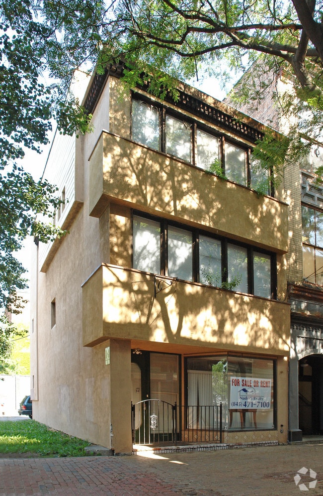
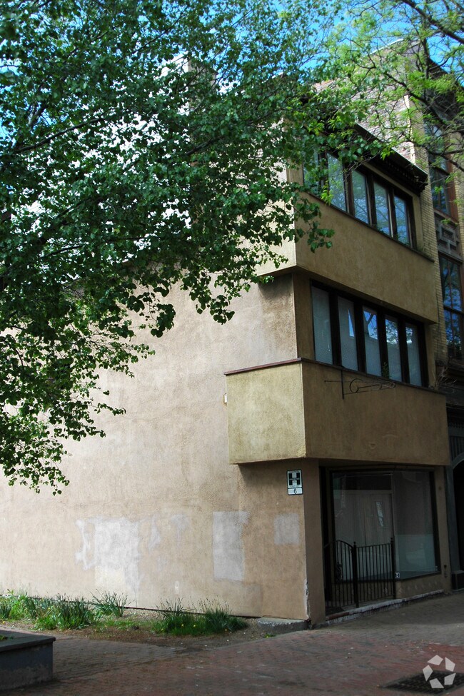
Property Record
6 Liberty St, Poughkeepsie, NY 12601

Property Detail
6 Liberty St
131300-6162-77-073073-0000
0.01 AC (C) 1983 0707 1850 0583
Officebuilding
Dutchess
C-2
New York
B and X Area of moderate flood hazard, usually the area between the limits of the 100-year and 500-year floods.
73
2025
0.01 AC
2024
Fishkill
221100
Westchester/So Connecticut
1,692 SF
Kiryas Joel-Poughkeepsie-Newburgh, NY
NEARBY LISTINGS FOR SALE OR LEASE
DEMOGRAPHICS near 6 Liberty St
1 mile
3 mile
5 mile
2025 Total Population
22,625
65,328
96,959
2030 Population
22,455
65,534
97,244
Pop Growth 2025-2030
(0.75%)
+ 0.32%
+ 0.29%
Average Age
38
39
40
2025 Total Households
9,338
24,768
36,100
HH Growth 2025-2030
(0.54%)
+ 0.41%
+ 0.35%
Median Household Inc
$55,540
$74,449
$84,236
Avg Household Size
2.20
2.20
2.40
2025 Avg HH Vehicles
1.00
1.00
2.00
Median Home Value
$302,421
$319,739
$350,087
Median Year Built
1948
1963
1965
Nearby Places
Map Layers
Map Styles
 Street
 Aerial
Transit
 Traffic
 Biking
Places
Listings with unknown addresses are not visible on the map
- Restaurants
- Banks
- Shops
- Fitness
- Groceries
PUBLIC TRANSPORTATION
TRANSIT/SUBWAY
Poughkeepsie Station (Hudson Line - Metro-North Commuter Railroad Company (Metro-North))
Drive
Walk
Distance
Poughkeepsie Station (Hudson Line - Metro-North Commuter Railroad Company (Metro-North))
3 min
15 min
0.8 mi
AIRPORT
New York Stewart International
Drive
Walk
Distance
New York Stewart International
37 min
24.2 mi
Nearby Properties
Address
Land Use
TOTAL SIZE
Lot Size
Zoning
Address
Land Use
TOTAL SIZE
Lot Size
Zoning
640,854 SF
21.22 AC
H-M
Address
Land Use
TOTAL SIZE
Lot Size
Zoning
1,279,884 SF
255.89 AC
IN
Address
Land Use
TOTAL SIZE
Lot Size
Zoning
539,228 SF
62.57 AC
IN
Address
Land Use
TOTAL SIZE
Lot Size
Zoning
314,927 SF
24.59 AC
IN
Address
Land Use
TOTAL SIZE
Lot Size
Zoning
4.99 AC
R2A
Address
Land Use
TOTAL SIZE
Lot Size
Zoning
488,904 SF
12.90 AC
R-3
Address
Land Use
TOTAL SIZE
Lot Size
Zoning
246,913 SF
43.93 AC
IN
Address
Land Use
TOTAL SIZE
Lot Size
Zoning
181,295 SF
20.48 AC
IN
Address
Land Use
TOTAL SIZE
Lot Size
Zoning
127,976 SF
6.57 AC
OR
Address
Land Use
TOTAL SIZE
Lot Size
Zoning
3 AC
R-D
Address
Land Use
TOTAL SIZE
Lot Size
Zoning
4.49 AC
IH
Address
Land Use
TOTAL SIZE
Lot Size
Zoning
2.11 AC
IN
Address
Land Use
TOTAL SIZE
Lot Size
Zoning
39.21 AC
R-1
Address
Land Use
TOTAL SIZE
Lot Size
Zoning
108,096 SF
2.50 AC
C-2
Address
Land Use
TOTAL SIZE
Lot Size
Zoning
317,644 SF
35.25 AC
CIA
Address
Land Use
TOTAL SIZE
Lot Size
Zoning
105,762 SF
2.41 AC
H-M
Address
Land Use
TOTAL SIZE
Lot Size
Zoning
12,638 SF
159.73 AC
R2A
Address
Land Use
TOTAL SIZE
Lot Size
Zoning
5.29 AC
I-2
Address
Land Use
TOTAL SIZE
Lot Size
Zoning
4 AC
R-1
Address
Land Use
TOTAL SIZE
Lot Size
Zoning
296,400 SF
0.66 AC
C-2
Address
Land Use
TOTAL SIZE
Lot Size
Zoning
218,118 SF
13.15 AC
FC
Address
Land Use
TOTAL SIZE
Lot Size
Zoning
102,798 SF
16.71 AC
IN
Address
Land Use
TOTAL SIZE
Lot Size
Zoning
167,456 SF
18.50 AC
RM
Address
Land Use
TOTAL SIZE
Lot Size
Zoning
119,832 SF
18.20 AC
RM
Address
Land Use
TOTAL SIZE
Lot Size
Zoning
2.53 AC
R-D
Address
Land Use
TOTAL SIZE
Lot Size
Zoning
23,044 SF
12.60 AC
R-5
Address
Land Use
TOTAL SIZE
Lot Size
Zoning
103,108 SF
24.31 AC
HRDD
Address
Land Use
TOTAL SIZE
Lot Size
Zoning
82,739 SF
6.16 AC
IN
Address
Land Use
TOTAL SIZE
Lot Size
Zoning
32,864 SF
22.85 AC
RM
Address
Land Use
TOTAL SIZE
Lot Size
Zoning
30,420 SF
11.30 AC
R-2
The World's #1 Commercial Real Estate Marketplace
Connect with us
© 2026 CoStar Group
The information above has been obtained from sources believed reliable. While we do not doubt its accuracy we have not verified it and make no guarantee, warranty or representation about it. It is your responsibility to independently confirm its accuracy and completeness. Any projections, opinions, assumptions, or estimates used are for example only and do not represent the current or future performance of the property. The value of this transaction to you depends on tax and other factors which should be evaluated by your tax, financial, and legal advisors. You and your advisors should conduct a careful, independent investigation of the property to determine to your satisfaction the suitability of the property for your needs.