Property Record
17630 Chanute Rd, Houston, TX 77032

NEARBY LISTINGS FOR SALE OR LEASE
Property Detail
17630 Chanute Rd
0450730001006
Abst 769 N W Travis
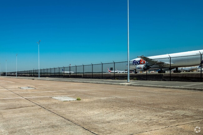
Aircraft
IMPS ONLY ON LSHLD INT IN LAND HANGER HOUSTON INTER- CONTINENTAL AIRPORT ABST 769 N W TRAVIS
AE
Harris
48201C0480M
Texas
0
648.95 AC
2025
North Hardy Toll Road
980100
Houston
32,510 SF
Houston-The Woodlands-Sugar Land, TX
DEMOGRAPHICS near 17630 Chanute Rd
1 Mile
3 Mile
5 Mile
2024 Total Population
0
14,660
164,820
2029 Population
0
14,985
167,957
Pop Growth 2024-2029
0.00%
+ 2.22%
+ 1.90%
Average Age
0
34
33
2024 Total Households
0
4,604
54,200
HH Growth 2024-2029
0.00%
+ 2.24%
+ 1.96%
Median Household Inc
$0
$63,128
$48,117
Avg Household Size
.00
3.10
3.00
2024 Avg HH Vehicles
.00
2.00
2.00
Median Home Value
$0
$165,331
$158,427
Median Year Built
0
2002
1992
Nearby Places
Map Layers
Map Styles
 Street
 Aerial
- Restaurants
- Banks
- Shops
- Fitness
- Groceries
PUBLIC TRANSPORTATION
AIRPORT
George Bush Intcntl/Houston
DRIVE
WALK
Distance
George Bush Intcntl/Houston
12 min
6.0 mi
William P Hobby
DRIVE
WALK
Distance
William P Hobby
48 min
29.8 mi
Freight Ports
Port of Houston
DRIVE
WALK
Distance
Port of Houston
36 min
23.7 mi
Nearby Properties
Address
Land Use
TOTAL SIZE
Lot Size
Zoning
Address
Land Use
TOTAL SIZE
Lot Size
Zoning
1,213,044 SF
69.99 AC
Address
Land Use
TOTAL SIZE
Lot Size
Zoning
1,767,053 SF
88.85 AC
Address
Land Use
TOTAL SIZE
Lot Size
Zoning
785,390 SF
66.02 AC
Address
Land Use
TOTAL SIZE
Lot Size
Zoning
621,700 SF
67.57 AC
Address
Land Use
TOTAL SIZE
Lot Size
Zoning
657,500 SF
36.24 AC
Address
Land Use
TOTAL SIZE
Lot Size
Zoning
500,000 SF
24.58 AC
Address
Land Use
TOTAL SIZE
Lot Size
Zoning
502,325 SF
25.13 AC
Address
Land Use
TOTAL SIZE
Lot Size
Zoning
276,324 SF
33.79 AC
Address
Land Use
TOTAL SIZE
Lot Size
Zoning
379,570 SF
30.12 AC
Address
Land Use
TOTAL SIZE
Lot Size
Zoning
368,632 SF
20.06 AC
Address
Land Use
TOTAL SIZE
Lot Size
Zoning
241,625 SF
11.10 AC
Address
Land Use
TOTAL SIZE
Lot Size
Zoning
394,784 SF
22.47 AC
Address
Land Use
TOTAL SIZE
Lot Size
Zoning
353,600 SF
23.45 AC
Address
Land Use
TOTAL SIZE
Lot Size
Zoning
448,760 SF
8.46 AC
Address
Land Use
TOTAL SIZE
Lot Size
Zoning
291,656 SF
18.94 AC
Address
Land Use
TOTAL SIZE
Lot Size
Zoning
435,650 SF
Address
Land Use
TOTAL SIZE
Lot Size
Zoning
57,551 SF
49.71 AC
Address
Land Use
TOTAL SIZE
Lot Size
Zoning
318,000 SF
18.53 AC
Address
Land Use
TOTAL SIZE
Lot Size
Zoning
207,720 SF
12.33 AC
Address
Land Use
TOTAL SIZE
Lot Size
Zoning
257,000 SF
13.34 AC
Address
Land Use
TOTAL SIZE
Lot Size
Zoning
288,525 SF
17.66 AC
Address
Land Use
TOTAL SIZE
Lot Size
Zoning
597,462 SF
42.07 AC
Address
Land Use
TOTAL SIZE
Lot Size
Zoning
227,400 SF
19.37 AC
Address
Land Use
TOTAL SIZE
Lot Size
Zoning
281,252 SF
8 AC
Address
Land Use
TOTAL SIZE
Lot Size
Zoning
215,879 SF
7.30 AC
Address
Land Use
TOTAL SIZE
Lot Size
Zoning
90,033 SF
46.96 AC
Address
Land Use
TOTAL SIZE
Lot Size
Zoning
239,270 SF
13.39 AC
Address
Land Use
TOTAL SIZE
Lot Size
Zoning
323,967 SF
13.21 AC
Address
Land Use
TOTAL SIZE
Lot Size
Zoning
194,646 SF
10.85 AC
Address
Land Use
TOTAL SIZE
Lot Size
Zoning
350,511 SF
15.40 AC
The World's #1 Commercial Real Estate Marketplace
Connect with us
© 2025 CoStar Group
The information above has been obtained from sources believed reliable. While we do not doubt its accuracy we have not verified it and make no guarantee, warranty or representation about it. It is your responsibility to independently confirm its accuracy and completeness. Any projections, opinions, assumptions, or estimates used are for example only and do not represent the current or future performance of the property. The value of this transaction to you depends on tax and other factors which should be evaluated by your tax, financial, and legal advisors. You and your advisors should conduct a careful, independent investigation of the property to determine to your satisfaction the suitability of the property for your needs.