Property Record
22719 S Ellsworth Rd, Queen Creek, AZ 85142

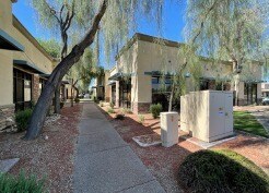
Property Detail
22719 S Ellsworth Rd
304-67-978
VILLAGES OFFICE SUITES CONDOMINIUM BUILDING C 3RD MCR 1375-35
Officecondo
Maricopa
C2
Arizona
C and X Area of minimal flood hazard, usually depicted on FIRMs as above the 500-year flood level.
c2
2025
0.08 AC
2025
Gateway Airport/Loop 202
817102
Phoenix
9,723 SF
Phoenix-Mesa-Chandler, AZ
NEARBY LISTINGS FOR SALE OR LEASE
-
-
View all Queen Creek listings for lease on LoopNet.com
DEMOGRAPHICS near 22719 S Ellsworth Rd
1 mile
3 mile
5 mile
2025 Total Population
13,660
61,028
182,072
2030 Population
14,393
65,906
203,025
Pop Growth 2025-2030
+ 5.37%
+ 7.99%
+ 11.51%
Average Age
36
36
37
2025 Total Households
4,082
17,670
55,726
HH Growth 2025-2030
+ 5.34%
+ 8.04%
+ 11.59%
Median Household Inc
$124,444
$142,022
$118,734
Avg Household Size
3.30
3.40
3.20
2025 Avg HH Vehicles
2.00
2.00
2.00
Median Home Value
$587,615
$685,293
$562,584
Median Year Built
2009
2010
2009
Nearby Places
Map Layers
Map Styles
 Street
 Aerial
Transit
 Traffic
 Biking
Places
Listings with unknown addresses are not visible on the map
- Restaurants
- Banks
- Shops
- Fitness
- Groceries
PUBLIC TRANSPORTATION
AIRPORT
Phoenix-Mesa Gateway
Drive
Walk
Distance
Phoenix-Mesa Gateway
12 min
5.8 mi
Phoenix Sky Harbor International
Drive
Walk
Distance
Phoenix Sky Harbor International
50 min
35.0 mi
SALE & LEASE HISTORY
LISTING DATE
SALE/LEASE

Nov 03, 2017
For Sale
Jul 28, 2022
For Lease
Feb 23, 2017
For Lease
Nearby Properties
Address
Land Use
TOTAL SIZE
Lot Size
Zoning
Address
Land Use
TOTAL SIZE
Lot Size
Zoning
64.72 AC
LI
Address
Land Use
TOTAL SIZE
Lot Size
Zoning
32,858 SF
13.76 AC
C-G
Address
Land Use
TOTAL SIZE
Lot Size
Zoning
53,995 SF
10.12 AC
Address
Land Use
TOTAL SIZE
Lot Size
Zoning
250,050 SF
17.47 AC
Address
Land Use
TOTAL SIZE
Lot Size
Zoning
477,934 SF
24.18 AC
MU
Address
Land Use
TOTAL SIZE
Lot Size
Zoning
227,555 SF
53.44 AC
R-43
Address
Land Use
TOTAL SIZE
Lot Size
Zoning
30,944 SF
7.03 AC
Address
Land Use
TOTAL SIZE
Lot Size
Zoning
21,010 SF
2.72 AC
I-1
Address
Land Use
TOTAL SIZE
Lot Size
Zoning
97,313 SF
5.69 AC
CB2
Address
Land Use
TOTAL SIZE
Lot Size
Zoning
20,053 SF
3.86 AC
R-43
Address
Land Use
TOTAL SIZE
Lot Size
Zoning
139,348 SF
16.39 AC
R-12
Address
Land Use
TOTAL SIZE
Lot Size
Zoning
187,208 SF
34.75 AC
MDR
Address
Land Use
TOTAL SIZE
Lot Size
Zoning
269,550 SF
63.63 AC
Address
Land Use
TOTAL SIZE
Lot Size
Zoning
6.02 AC
I-1
Address
Land Use
TOTAL SIZE
Lot Size
Zoning
270,126 SF
12.65 AC
C-TC
Address
Land Use
TOTAL SIZE
Lot Size
Zoning
163,373 SF
16.44 AC
MDR
Address
Land Use
TOTAL SIZE
Lot Size
Zoning
127,184 SF
14.80 AC
R-43
Address
Land Use
TOTAL SIZE
Lot Size
Zoning
117,552 SF
30.35 AC
R143
Address
Land Use
TOTAL SIZE
Lot Size
Zoning
216,568 SF
22.18 AC
C-G
Address
Land Use
TOTAL SIZE
Lot Size
Zoning
89,669 SF
13.60 AC
C-G
Address
Land Use
TOTAL SIZE
Lot Size
Zoning
95,413 SF
11.30 AC
R-43
Address
Land Use
TOTAL SIZE
Lot Size
Zoning
179,893 SF
15 AC
C-G
Address
Land Use
TOTAL SIZE
Lot Size
Zoning
112,277 SF
9.68 AC
C-TC
Address
Land Use
TOTAL SIZE
Lot Size
Zoning
101,394 SF
8.70 AC
MDR
Address
Land Use
TOTAL SIZE
Lot Size
Zoning
152,901 SF
19.45 AC
Address
Land Use
TOTAL SIZE
Lot Size
Zoning
69,001 SF
16.70 AC
DC
Address
Land Use
TOTAL SIZE
Lot Size
Zoning
3.34 AC
I-1
Address
Land Use
TOTAL SIZE
Lot Size
Zoning
119,569 SF
11.13 AC
C-G
Address
Land Use
TOTAL SIZE
Lot Size
Zoning
182,360 SF
10.52 AC
M-H
Address
Land Use
TOTAL SIZE
Lot Size
Zoning
125,933 SF
7.92 AC
C-G
The World's #1 Commercial Real Estate Marketplace
Connect with us
© 2026 CoStar Group
The information above has been obtained from sources believed reliable. While we do not doubt its accuracy we have not verified it and make no guarantee, warranty or representation about it. It is your responsibility to independently confirm its accuracy and completeness. Any projections, opinions, assumptions, or estimates used are for example only and do not represent the current or future performance of the property. The value of this transaction to you depends on tax and other factors which should be evaluated by your tax, financial, and legal advisors. You and your advisors should conduct a careful, independent investigation of the property to determine to your satisfaction the suitability of the property for your needs.